Laughing Fish Point Topo Map Michigan
To zoom in, hover over the map of Laughing Fish Point
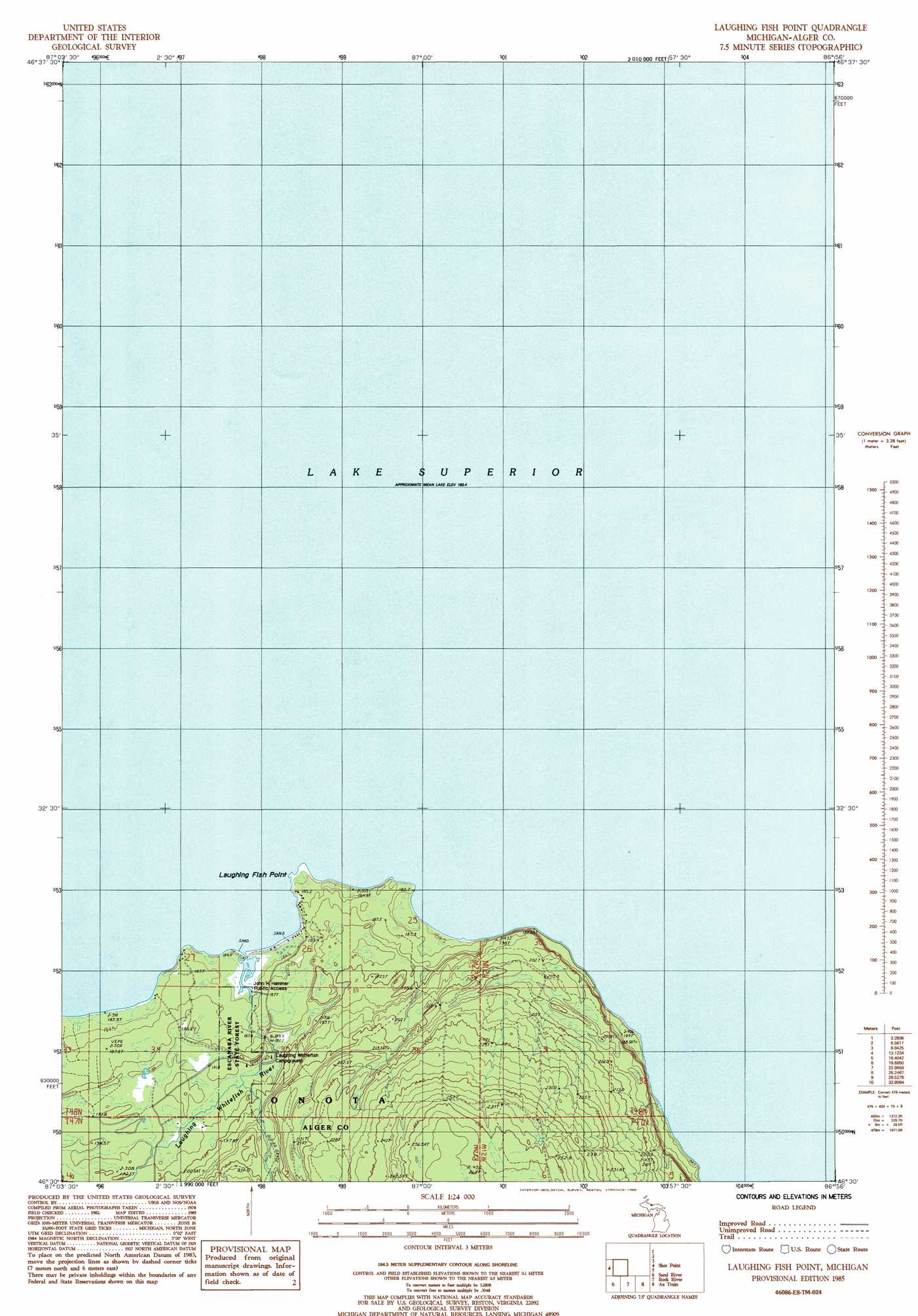
USGS Topo Quad 46086e8 - 1:24,000 scale
| Topo Map Name: | Laughing Fish Point |
| USGS Topo Quad ID: | 46086e8 |
| Print Size: | ca. 21 1/4" wide x 27" high |
| Southeast Coordinates: | 46.5° N latitude / 86.875° W longitude |
| Map Center Coordinates: | 46.5625° N latitude / 86.9375° W longitude |
| U.S. State: | MI |
| Filename: | o46086e8.jpg |
| Download Map JPG Image: | Laughing Fish Point topo map 1:24,000 scale |
| Map Type: | Topographic |
| Topo Series: | 7.5´ |
| Map Scale: | 1:24,000 |
| Source of Map Images: | United States Geological Survey (USGS) |
| Alternate Map Versions: |
Laughing Fish Point OE E MI 2011 Download PDF Buy paper map Laughing Fish Point OE E MI 2014 Download PDF Buy paper map Laughing Fish Point OE E MI 2017 Download PDF Buy paper map |
1:24,000 Topo Quads surrounding Laughing Fish Point
Shot Point |
Laughing Fish Point |
Wood Island |
||
Skandia |
Sand River |
Rock River |
Au Train |
Munsing |
Carlshend |
Ladoga |
Chatham |
Forest Lake |
Powell Lake |
> Back to 46086e1 at 1:100,000 scale
> Back to 46086a1 at 1:250,000 scale
> Back to U.S. Topo Maps home
Laughing Fish Point topo map: Gazetteer
Laughing Fish Point: Bars
North Drisco Shoal elevation 184m 603′Laughing Fish Point digital topo map on disk
Buy this Laughing Fish Point topo map showing relief, roads, GPS coordinates and other geographical features, as a high-resolution digital map file on DVD: