Sebeka Sw Topo Map Minnesota
To zoom in, hover over the map of Sebeka Sw
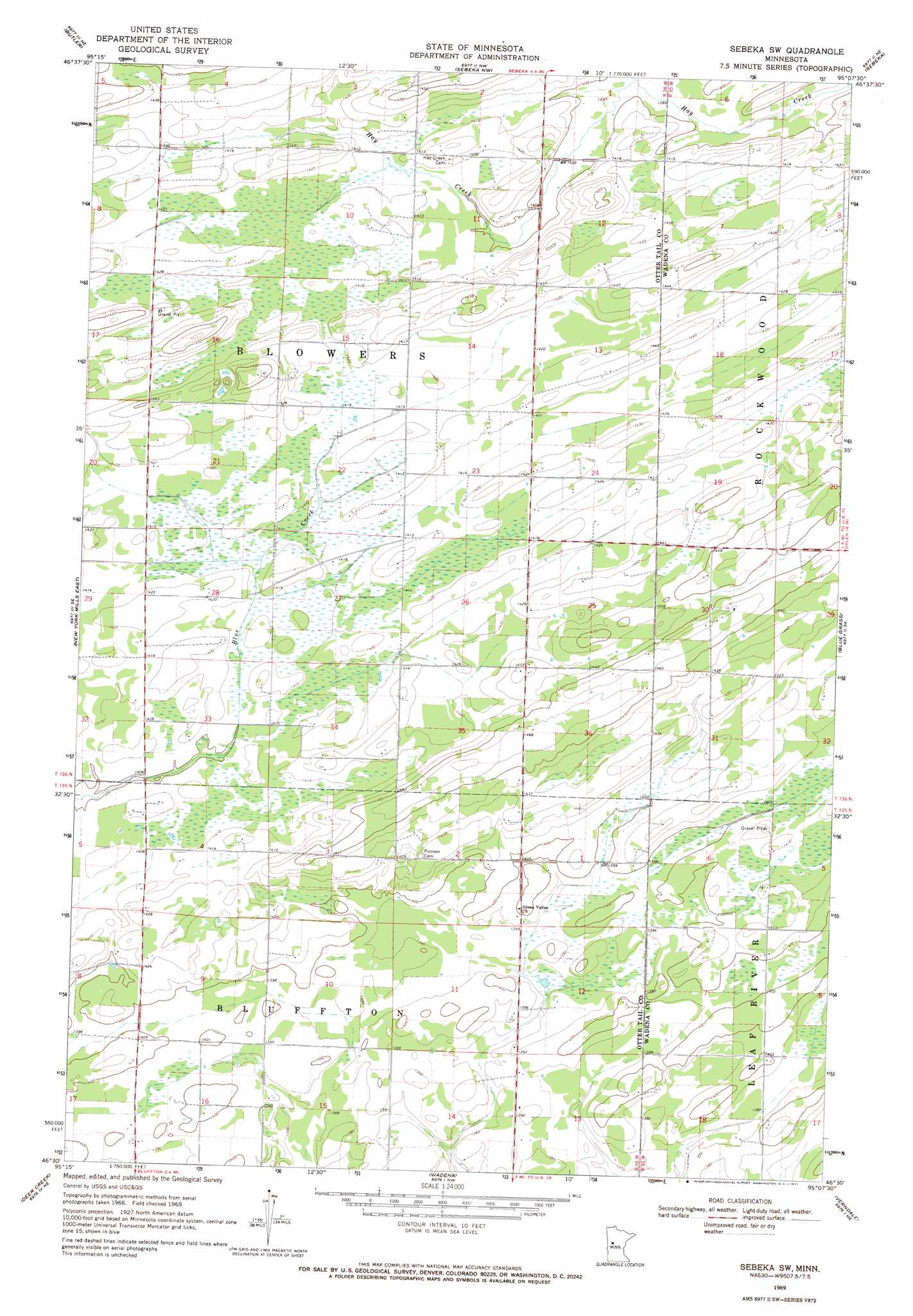
USGS Topo Quad 46095e2 - 1:24,000 scale
| Topo Map Name: | Sebeka Sw |
| USGS Topo Quad ID: | 46095e2 |
| Print Size: | ca. 21 1/4" wide x 27" high |
| Southeast Coordinates: | 46.5° N latitude / 95.125° W longitude |
| Map Center Coordinates: | 46.5625° N latitude / 95.1875° W longitude |
| U.S. State: | MN |
| Filename: | o46095e2.jpg |
| Download Map JPG Image: | Sebeka Sw topo map 1:24,000 scale |
| Map Type: | Topographic |
| Topo Series: | 7.5´ |
| Map Scale: | 1:24,000 |
| Source of Map Images: | United States Geological Survey (USGS) |
| Alternate Map Versions: |
Sebeka SW MN 1969, updated 1971 Download PDF Buy paper map Sebeka SW MN 2010 Download PDF Buy paper map Sebeka SW MN 2013 Download PDF Buy paper map Sebeka SW MN 2016 Download PDF Buy paper map |
1:24,000 Topo Quads surrounding Sebeka Sw
Evergreen |
Wolf Lake |
Park Rapids Sw |
Menahga |
Huntersville |
New York Mills Nw |
Butler |
Sebeka Nw |
Sebeka |
Nimrod |
New York Mills West |
New York Mills East |
Sebeka Sw |
Blue Grass |
Nimrod Sw |
Heinola |
Deer Creek |
Wadena |
Verndale |
Aldrich North |
Henning |
Henning Se |
Wrightstown |
Bertha |
Aldrich South |
> Back to 46095e1 at 1:100,000 scale
> Back to 46094a1 at 1:250,000 scale
> Back to U.S. Topo Maps home
No gazetteer data is available for the Sebeka Sw topo map sheet.
Sebeka Sw digital topo map on disk
Buy this Sebeka Sw topo map showing relief, roads, GPS coordinates and other geographical features, as a high-resolution digital map file on DVD: