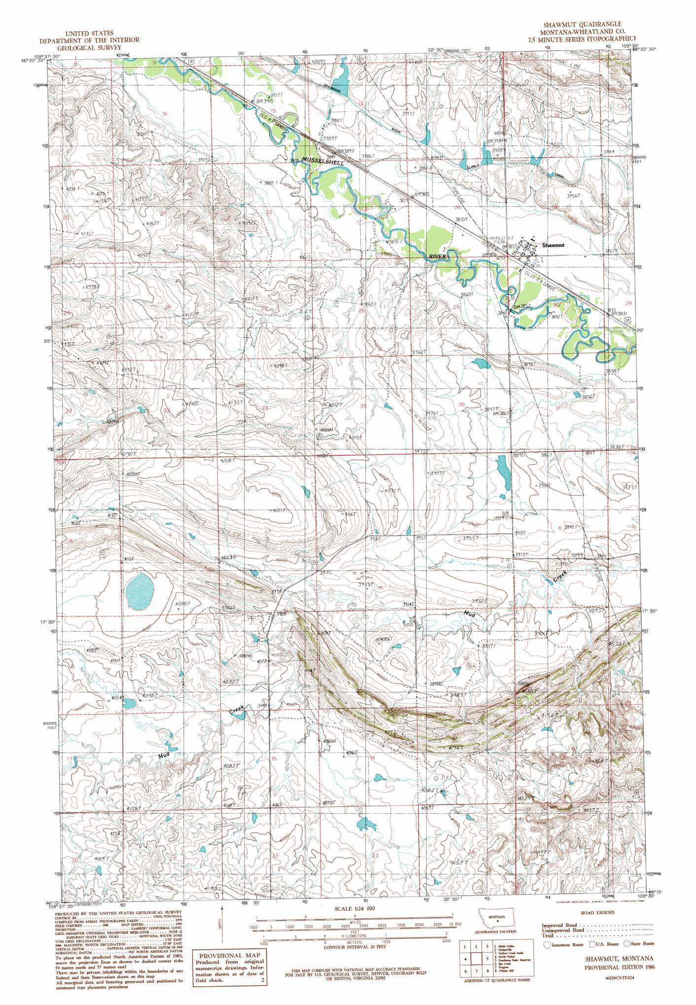
Shawmut Topo Map Montana
To zoom in, hover over the map of Shawmut
USGS Topo Quad 46109c5 - 1:24,000 scale
| Topo Map Name: | Shawmut |
| USGS Topo Quad ID: | 46109c5 |
| Print Size: | ca. 21 1/4" wide x 27" high |
| Southeast Coordinates: | 46.25° N latitude / 109.5° W longitude |
| Map Center Coordinates: | 46.3125° N latitude / 109.5625° W longitude |
| U.S. State: | MT |
| Filename: | o46109c5.jpg |
| Download Map JPG Image: | Shawmut topo map 1:24,000 scale |
| Map Type: | Topographic |
| Topo Series: | 7.5´ |
| Map Scale: | 1:24,000 |
| Source of Map Images: | United States Geological Survey (USGS) |
| Alternate Map Versions: |
Shawmut MT 1986, updated 1986 Download PDF Buy paper map Shawmut MT 2011 Download PDF Buy paper map Shawmut MT 2014 Download PDF Buy paper map |
1:24,000 Topo Quads surrounding Shawmut
Oka |
Oxford |
Nihill |
Halbert Creek North |
Rothiemay |
Harlowton |
Ethels Coulee |
Hedgesville |
Halbert Creek South |
Vallum |
Ten O'Clock Gate |
Devils Pocket |
Shawmut |
Deadman Basin Res. |
Ryegate West |
Gougley Creek |
Jim Creek |
Progress |
O'Brien Hill |
Locomotive Butte |
Upper Glaston Lake |
Gibson Sw |
Gibson |
Locomotive Butte Sw |
Locomotive Butte Se |
> Back to 46109a1 at 1:100,000 scale
> Back to 46108a1 at 1:250,000 scale
> Back to U.S. Topo Maps home
Shawmut topo map: Gazetteer
Shawmut: Canals
Deadmans Basin Supply Canal elevation 1207m 3959′Shawmut: Dams
Berg Dam elevation 1279m 4196′Cinnamon Number 6 Dam elevation 1203m 3946′
Deadmans Basin Dike elevation 1208m 3963′
Shawmut: Populated Places
Shawmut elevation 1175m 3854′Shawmut: Post Offices
Shawmut Post Office elevation 1176m 3858′Shawmut: Wells
06N17E02CBA_01 Well elevation 1201m 3940′07N17E24DD__01 Well elevation 1178m 3864′
07N17E25____01 Well elevation 1183m 3881′
07N18E19____01 Well elevation 1199m 3933′
Shawmut digital topo map on disk
Buy this Shawmut topo map showing relief, roads, GPS coordinates and other geographical features, as a high-resolution digital map file on DVD: