Ralston Topo Map Washington
To zoom in, hover over the map of Ralston
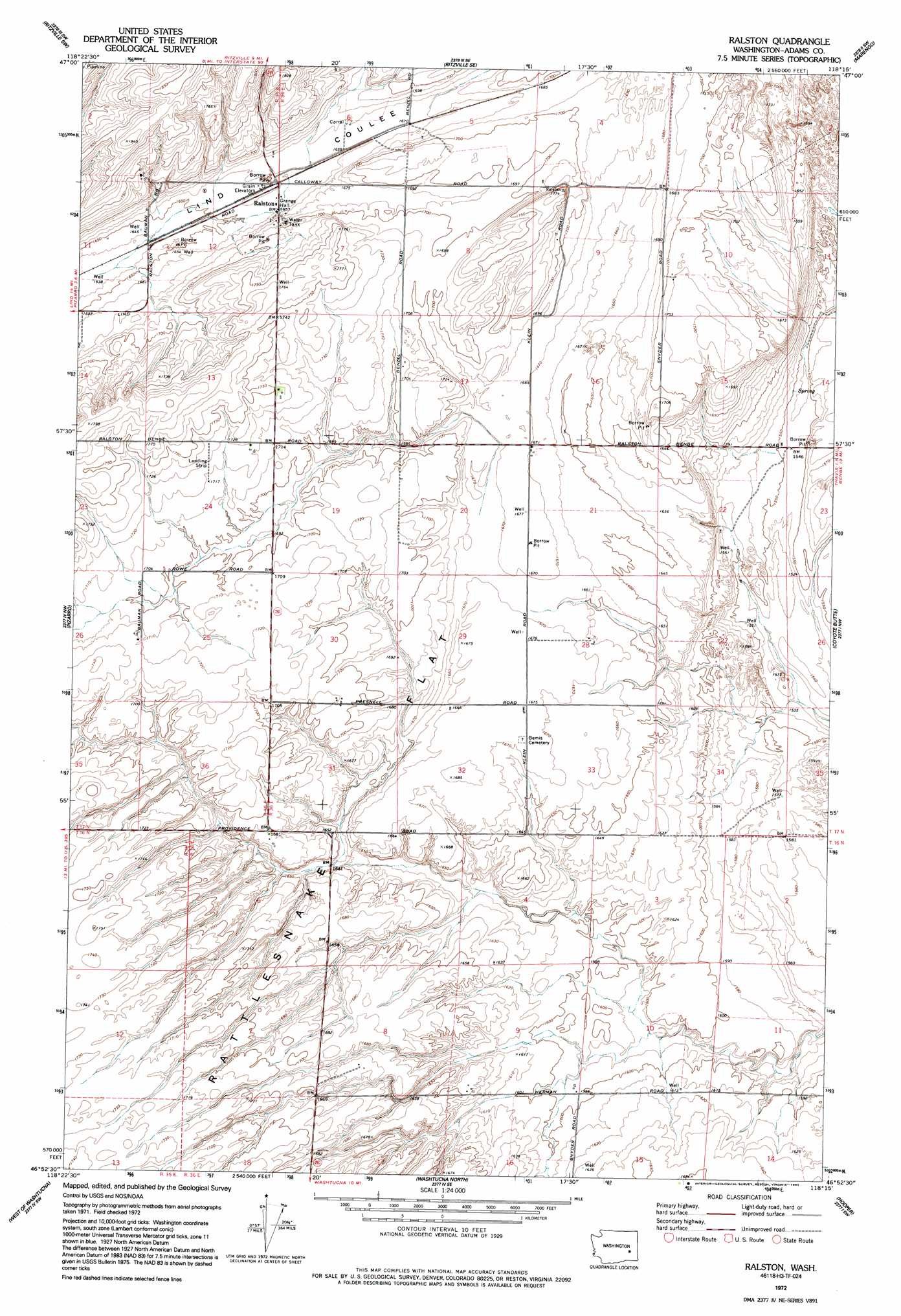
USGS Topo Quad 46118h3 - 1:24,000 scale
| Topo Map Name: | Ralston |
| USGS Topo Quad ID: | 46118h3 |
| Print Size: | ca. 21 1/4" wide x 27" high |
| Southeast Coordinates: | 46.875° N latitude / 118.25° W longitude |
| Map Center Coordinates: | 46.9375° N latitude / 118.3125° W longitude |
| U.S. State: | WA |
| Filename: | o46118h3.jpg |
| Download Map JPG Image: | Ralston topo map 1:24,000 scale |
| Map Type: | Topographic |
| Topo Series: | 7.5´ |
| Map Scale: | 1:24,000 |
| Source of Map Images: | United States Geological Survey (USGS) |
| Alternate Map Versions: |
Ralston WA 1972, updated 1974 Download PDF Buy paper map Ralston WA 1972, updated 1992 Download PDF Buy paper map Ralston WA 2011 Download PDF Buy paper map Ralston WA 2013 Download PDF Buy paper map |
1:24,000 Topo Quads surrounding Ralston
Schoonover |
Ritzville Nw |
Ritzville Ne |
Karakul Hills |
Palm Lake |
Reiman Se |
Ritzville Sw |
Ritzville Se |
Marengo |
Macall |
Lind |
Pizarro |
Ralston |
Coyote Butte |
Benge |
Lind Se |
West Of Washtucna |
Washtucna North |
Hooper |
Rattlesnake Canyon |
Kahlotus |
Sperry |
Washtucna South |
Palouse Falls |
Hooper Lake |
> Back to 46118e1 at 1:100,000 scale
> Back to 46118a1 at 1:250,000 scale
> Back to U.S. Topo Maps home
Ralston digital topo map on disk
Buy this Ralston topo map showing relief, roads, GPS coordinates and other geographical features, as a high-resolution digital map file on DVD: