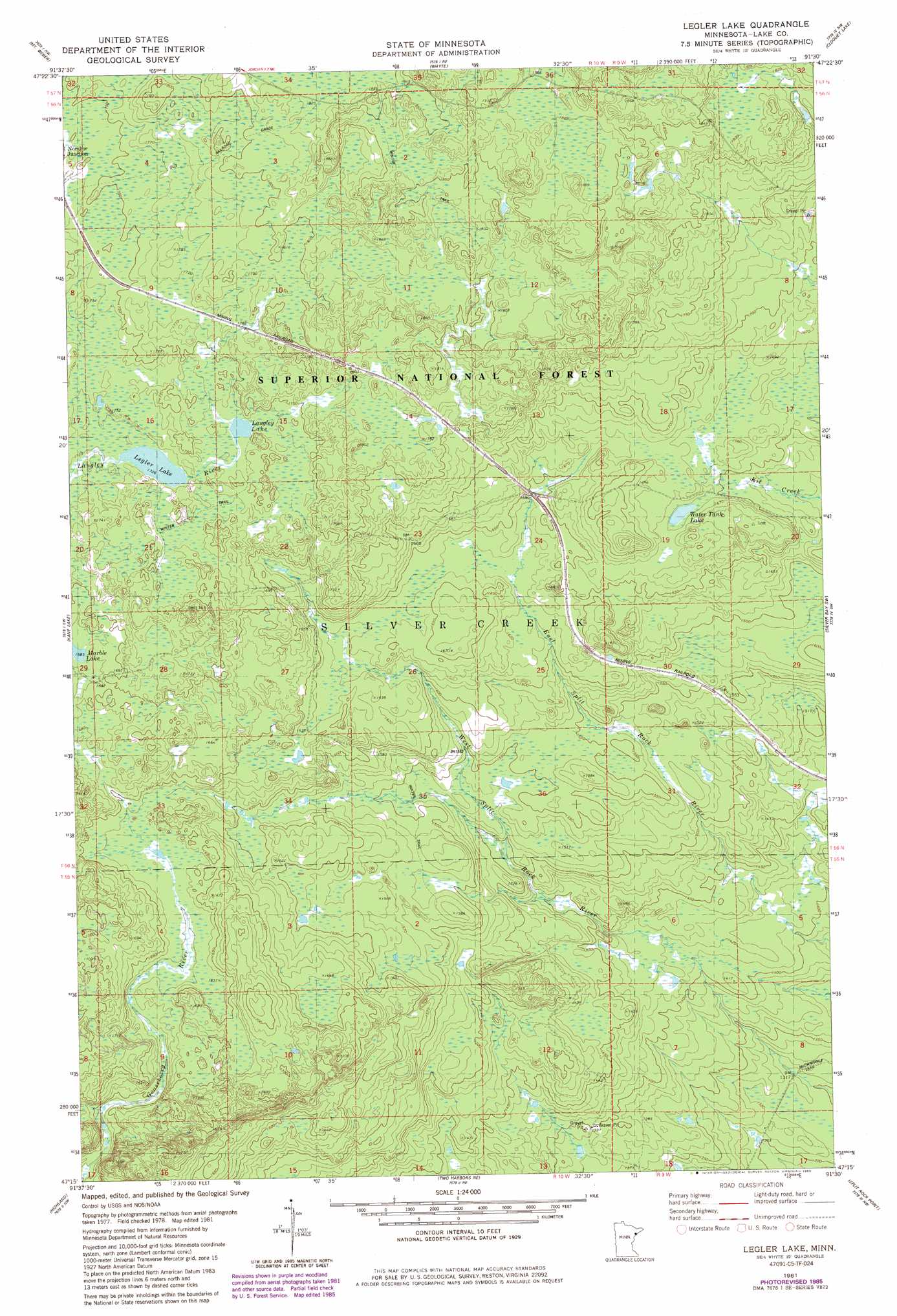
Legler Lake Topo Map Minnesota
To zoom in, hover over the map of Legler Lake
USGS Topo Quad 47091c5 - 1:24,000 scale
| Topo Map Name: | Legler Lake |
| USGS Topo Quad ID: | 47091c5 |
| Print Size: | ca. 21 1/4" wide x 27" high |
| Southeast Coordinates: | 47.25° N latitude / 91.5° W longitude |
| Map Center Coordinates: | 47.3125° N latitude / 91.5625° W longitude |
| U.S. State: | MN |
| Filename: | o47091c5.jpg |
| Download Map JPG Image: | Legler Lake topo map 1:24,000 scale |
| Map Type: | Topographic |
| Topo Series: | 7.5´ |
| Map Scale: | 1:24,000 |
| Source of Map Images: | United States Geological Survey (USGS) |
| Alternate Map Versions: |
Legler Lake MN 1981, updated 1982 Download PDF Buy paper map Legler Lake MN 1981, updated 1985 Download PDF Buy paper map Legler Lake MN 2011 Download PDF Buy paper map Legler Lake MN 2013 Download PDF Buy paper map Legler Lake MN 2016 Download PDF Buy paper map |
| FStopo: | US Forest Service topo Legler Lake is available: Download FStopo PDF Download FStopo TIF |
1:24,000 Topo Quads surrounding Legler Lake
Babbitt Se |
Greenwood Lake West |
Greenwood Lake East |
Isabella Station |
Isabella |
Toimi |
Mount Weber |
Whyte |
Cloquet Lake |
Doyle Lake |
Brimson |
Kane Lake |
Legler Lake |
Silver Bay Sw |
Silver Bay |
King Lake |
Highland |
Two Harbors Ne |
Split Rock Point |
Split Rock Point Ne |
Mccarthy Creek |
Two Harbors |
Castle Danger |
> Back to 47091a1 at 1:100,000 scale
> Back to 47090a1 at 1:250,000 scale
> Back to U.S. Topo Maps home
Legler Lake topo map: Gazetteer
Legler Lake: Lakes
Langley Lake elevation 529m 1735′Legler Lake elevation 526m 1725′
Water Tank Lake elevation 505m 1656′
Legler Lake digital topo map on disk
Buy this Legler Lake topo map showing relief, roads, GPS coordinates and other geographical features, as a high-resolution digital map file on DVD: