Blanchard Topo Map North Dakota
To zoom in, hover over the map of Blanchard
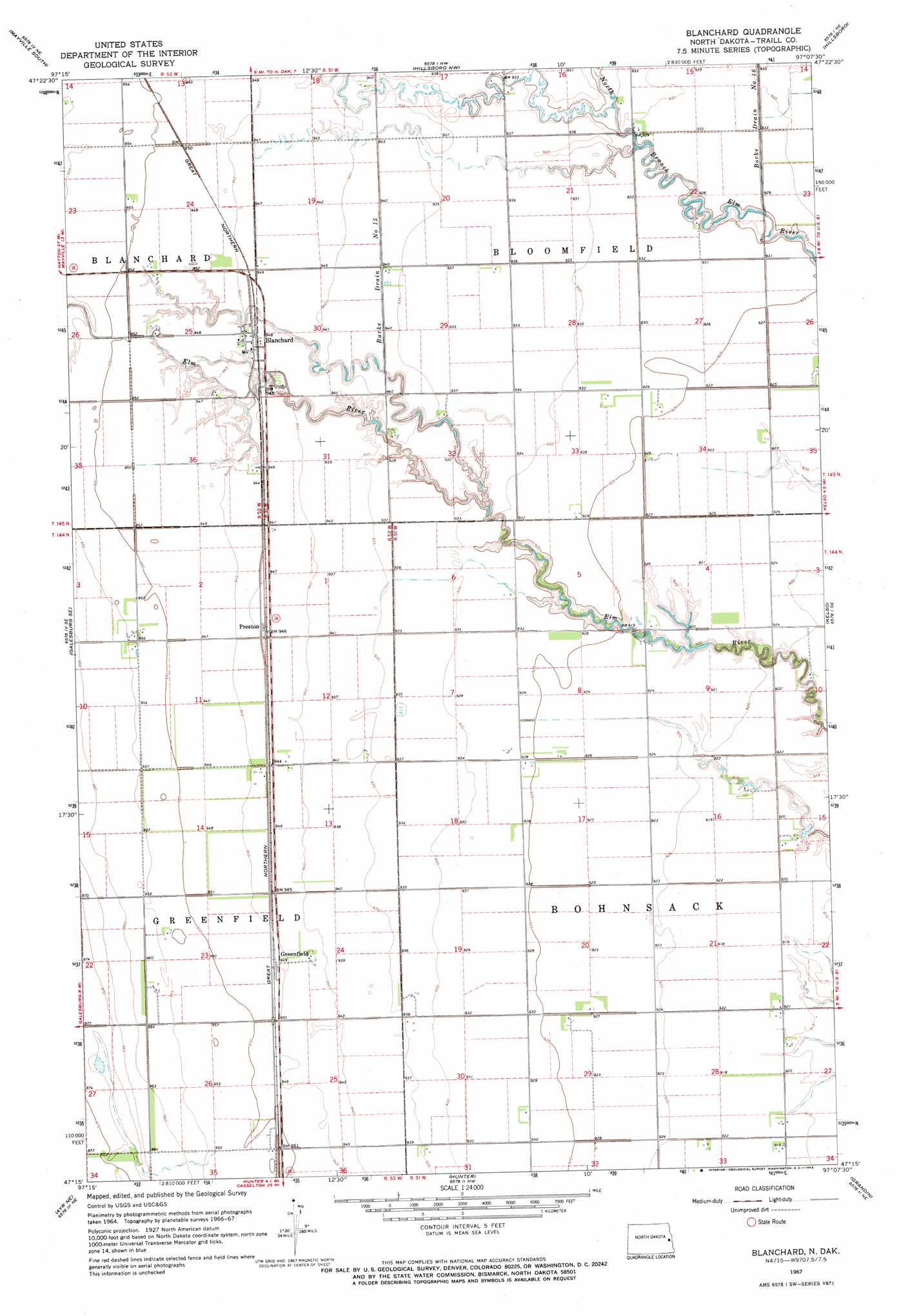
USGS Topo Quad 47097c2 - 1:24,000 scale
| Topo Map Name: | Blanchard |
| USGS Topo Quad ID: | 47097c2 |
| Print Size: | ca. 21 1/4" wide x 27" high |
| Southeast Coordinates: | 47.25° N latitude / 97.125° W longitude |
| Map Center Coordinates: | 47.3125° N latitude / 97.1875° W longitude |
| U.S. State: | ND |
| Filename: | O47097C2.jpg |
| Download Map JPG Image: | Blanchard topo map 1:24,000 scale |
| Map Type: | Topographic |
| Topo Series: | 7.5´ |
| Map Scale: | 1:24,000 |
| Source of Map Images: | United States Geological Survey (USGS) |
| Alternate Map Versions: |
Blanchard ND 1967, updated 1969 Download PDF Buy paper map Blanchard ND 2011 Download PDF Buy paper map Blanchard ND 2014 Download PDF Buy paper map |
1:24,000 Topo Quads surrounding Blanchard
Hatton Sw |
Mayville North |
Buxton Sw |
Buxton |
Climax Sw |
Galesburg Nw |
Mayville South |
Hillsboro Nw |
Hillsboro |
Caledonia |
Galesburg |
Galesburg Se |
Blanchard |
Kelso |
Halstad Sw |
Ayr Nw |
Ayr Ne |
Hunter |
Grandin |
Gardner |
Ayr |
Ayr Se |
Arthur |
Arthur Se |
Argusville |
> Back to 47097a1 at 1:100,000 scale
> Back to 47096a1 at 1:250,000 scale
> Back to U.S. Topo Maps home
Blanchard topo map: Gazetteer
Blanchard: Canals
Borke Drain Number Sixteen elevation 284m 931′Burke Drain Number 15 elevation 286m 938′
Blanchard: Populated Places
Blanchard elevation 288m 944′Greenfield elevation 289m 948′
Preston elevation 288m 944′
Blanchard digital topo map on disk
Buy this Blanchard topo map showing relief, roads, GPS coordinates and other geographical features, as a high-resolution digital map file on DVD:
Eastern North Dakota & Eastern South Dakota
Buy digital topo maps: Eastern North Dakota & Eastern South Dakota