Hatton Sw Topo Map North Dakota
To zoom in, hover over the map of Hatton Sw
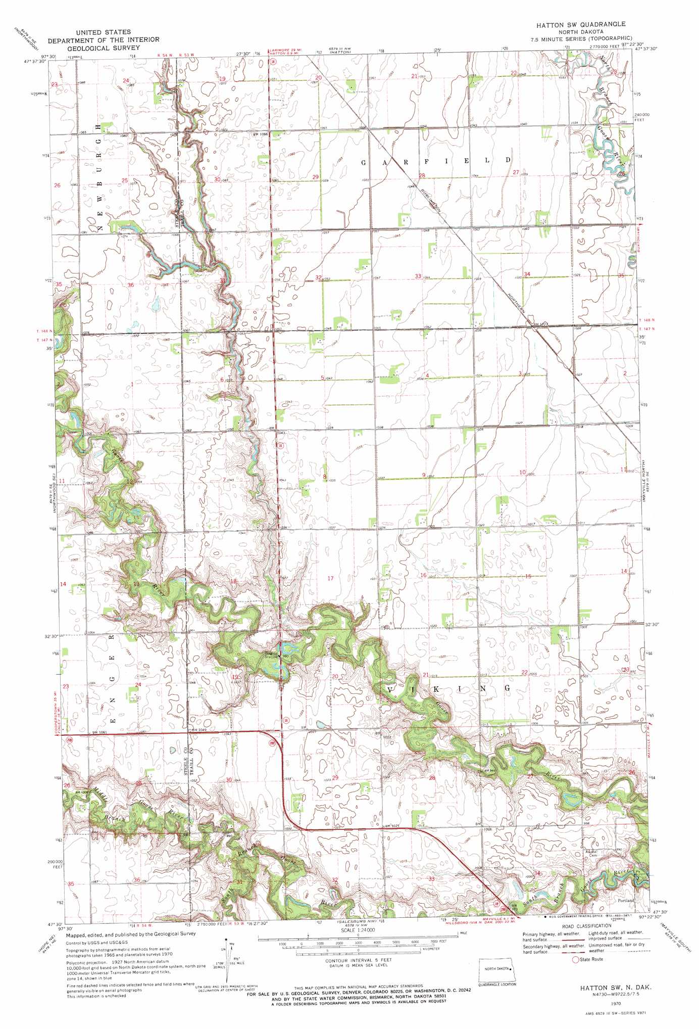
USGS Topo Quad 47097e4 - 1:24,000 scale
| Topo Map Name: | Hatton Sw |
| USGS Topo Quad ID: | 47097e4 |
| Print Size: | ca. 21 1/4" wide x 27" high |
| Southeast Coordinates: | 47.5° N latitude / 97.375° W longitude |
| Map Center Coordinates: | 47.5625° N latitude / 97.4375° W longitude |
| U.S. State: | ND |
| Filename: | O47097E4.jpg |
| Download Map JPG Image: | Hatton Sw topo map 1:24,000 scale |
| Map Type: | Topographic |
| Topo Series: | 7.5´ |
| Map Scale: | 1:24,000 |
| Source of Map Images: | United States Geological Survey (USGS) |
| Alternate Map Versions: |
Hatton SW ND 1970, updated 1972 Download PDF Buy paper map Hatton SW ND 2011 Download PDF Buy paper map Hatton SW ND 2014 Download PDF Buy paper map |
1:24,000 Topo Quads surrounding Hatton Sw
Larimore Sw |
Kempton |
Emerado Sw |
Emerado Se |
Grand Forks Sw |
Northwood Nw |
Northwood |
Hatton |
Holmes |
Buxton Nw |
Golden Lake |
Northwood Se |
Hatton Sw |
Mayville North |
Buxton Sw |
Sherbrooke |
Hope Ne |
Galesburg Nw |
Mayville South |
Hillsboro Nw |
Hope |
Hope Se |
Galesburg |
Galesburg Se |
Blanchard |
> Back to 47097e1 at 1:100,000 scale
> Back to 47096a1 at 1:250,000 scale
> Back to U.S. Topo Maps home
Hatton Sw topo map: Gazetteer
Hatton Sw: Streams
Beaver Creek elevation 304m 997′Middle Branch Goose River elevation 297m 974′
Hatton Sw digital topo map on disk
Buy this Hatton Sw topo map showing relief, roads, GPS coordinates and other geographical features, as a high-resolution digital map file on DVD:
Eastern North Dakota & Eastern South Dakota
Buy digital topo maps: Eastern North Dakota & Eastern South Dakota