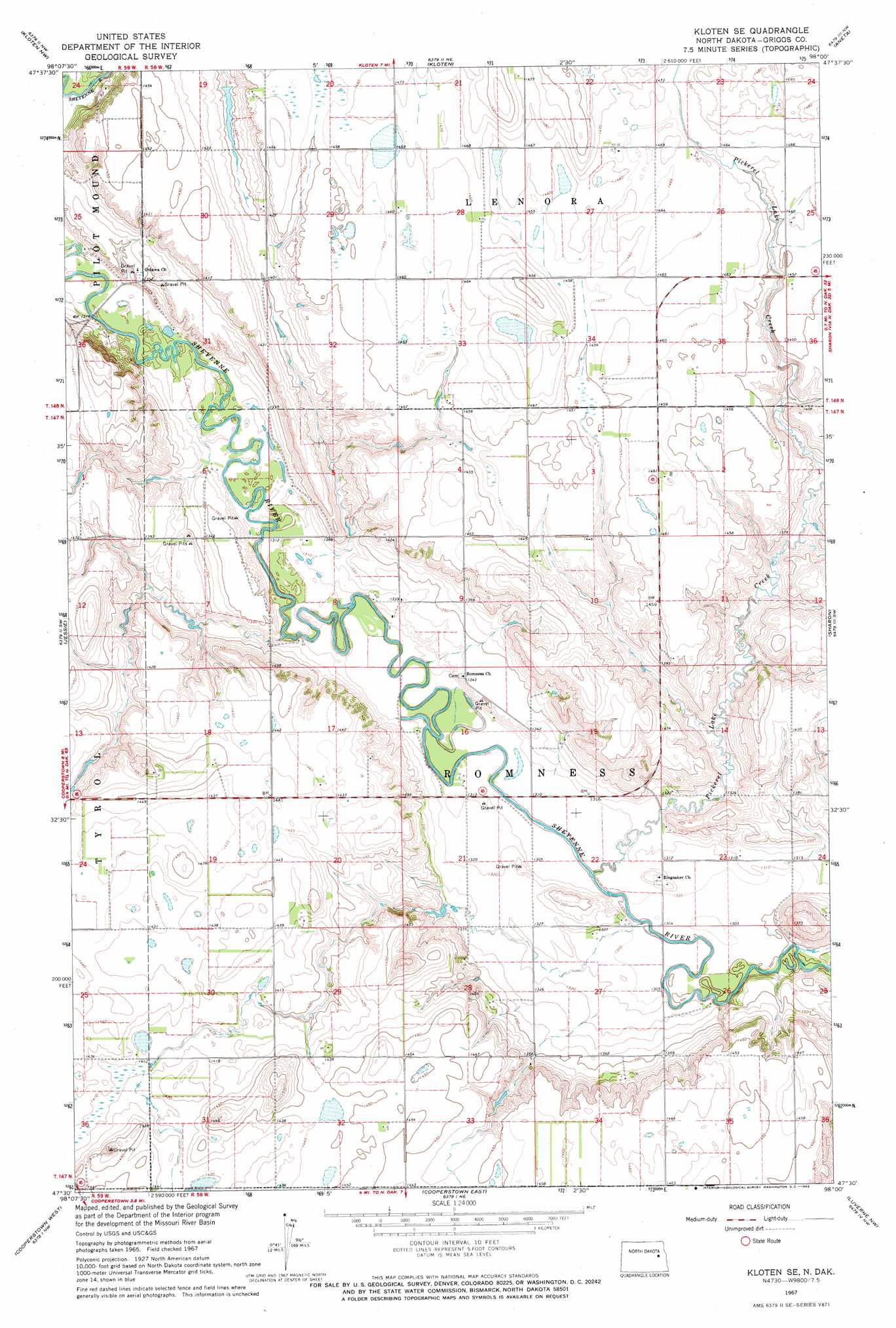
Kloten Se Topo Map North Dakota
To zoom in, hover over the map of Kloten Se
USGS Topo Quad 47098e1 - 1:24,000 scale
| Topo Map Name: | Kloten Se |
| USGS Topo Quad ID: | 47098e1 |
| Print Size: | ca. 21 1/4" wide x 27" high |
| Southeast Coordinates: | 47.5° N latitude / 98° W longitude |
| Map Center Coordinates: | 47.5625° N latitude / 98.0625° W longitude |
| U.S. State: | ND |
| Filename: | O47098E1.jpg |
| Download Map JPG Image: | Kloten Se topo map 1:24,000 scale |
| Map Type: | Topographic |
| Topo Series: | 7.5´ |
| Map Scale: | 1:24,000 |
| Source of Map Images: | United States Geological Survey (USGS) |
| Alternate Map Versions: |
Kloten SE ND 1967, updated 1969 Download PDF Buy paper map Kloten SE ND 2011 Download PDF Buy paper map Kloten SE ND 2014 Download PDF Buy paper map |
1:24,000 Topo Quads surrounding Kloten Se
Pekin |
Mcville |
Mcville Se |
Niagara Sw |
Logan Center |
Binford Ne |
Kloten Nw |
Kloten |
Aneta |
Finley Ne |
Binford |
Jessie |
Kloten Se |
Sharon |
Finley |
Sutton Ne |
Cooperstown West |
Cooperstown East |
Luverne Nw |
Blabon |
Revere |
Hannaford |
Karnak |
Luverne |
Luverne Se |
> Back to 47098e1 at 1:100,000 scale
> Back to 47098a1 at 1:250,000 scale
> Back to U.S. Topo Maps home
Kloten Se digital topo map on disk
Buy this Kloten Se topo map showing relief, roads, GPS coordinates and other geographical features, as a high-resolution digital map file on DVD:
Eastern North Dakota & Eastern South Dakota
Buy digital topo maps: Eastern North Dakota & Eastern South Dakota