Aneta Topo Map North Dakota
To zoom in, hover over the map of Aneta
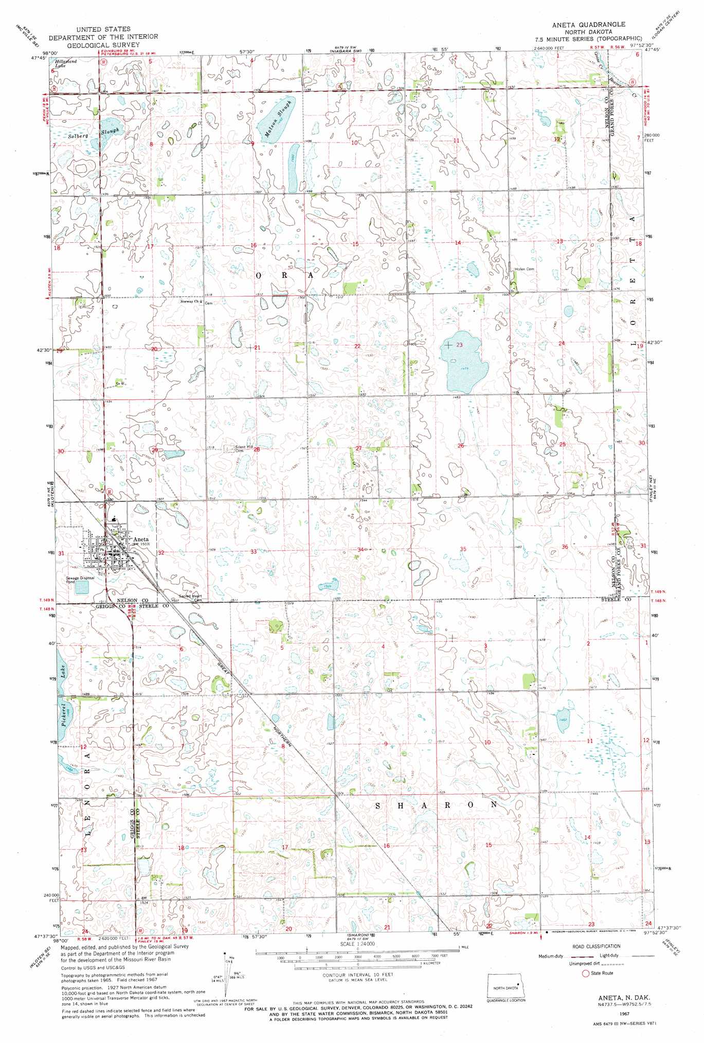
USGS Topo Quad 47097f8 - 1:24,000 scale
| Topo Map Name: | Aneta |
| USGS Topo Quad ID: | 47097f8 |
| Print Size: | ca. 21 1/4" wide x 27" high |
| Southeast Coordinates: | 47.625° N latitude / 97.875° W longitude |
| Map Center Coordinates: | 47.6875° N latitude / 97.9375° W longitude |
| U.S. State: | ND |
| Filename: | O47097F8.jpg |
| Download Map JPG Image: | Aneta topo map 1:24,000 scale |
| Map Type: | Topographic |
| Topo Series: | 7.5´ |
| Map Scale: | 1:24,000 |
| Source of Map Images: | United States Geological Survey (USGS) |
| Alternate Map Versions: |
Aneta ND 1967, updated 1969 Download PDF Buy paper map Aneta ND 2011 Download PDF Buy paper map Aneta ND 2014 Download PDF Buy paper map |
1:24,000 Topo Quads surrounding Aneta
Bitter Lake |
Lambs Lake |
Lake Pickard |
Niagara |
Larimore West |
Mcville |
Mcville Se |
Niagara Sw |
Logan Center |
Larimore Sw |
Kloten Nw |
Kloten |
Aneta |
Finley Ne |
Northwood Nw |
Jessie |
Kloten Se |
Sharon |
Finley |
Golden Lake |
Cooperstown West |
Cooperstown East |
Luverne Nw |
Blabon |
Sherbrooke |
> Back to 47097e1 at 1:100,000 scale
> Back to 47096a1 at 1:250,000 scale
> Back to U.S. Topo Maps home
Aneta topo map: Gazetteer
Aneta: Guts
Solberg Slough elevation 454m 1489′Aneta: Lakes
Matson Slough elevation 455m 1492′Aneta: Populated Places
Aneta elevation 458m 1502′Aneta: Streams
Goose Creek elevation 445m 1459′Aneta digital topo map on disk
Buy this Aneta topo map showing relief, roads, GPS coordinates and other geographical features, as a high-resolution digital map file on DVD:
Eastern North Dakota & Eastern South Dakota
Buy digital topo maps: Eastern North Dakota & Eastern South Dakota