Rush Lake Topo Map North Dakota
To zoom in, hover over the map of Rush Lake
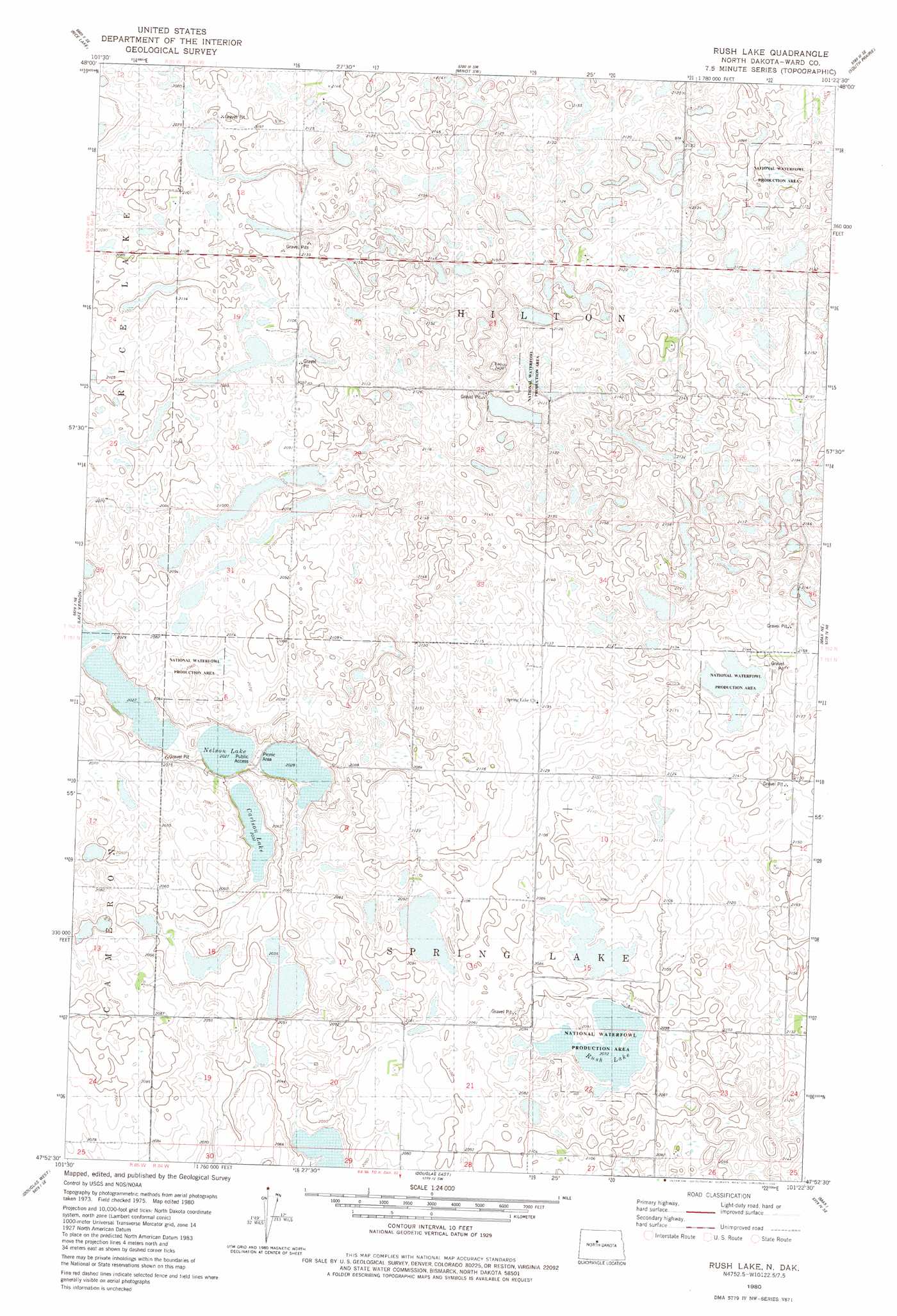
USGS Topo Quad 47101h4 - 1:24,000 scale
| Topo Map Name: | Rush Lake |
| USGS Topo Quad ID: | 47101h4 |
| Print Size: | ca. 21 1/4" wide x 27" high |
| Southeast Coordinates: | 47.875° N latitude / 101.375° W longitude |
| Map Center Coordinates: | 47.9375° N latitude / 101.4375° W longitude |
| U.S. State: | ND |
| Filename: | O47101H4.jpg |
| Download Map JPG Image: | Rush Lake topo map 1:24,000 scale |
| Map Type: | Topographic |
| Topo Series: | 7.5´ |
| Map Scale: | 1:24,000 |
| Source of Map Images: | United States Geological Survey (USGS) |
| Alternate Map Versions: |
Rush Lake ND 1980, updated 1981 Download PDF Buy paper map Rush Lake ND 2011 Download PDF Buy paper map Rush Lake ND 2014 Download PDF Buy paper map |
1:24,000 Topo Quads surrounding Rush Lake
Rice Lake Nw |
Mork Lake |
Minot Nw |
Minot |
Surrey |
Underdahl Lake |
Rice Lake |
Minot Sw |
South Prairie |
Sawyer Sw |
Ryder |
Lake Vernon |
Rush Lake |
Max Ne |
Benedict Nw |
Blue Hill |
Douglas West |
Douglas East |
Max |
Benedict Sw |
Emmet |
Emmet Ne |
Garrison |
Garrison Ne |
Coleharbor Nw |
> Back to 47101e1 at 1:100,000 scale
> Back to 47100a1 at 1:250,000 scale
> Back to U.S. Topo Maps home
Rush Lake topo map: Gazetteer
Rush Lake: Lakes
Nelson and Carlson Lakes elevation 631m 2070′Rush Lake elevation 632m 2073′
Rush Lake: Parks
National Waterfowl Production Areas elevation 632m 2073′Rush Lake digital topo map on disk
Buy this Rush Lake topo map showing relief, roads, GPS coordinates and other geographical features, as a high-resolution digital map file on DVD:
Eastern North Dakota & Eastern South Dakota
Buy digital topo maps: Eastern North Dakota & Eastern South Dakota