North Killdeer Mountain Topo Map North Dakota
To zoom in, hover over the map of North Killdeer Mountain
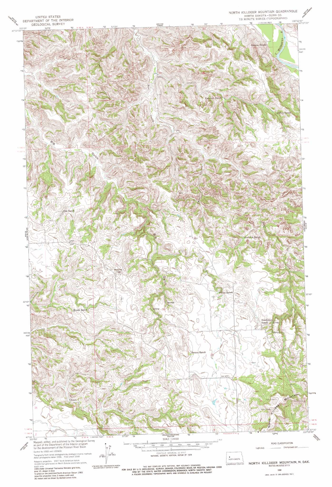
USGS Topo Quad 47102e8 - 1:24,000 scale
| Topo Map Name: | North Killdeer Mountain |
| USGS Topo Quad ID: | 47102e8 |
| Print Size: | ca. 21 1/4" wide x 27" high |
| Southeast Coordinates: | 47.5° N latitude / 102.875° W longitude |
| Map Center Coordinates: | 47.5625° N latitude / 102.9375° W longitude |
| U.S. State: | ND |
| Filename: | O47102E8.jpg |
| Download Map JPG Image: | North Killdeer Mountain topo map 1:24,000 scale |
| Map Type: | Topographic |
| Topo Series: | 7.5´ |
| Map Scale: | 1:24,000 |
| Source of Map Images: | United States Geological Survey (USGS) |
| Alternate Map Versions: |
North Killdeer Mountain ND 1958, updated 1960 Download PDF Buy paper map North Killdeer Mountain ND 1958, updated 1982 Download PDF Buy paper map North Killdeer Mountain ND 2011 Download PDF Buy paper map North Killdeer Mountain ND 2014 Download PDF Buy paper map |
1:24,000 Topo Quads surrounding North Killdeer Mountain
Schafer |
Schafer Se |
Johnsons Corner |
Blue Buttes Se |
Sanish Sw |
Lone Butte Nw |
Lone Butte Ne |
Croff |
Figure 4 Ranch |
Mandaree |
Lone Butte |
Lone Butte Se |
North Killdeer Mountain |
Lost Bridge |
Mandaree Sw |
Grassy Butte |
Petes Creek |
Killdeer Mountains |
Oakdale |
Dunn Center Nw |
Grassy Butte Sw |
Grassy Butte Se |
Fayette |
Killdeer |
Lake Ilo |
> Back to 47102e1 at 1:100,000 scale
> Back to 47102a1 at 1:250,000 scale
> Back to U.S. Topo Maps home
North Killdeer Mountain topo map: Gazetteer
North Killdeer Mountain: Summits
North Killdeer Mountain elevation 966m 3169′Round Top elevation 819m 2687′
North Killdeer Mountain: Valleys
Cedar Coulee elevation 627m 2057′North Killdeer Mountain digital topo map on disk
Buy this North Killdeer Mountain topo map showing relief, roads, GPS coordinates and other geographical features, as a high-resolution digital map file on DVD:
Eastern Montana & Western North Dakota
Buy digital topo maps: Eastern Montana & Western North Dakota