Blue Buttes Se Topo Map North Dakota
To zoom in, hover over the map of Blue Buttes Se
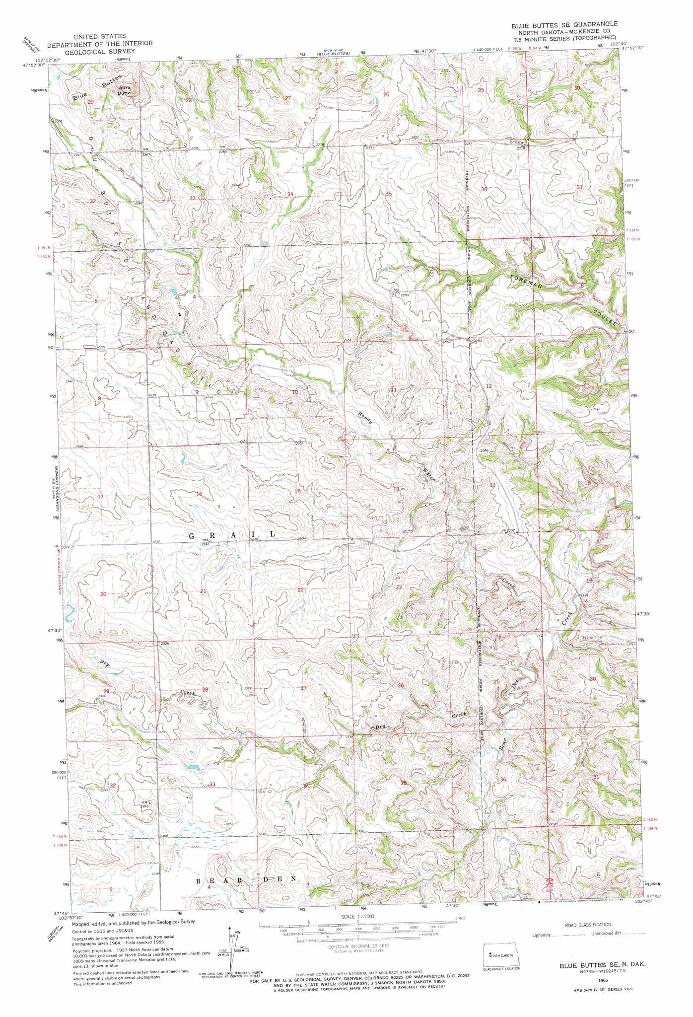
USGS Topo Quad 47102g7 - 1:24,000 scale
| Topo Map Name: | Blue Buttes Se |
| USGS Topo Quad ID: | 47102g7 |
| Print Size: | ca. 21 1/4" wide x 27" high |
| Southeast Coordinates: | 47.75° N latitude / 102.75° W longitude |
| Map Center Coordinates: | 47.8125° N latitude / 102.8125° W longitude |
| U.S. State: | ND |
| Filename: | O47102G7.jpg |
| Download Map JPG Image: | Blue Buttes Se topo map 1:24,000 scale |
| Map Type: | Topographic |
| Topo Series: | 7.5´ |
| Map Scale: | 1:24,000 |
| Source of Map Images: | United States Geological Survey (USGS) |
| Alternate Map Versions: |
Blue Buttes SE ND 1965, updated 1967 Download PDF Buy paper map Blue Buttes SE ND 1997, updated 2001 Download PDF Buy paper map Blue Buttes SE ND 2011 Download PDF Buy paper map Blue Buttes SE ND 2014 Download PDF Buy paper map |
| FStopo: | US Forest Service topo Blue Buttes SE is available: Download FStopo PDF Download FStopo TIF |
1:24,000 Topo Quads surrounding Blue Buttes Se
Tobacco Garden Bay |
Charlson Sw |
Charlson |
Rat Lake Sw |
Rat Lake Se |
Demicks Lake |
Keene |
Blue Buttes |
Sanish Nw |
Sanish |
Schafer Se |
Johnsons Corner |
Blue Buttes Se |
Sanish Sw |
Sanish Se |
Lone Butte Ne |
Croff |
Figure 4 Ranch |
Mandaree |
Mandaree Ne |
Lone Butte Se |
North Killdeer Mountain |
Lost Bridge |
Mandaree Sw |
Mandaree Se |
> Back to 47102e1 at 1:100,000 scale
> Back to 47102a1 at 1:250,000 scale
> Back to U.S. Topo Maps home
Blue Buttes Se topo map: Gazetteer
Blue Buttes Se: Streams
Dry Creek elevation 614m 2014′Handy Water Creek elevation 596m 1955′
Blue Buttes Se: Summits
Aura Butte elevation 836m 2742′Blue Buttes Se digital topo map on disk
Buy this Blue Buttes Se topo map showing relief, roads, GPS coordinates and other geographical features, as a high-resolution digital map file on DVD:
Eastern Montana & Western North Dakota
Buy digital topo maps: Eastern Montana & Western North Dakota