Hallock Topo Map Minnesota
To zoom in, hover over the map of Hallock
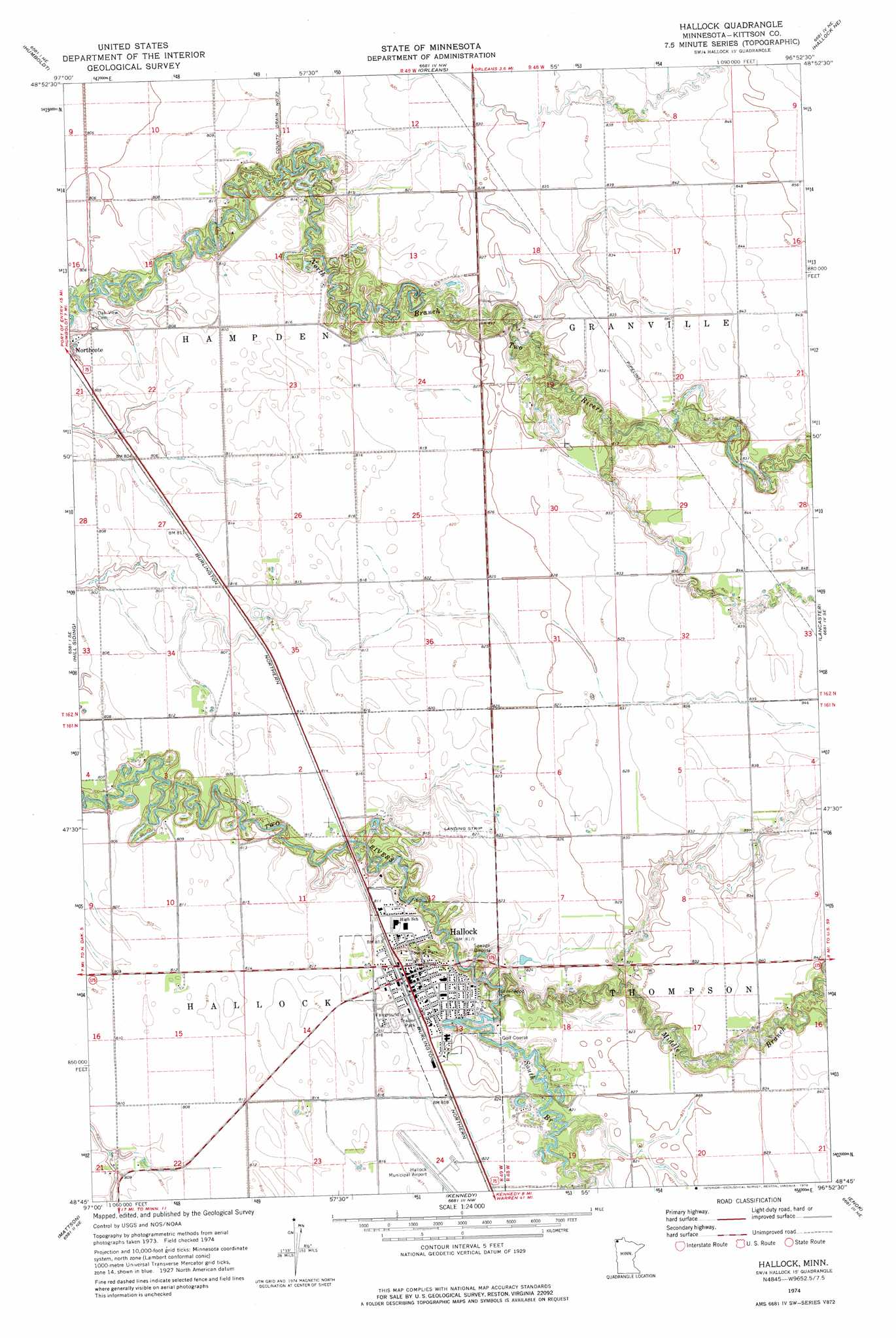
USGS Topo Quad 48096g8 - 1:24,000 scale
| Topo Map Name: | Hallock |
| USGS Topo Quad ID: | 48096g8 |
| Print Size: | ca. 21 1/4" wide x 27" high |
| Southeast Coordinates: | 48.75° N latitude / 96.875° W longitude |
| Map Center Coordinates: | 48.8125° N latitude / 96.9375° W longitude |
| U.S. State: | MN |
| Filename: | o48096g8.jpg |
| Download Map JPG Image: | Hallock topo map 1:24,000 scale |
| Map Type: | Topographic |
| Topo Series: | 7.5´ |
| Map Scale: | 1:24,000 |
| Source of Map Images: | United States Geological Survey (USGS) |
| Alternate Map Versions: |
Hallock MN 1974, updated 1976 Download PDF Buy paper map Hallock MN 2010 Download PDF Buy paper map Hallock MN 2013 Download PDF Buy paper map Hallock MN 2016 Download PDF Buy paper map |
1:24,000 Topo Quads surrounding Hallock
Pembina |
Humboldt |
Orleans |
Hallock Ne |
Skull Lake |
Joliette |
Hill Siding |
Hallock |
Lancaster |
Skull Lake Sw |
Bowesmont |
Mattson |
Kennedy |
Enok |
Lake Bronson |
Drayton |
Drayton Se |
Donaldson |
Kennedy Se |
Karlstad Sw |
> Back to 48096e1 at 1:100,000 scale
> Back to 48096a1 at 1:250,000 scale
> Back to U.S. Topo Maps home
Hallock topo map: Gazetteer
Hallock: Airports
Hallock Municipal Airport elevation 250m 820′Maurice Sugden Flying Service Strip elevation 250m 820′
Hallock: Dams
Two Rivers Dam elevation 250m 820′Hallock: Parks
Tourist Park elevation 244m 800′Hallock: Populated Places
Hallock elevation 249m 816′Viking Land Terrace elevation 250m 820′
Hallock: Post Offices
Hallock Post Office elevation 249m 816′Hallock: Streams
Little Joe River elevation 244m 800′Middle Branch Two Rivers elevation 243m 797′
South Branch Two Rivers elevation 243m 797′
Hallock digital topo map on disk
Buy this Hallock topo map showing relief, roads, GPS coordinates and other geographical features, as a high-resolution digital map file on DVD:
Eastern North Dakota & Eastern South Dakota
Buy digital topo maps: Eastern North Dakota & Eastern South Dakota