Mattson Topo Map Minnesota
To zoom in, hover over the map of Mattson
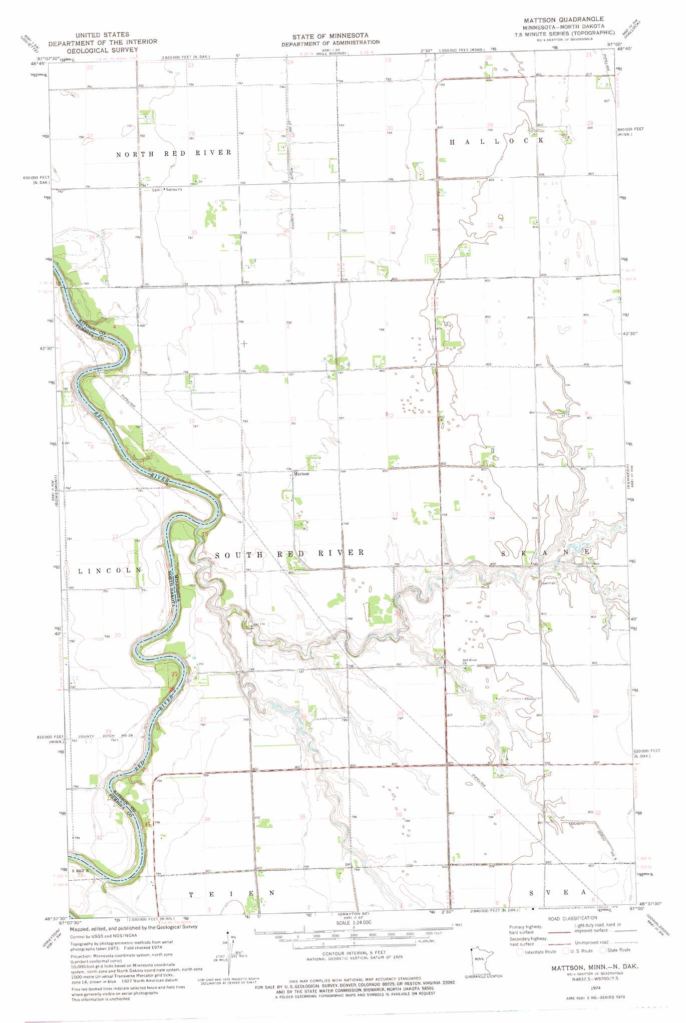
USGS Topo Quad 48097f1 - 1:24,000 scale
| Topo Map Name: | Mattson |
| USGS Topo Quad ID: | 48097f1 |
| Print Size: | ca. 21 1/4" wide x 27" high |
| Southeast Coordinates: | 48.625° N latitude / 97° W longitude |
| Map Center Coordinates: | 48.6875° N latitude / 97.0625° W longitude |
| U.S. States: | MN, ND |
| Filename: | o48097f1.jpg |
| Download Map JPG Image: | Mattson topo map 1:24,000 scale |
| Map Type: | Topographic |
| Topo Series: | 7.5´ |
| Map Scale: | 1:24,000 |
| Source of Map Images: | United States Geological Survey (USGS) |
| Alternate Map Versions: |
Mattson MN 1974, updated 1976 Download PDF Buy paper map Mattson MN 2011 Download PDF Buy paper map Mattson MN 2013 Download PDF Buy paper map Mattson MN 2016 Download PDF Buy paper map |
1:24,000 Topo Quads surrounding Mattson
Bathgate Ne |
Pembina |
Humboldt |
Orleans |
Hallock Ne |
Bathgate Se |
Joliette |
Hill Siding |
Hallock |
Lancaster |
Glasston Ne |
Bowesmont |
Mattson |
Kennedy |
Enok |
North Salt Lake |
Drayton |
Drayton Se |
Donaldson |
Kennedy Se |
Oakwood |
Big Woods Nw |
Big Woods Ne |
Stephen West |
Stephen East |
> Back to 48097e1 at 1:100,000 scale
> Back to 48096a1 at 1:250,000 scale
> Back to U.S. Topo Maps home
Mattson topo map: Gazetteer
Mattson: Canals
County Ditch Number Nine elevation 245m 803′County Ditch Number Twentyone elevation 240m 787′
Mattson: Populated Places
Mattson elevation 242m 793′Mattson: Post Offices
Mattson Post Office (historical) elevation 243m 797′Mattson digital topo map on disk
Buy this Mattson topo map showing relief, roads, GPS coordinates and other geographical features, as a high-resolution digital map file on DVD:
Eastern North Dakota & Eastern South Dakota
Buy digital topo maps: Eastern North Dakota & Eastern South Dakota