Hurricane Lake East Topo Map North Dakota
To zoom in, hover over the map of Hurricane Lake East
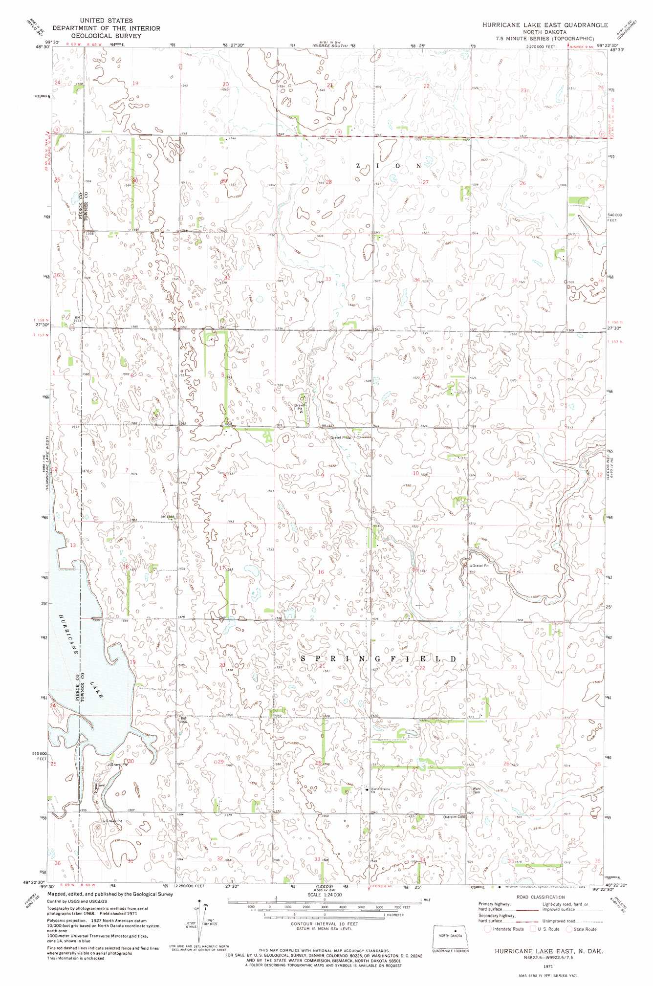
USGS Topo Quad 48099d4 - 1:24,000 scale
| Topo Map Name: | Hurricane Lake East |
| USGS Topo Quad ID: | 48099d4 |
| Print Size: | ca. 21 1/4" wide x 27" high |
| Southeast Coordinates: | 48.375° N latitude / 99.375° W longitude |
| Map Center Coordinates: | 48.4375° N latitude / 99.4375° W longitude |
| U.S. State: | ND |
| Filename: | O48099D4.jpg |
| Download Map JPG Image: | Hurricane Lake East topo map 1:24,000 scale |
| Map Type: | Topographic |
| Topo Series: | 7.5´ |
| Map Scale: | 1:24,000 |
| Source of Map Images: | United States Geological Survey (USGS) |
| Alternate Map Versions: |
Hurricane Lake East ND 1971, updated 1973 Download PDF Buy paper map Hurricane Lake East ND 2011 Download PDF Buy paper map Hurricane Lake East ND 2014 Download PDF Buy paper map |
1:24,000 Topo Quads surrounding Hurricane Lake East
Mylo Nw |
Mylo |
Bisbee North |
Big Coulee Dam |
Snyder Lake |
Island Lake |
Mylo Se |
Bisbee South |
Considine |
Egeland Sw |
Wolford |
Hurricane Lake West |
Hurricane Lake East |
Leeds Ne |
Cando |
Knox |
York |
Leeds |
Niles |
Churchs Ferry |
Baker |
Harlow |
Comstock |
Brinsmade |
Tilden |
> Back to 48099a1 at 1:100,000 scale
> Back to 48098a1 at 1:250,000 scale
> Back to U.S. Topo Maps home
No gazetteer data is available for the Hurricane Lake East topo map sheet.
Hurricane Lake East digital topo map on disk
Buy this Hurricane Lake East topo map showing relief, roads, GPS coordinates and other geographical features, as a high-resolution digital map file on DVD:
Eastern North Dakota & Eastern South Dakota
Buy digital topo maps: Eastern North Dakota & Eastern South Dakota