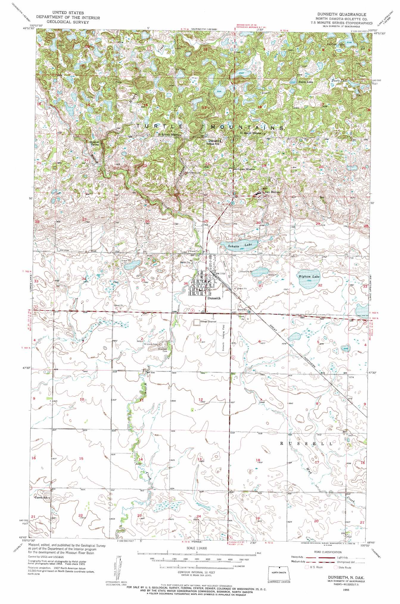
Dunseith Topo Map North Dakota
To zoom in, hover over the map of Dunseith
USGS Topo Quad 48100g1 - 1:24,000 scale
| Topo Map Name: | Dunseith |
| USGS Topo Quad ID: | 48100g1 |
| Print Size: | ca. 21 1/4" wide x 27" high |
| Southeast Coordinates: | 48.75° N latitude / 100° W longitude |
| Map Center Coordinates: | 48.8125° N latitude / 100.0625° W longitude |
| U.S. State: | ND |
| Filename: | O48100G1.jpg |
| Download Map JPG Image: | Dunseith topo map 1:24,000 scale |
| Map Type: | Topographic |
| Topo Series: | 7.5´ |
| Map Scale: | 1:24,000 |
| Source of Map Images: | United States Geological Survey (USGS) |
| Alternate Map Versions: |
Dunseith ND 1955, updated 1956 Download PDF Buy paper map Dunseith ND 2011 Download PDF Buy paper map Dunseith ND 2014 Download PDF Buy paper map |
1:24,000 Topo Quads surrounding Dunseith
Metigoshe Lake |
Boundary Lake |
International Peace Garden |
Carpenter Lake |
Lake Upsilon |
Bottineau Se |
Lords Lake |
Dunseith |
Lake Upsilon Sw |
Lake Upsilon Se |
Omemee |
Overly |
Fonda |
Thorne |
Rolette |
Willow City |
Barton |
Overly Se |
Rolette Sw |
Nanson |
> Back to 48100e1 at 1:100,000 scale
> Back to 48100a1 at 1:250,000 scale
> Back to U.S. Topo Maps home
Dunseith topo map: Gazetteer
Dunseith: Airports
Dunseith Landing Field elevation 512m 1679′Dunseith: Lakes
Bigham Lake elevation 519m 1702′Carlisle Lake elevation 636m 2086′
Schutte Lake elevation 525m 1722′
Smith Lake elevation 621m 2037′
Thorn Lake elevation 621m 2037′
Dunseith: Populated Places
Dunseith elevation 520m 1706′East Dunseith elevation 631m 2070′
San Haven elevation 579m 1899′
Dunseith: Streams
Indian Creek elevation 539m 1768′Mineral Creek elevation 564m 1850′
Dunseith digital topo map on disk
Buy this Dunseith topo map showing relief, roads, GPS coordinates and other geographical features, as a high-resolution digital map file on DVD:
Eastern North Dakota & Eastern South Dakota
Buy digital topo maps: Eastern North Dakota & Eastern South Dakota