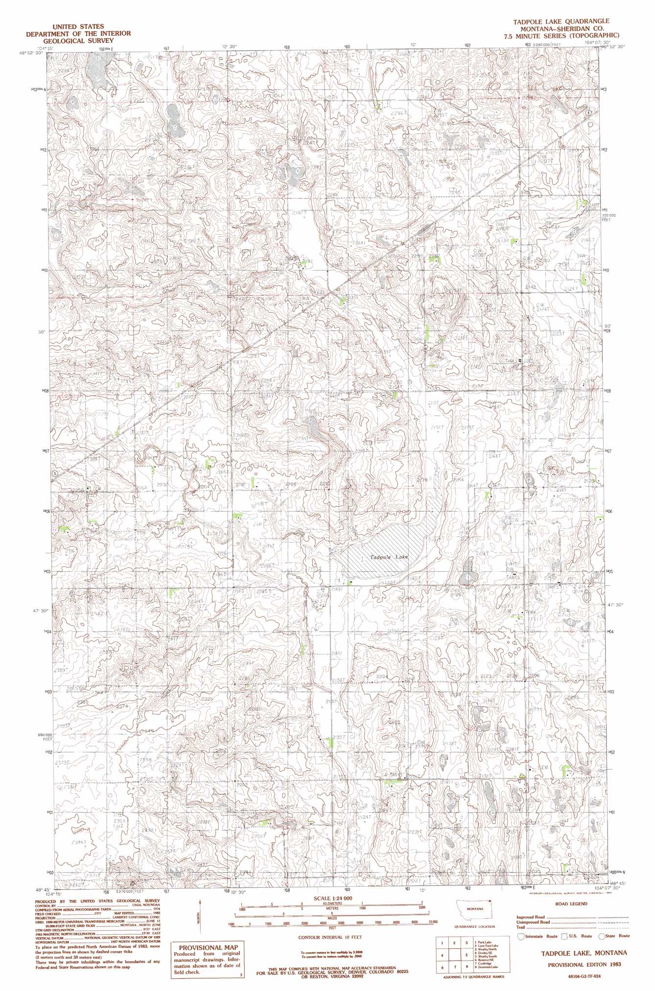
Tadpole Lake Topo Map Montana
To zoom in, hover over the map of Tadpole Lake
USGS Topo Quad 48104g2 - 1:24,000 scale
| Topo Map Name: | Tadpole Lake |
| USGS Topo Quad ID: | 48104g2 |
| Print Size: | ca. 21 1/4" wide x 27" high |
| Southeast Coordinates: | 48.75° N latitude / 104.125° W longitude |
| Map Center Coordinates: | 48.8125° N latitude / 104.1875° W longitude |
| U.S. State: | MT |
| Filename: | o48104g2.jpg |
| Download Map JPG Image: | Tadpole Lake topo map 1:24,000 scale |
| Map Type: | Topographic |
| Topo Series: | 7.5´ |
| Map Scale: | 1:24,000 |
| Source of Map Images: | United States Geological Survey (USGS) |
| Alternate Map Versions: |
Tadpole Lake MT 1983, updated 1983 Download PDF Buy paper map Tadpole Lake MT 2011 Download PDF Buy paper map Tadpole Lake MT 2014 Download PDF Buy paper map |
1:24,000 Topo Quads surrounding Tadpole Lake
Dooley |
Park Lake |
Lone Tree Lake |
Westby North |
Skjermo Lake |
Dooley Sw |
Dooley Se |
Tadpole Lake |
Westby South |
Alkabo |
Antelope |
Reserve Ne |
Coalridge |
Dominek Lake |
Camp Lake |
Reserve |
Reserve Se |
Dagmar |
Brush Lake |
Grenora |
> Back to 48104e1 at 1:100,000 scale
> Back to 48104a1 at 1:250,000 scale
> Back to U.S. Topo Maps home
Tadpole Lake topo map: Gazetteer
Tadpole Lake: Dams
Reed Number 2 Dam elevation 699m 2293′Tadpole Lake: Lakes
Tadpole Lake elevation 648m 2125′Tadpole Lake: Wells
35N57E02DACC01 Well elevation 674m 2211′36N57E25DACC01 Well elevation 668m 2191′
36N58E29CBCA01 Well elevation 694m 2276′
Tadpole Lake digital topo map on disk
Buy this Tadpole Lake topo map showing relief, roads, GPS coordinates and other geographical features, as a high-resolution digital map file on DVD:
Eastern Montana & Western North Dakota
Buy digital topo maps: Eastern Montana & Western North Dakota