Thoeny Hills East Topo Map Montana
To zoom in, hover over the map of Thoeny Hills East
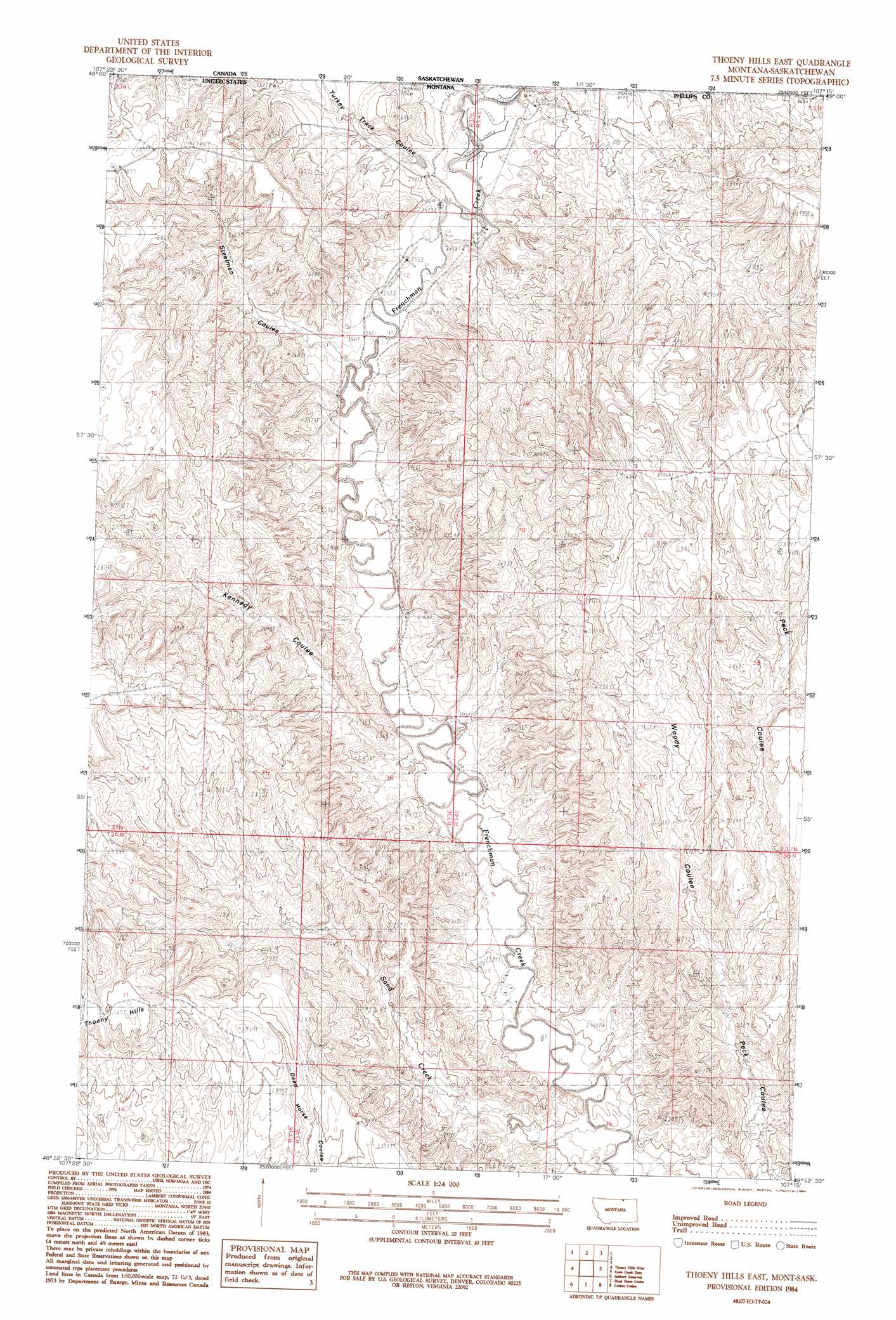
USGS Topo Quad 48107h3 - 1:24,000 scale
| Topo Map Name: | Thoeny Hills East |
| USGS Topo Quad ID: | 48107h3 |
| Print Size: | ca. 21 1/4" wide x 27" high |
| Southeast Coordinates: | 48.875° N latitude / 107.25° W longitude |
| Map Center Coordinates: | 48.9375° N latitude / 107.3125° W longitude |
| U.S. State: | MT |
| Filename: | o48107h3.jpg |
| Download Map JPG Image: | Thoeny Hills East topo map 1:24,000 scale |
| Map Type: | Topographic |
| Topo Series: | 7.5´ |
| Map Scale: | 1:24,000 |
| Source of Map Images: | United States Geological Survey (USGS) |
| Alternate Map Versions: |
Thoeny Hills East MT 1984, updated 1984 Download PDF Buy paper map Thoeny Hills East MT 2011 Download PDF Buy paper map Thoeny Hills East MT 2014 Download PDF Buy paper map |
1:24,000 Topo Quads surrounding Thoeny Hills East
Pea Lake |
Thoeny Hills West |
Thoeny Hills East |
Crow Creek Dam |
Black Calf Reservoir |
Whitewater East |
Salsbery Reservoir |
Dead Horse Coulee |
Coulter Coulee |
Snake Creek School |
Tattnall |
Forks |
Porcupine Coulee |
Genevieve |
Papoose Hills |
> Back to 48107e1 at 1:100,000 scale
> Back to 48106a1 at 1:250,000 scale
> Back to U.S. Topo Maps home
Thoeny Hills East topo map: Gazetteer
Thoeny Hills East: Ranges
Thoeny Hills elevation 946m 3103′Thoeny Hills East: Streams
Sand Creek elevation 719m 2358′Thoeny Hills East: Valleys
Kennedy Coulee elevation 726m 2381′Steelman Coulee elevation 732m 2401′
Turkey Track Coulee elevation 737m 2417′
Woody Coulee elevation 769m 2522′
Thoeny Hills East digital topo map on disk
Buy this Thoeny Hills East topo map showing relief, roads, GPS coordinates and other geographical features, as a high-resolution digital map file on DVD:
Eastern Montana & Western North Dakota
Buy digital topo maps: Eastern Montana & Western North Dakota