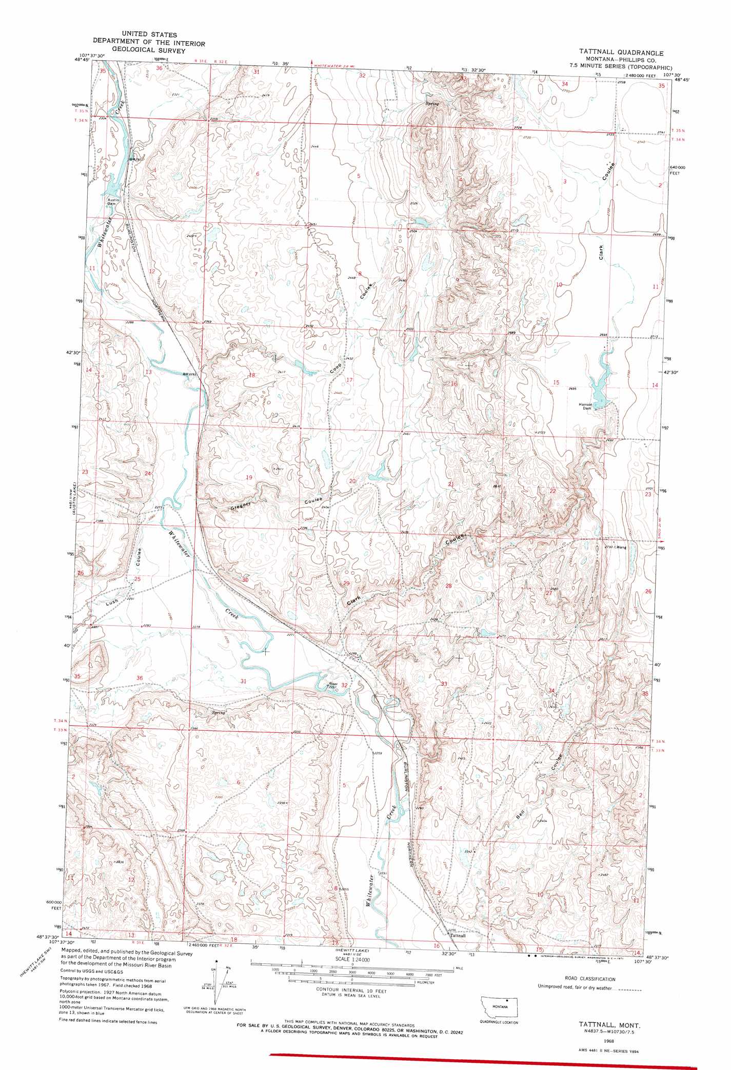
Tattnall Topo Map Montana
To zoom in, hover over the map of Tattnall
USGS Topo Quad 48107f5 - 1:24,000 scale
| Topo Map Name: | Tattnall |
| USGS Topo Quad ID: | 48107f5 |
| Print Size: | ca. 21 1/4" wide x 27" high |
| Southeast Coordinates: | 48.625° N latitude / 107.5° W longitude |
| Map Center Coordinates: | 48.6875° N latitude / 107.5625° W longitude |
| U.S. State: | MT |
| Filename: | o48107f5.jpg |
| Download Map JPG Image: | Tattnall topo map 1:24,000 scale |
| Map Type: | Topographic |
| Topo Series: | 7.5´ |
| Map Scale: | 1:24,000 |
| Source of Map Images: | United States Geological Survey (USGS) |
| Alternate Map Versions: |
Tattnall MT 1968, updated 1971 Download PDF Buy paper map Tattnall MT 2011 Download PDF Buy paper map Tattnall MT 2014 Download PDF Buy paper map |
1:24,000 Topo Quads surrounding Tattnall
Morgan |
Gustin Coulee |
Pea Lake |
Thoeny Hills West |
Thoeny Hills East |
Loring |
Whitewater West |
Whitewater East |
Salsbery Reservoir |
Dead Horse Coulee |
Austin Coulee |
Austin Lake |
Tattnall |
Forks |
Porcupine Coulee |
Fanny Hill |
Hewitt Lake Sw |
Hewitt Lake |
Cole |
Double S Hill |
Malta Ne |
Lake Bowdoin |
Bowdoin |
Robinson Ranch |
Saco |
> Back to 48107e1 at 1:100,000 scale
> Back to 48106a1 at 1:250,000 scale
> Back to U.S. Topo Maps home
Tattnall topo map: Gazetteer
Tattnall: Dams
Austin Dam elevation 701m 2299′Austin Dam elevation 700m 2296′
Hanson Dam elevation 819m 2687′
Hanson Dam elevation 819m 2687′
Tattnall: Populated Places
Tattnall elevation 688m 2257′Tattnall: Valleys
Clark Coulee elevation 697m 2286′Coop Coulee elevation 727m 2385′
Gregory Coulee elevation 697m 2286′
Lush Coulee elevation 695m 2280′
Tattnall digital topo map on disk
Buy this Tattnall topo map showing relief, roads, GPS coordinates and other geographical features, as a high-resolution digital map file on DVD:
Eastern Montana & Western North Dakota
Buy digital topo maps: Eastern Montana & Western North Dakota