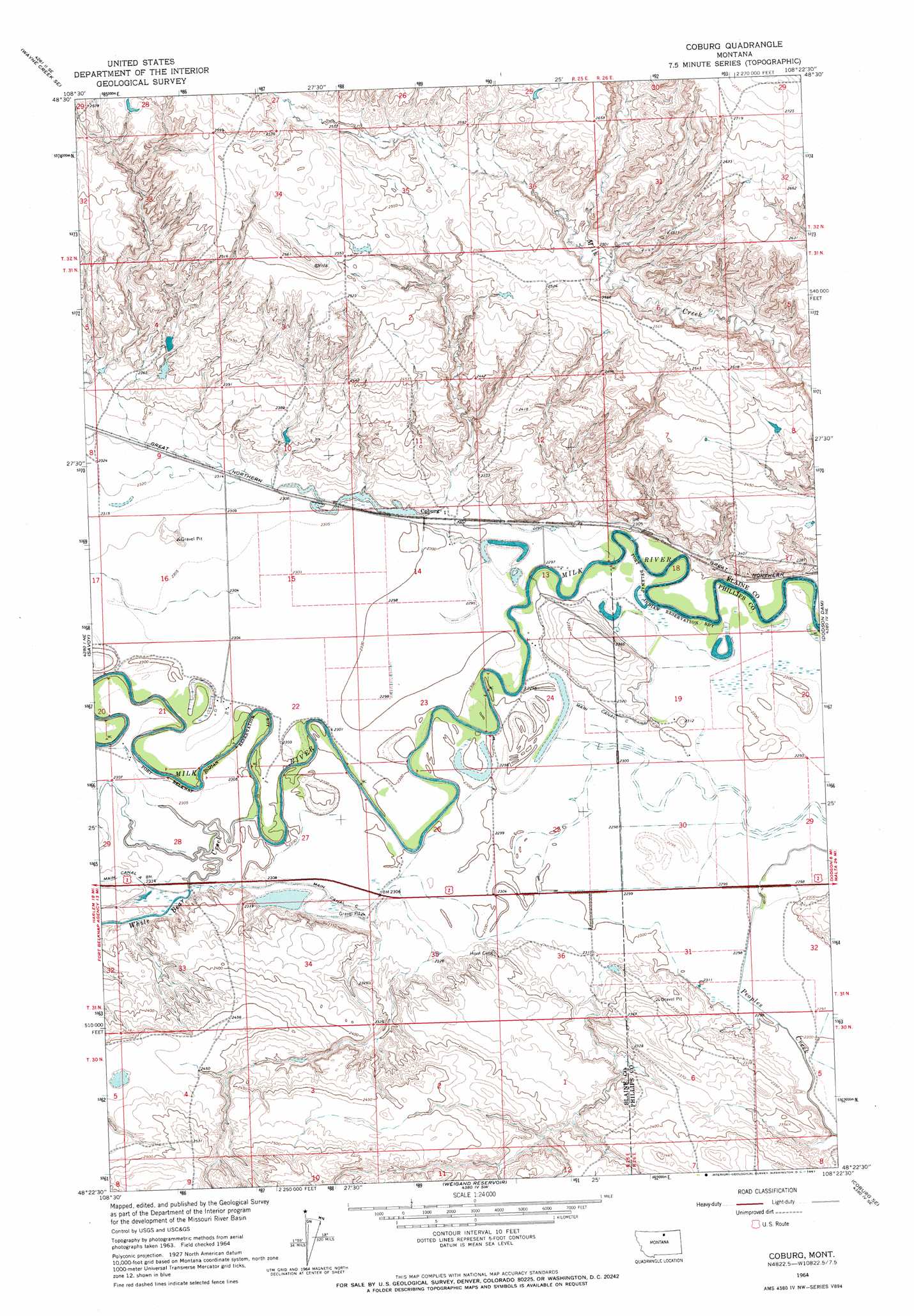
Coburg Topo Map Montana
To zoom in, hover over the map of Coburg
USGS Topo Quad 48108d4 - 1:24,000 scale
| Topo Map Name: | Coburg |
| USGS Topo Quad ID: | 48108d4 |
| Print Size: | ca. 21 1/4" wide x 27" high |
| Southeast Coordinates: | 48.375° N latitude / 108.375° W longitude |
| Map Center Coordinates: | 48.4375° N latitude / 108.4375° W longitude |
| U.S. State: | MT |
| Filename: | o48108d4.jpg |
| Download Map JPG Image: | Coburg topo map 1:24,000 scale |
| Map Type: | Topographic |
| Topo Series: | 7.5´ |
| Map Scale: | 1:24,000 |
| Source of Map Images: | United States Geological Survey (USGS) |
| Alternate Map Versions: |
Coburg MT 1964, updated 1967 Download PDF Buy paper map Coburg MT 2011 Download PDF Buy paper map Coburg MT 2014 Download PDF Buy paper map |
1:24,000 Topo Quads surrounding Coburg
Wayne Creek Nw |
Hornbeck Lake |
Down Reservoir Nw |
Down Reservoir Ne |
Emerick Bench |
Grable Coulee |
Wayne Creek Se |
Down Reservoir Sw |
Down Reservoir |
Hubert Hill Sw |
Threemile Reservoir |
Savoy |
Coburg |
Dodson Dam |
Dodson |
Wild Horse Butte |
Bigby Lake |
Weigand Reservoir |
Coburg Se |
Cow Creek |
Lodge Pole Nw |
Lodge Pole Ne |
Big Flat West |
Big Flat East |
Wild Horse Reservoir |
> Back to 48108a1 at 1:100,000 scale
> Back to 48108a1 at 1:250,000 scale
> Back to U.S. Topo Maps home
Coburg topo map: Gazetteer
Coburg: Bridges
Milk River Bridge elevation 698m 2290′Coburg: Canals
Main Canal elevation 701m 2299′Main Canal elevation 705m 2312′
Coburg: Dams
BR-38 Dam elevation 799m 2621′Mayflower Dam elevation 703m 2306′
Coburg: Populated Places
Coburg elevation 703m 2306′Coburg: Post Offices
Coburg Post Office (historical) elevation 703m 2306′Coburg: Streams
Eureka Creek elevation 760m 2493′White Bear Creek elevation 698m 2290′
Coburg: Wells
31N25E21CBCD01 Well elevation 702m 2303′31N25E24CCAA01 Well elevation 702m 2303′
31N25E24CCB_01 Well elevation 701m 2299′
31N25E24CCB_02 Well elevation 699m 2293′
31N26E19DCCD01 Well elevation 701m 2299′
31N26E32BAD_01 Well elevation 704m 2309′
31N26E32BAD_02 Well elevation 705m 2312′
Coburg digital topo map on disk
Buy this Coburg topo map showing relief, roads, GPS coordinates and other geographical features, as a high-resolution digital map file on DVD: