Bigby Lake Topo Map Montana
To zoom in, hover over the map of Bigby Lake
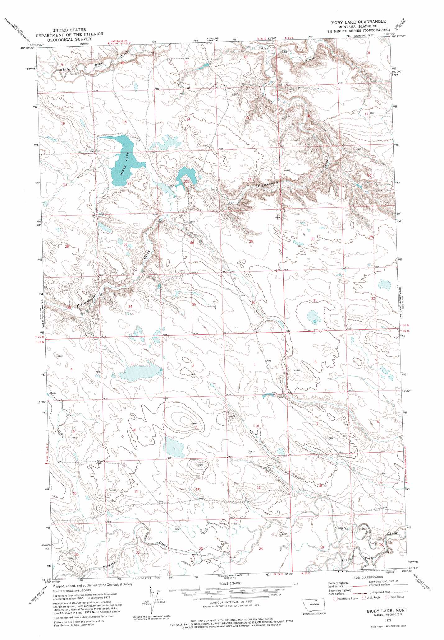
USGS Topo Quad 48108c5 - 1:24,000 scale
| Topo Map Name: | Bigby Lake |
| USGS Topo Quad ID: | 48108c5 |
| Print Size: | ca. 21 1/4" wide x 27" high |
| Southeast Coordinates: | 48.25° N latitude / 108.5° W longitude |
| Map Center Coordinates: | 48.3125° N latitude / 108.5625° W longitude |
| U.S. State: | MT |
| Filename: | o48108c5.jpg |
| Download Map JPG Image: | Bigby Lake topo map 1:24,000 scale |
| Map Type: | Topographic |
| Topo Series: | 7.5´ |
| Map Scale: | 1:24,000 |
| Source of Map Images: | United States Geological Survey (USGS) |
| Alternate Map Versions: |
Bigby Lake MT 1971, updated 1974 Download PDF Buy paper map Bigby Lake MT 2011 Download PDF Buy paper map Bigby Lake MT 2014 Download PDF Buy paper map |
1:24,000 Topo Quads surrounding Bigby Lake
Harlem |
Grable Coulee |
Wayne Creek Se |
Down Reservoir Sw |
Down Reservoir |
Fort Belknap Agency |
Threemile Reservoir |
Savoy |
Coburg |
Dodson Dam |
Fort Belknap Agency Se |
Wild Horse Butte |
Bigby Lake |
Weigand Reservoir |
Coburg Se |
Lake Seventeen Ne |
Lodge Pole Nw |
Lodge Pole Ne |
Big Flat West |
Big Flat East |
Lake Seventeen East |
Stiffarm Coulee |
Lodge Pole |
Ball Coulee |
Ester Lake |
> Back to 48108a1 at 1:100,000 scale
> Back to 48108a1 at 1:250,000 scale
> Back to U.S. Topo Maps home
Bigby Lake topo map: Gazetteer
Bigby Lake: Dams
Fort Belknap Number 10 Dam elevation 769m 2522′Bigby Lake: Lakes
Bigby Lake elevation 771m 2529′Bigby Lake: Streams
Fifteenmile Creek elevation 725m 2378′South Fork Peoples Creek elevation 778m 2552′
Bigby Lake digital topo map on disk
Buy this Bigby Lake topo map showing relief, roads, GPS coordinates and other geographical features, as a high-resolution digital map file on DVD: