Lost River Topo Map Montana
To zoom in, hover over the map of Lost River
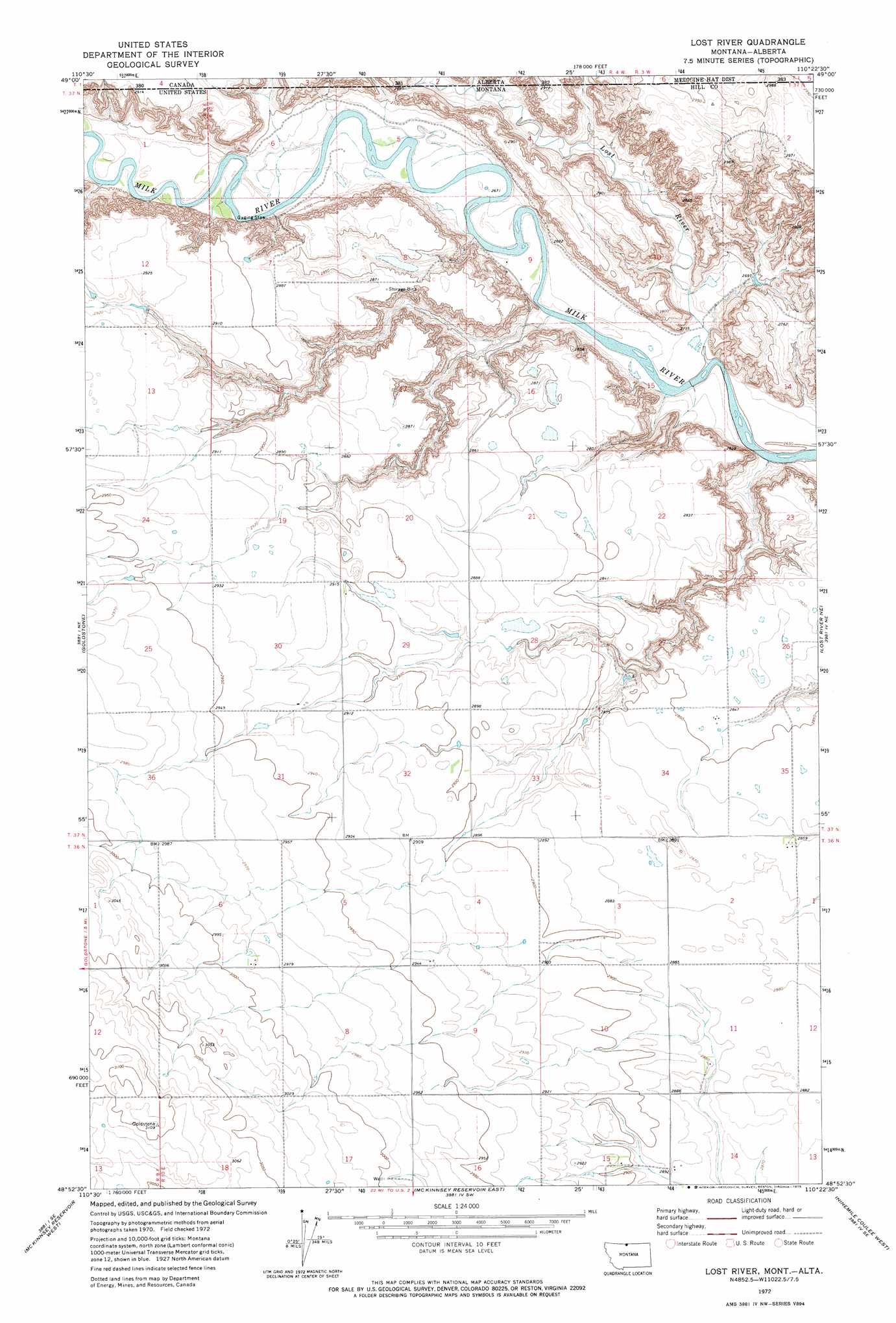
USGS Topo Quad 48110h4 - 1:24,000 scale
| Topo Map Name: | Lost River |
| USGS Topo Quad ID: | 48110h4 |
| Print Size: | ca. 21 1/4" wide x 27" high |
| Southeast Coordinates: | 48.875° N latitude / 110.375° W longitude |
| Map Center Coordinates: | 48.9375° N latitude / 110.4375° W longitude |
| U.S. State: | MT |
| Filename: | o48110h4.jpg |
| Download Map JPG Image: | Lost River topo map 1:24,000 scale |
| Map Type: | Topographic |
| Topo Series: | 7.5´ |
| Map Scale: | 1:24,000 |
| Source of Map Images: | United States Geological Survey (USGS) |
| Alternate Map Versions: |
Lost River MT 1972, updated 1975 Download PDF Buy paper map Lost River MT 2011 Download PDF Buy paper map Lost River MT 2014 Download PDF Buy paper map |
1:24,000 Topo Quads surrounding Lost River
Laird Lake |
Goldstone |
Lost River |
Lost River Ne |
Simpson |
Goldstone Sw |
Mckinnsey Reservoir West |
Mckinnsey Reservoir East |
Ninemile Coulee West |
Ninemile Coulee East |
Rudyard Nw |
Rudyaro Ne |
Gildford Nw |
Gildford Ne |
Dry Lake |
> Back to 48110e1 at 1:100,000 scale
> Back to 48110a1 at 1:250,000 scale
> Back to U.S. Topo Maps home
Lost River topo map: Gazetteer
Lost River: Post Offices
Fairchild Post Office (historical) elevation 870m 2854′Lost River: Streams
Lost River elevation 808m 2650′Lost River: Valleys
Sahara Coulee elevation 886m 2906′Lost River: Wells
36N10E06DDCC01 Well elevation 912m 2992′37N10E34AAAB01 Well elevation 868m 2847′
Lost River digital topo map on disk
Buy this Lost River topo map showing relief, roads, GPS coordinates and other geographical features, as a high-resolution digital map file on DVD: