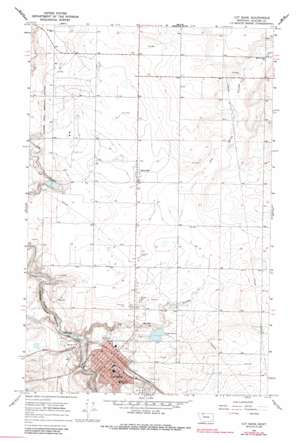
Cut Bank Topo Map Montana
To zoom in, hover over the map of Cut Bank
USGS Topo Quad 48112f3 - 1:24,000 scale
| Topo Map Name: | Cut Bank |
| USGS Topo Quad ID: | 48112f3 |
| Print Size: | ca. 21 1/4" wide x 27" high |
| Southeast Coordinates: | 48.625° N latitude / 112.25° W longitude |
| Map Center Coordinates: | 48.6875° N latitude / 112.3125° W longitude |
| U.S. State: | MT |
| Filename: | o48112f3.jpg |
| Download Map JPG Image: | Cut Bank topo map 1:24,000 scale |
| Map Type: | Topographic |
| Topo Series: | 7.5´ |
| Map Scale: | 1:24,000 |
| Source of Map Images: | United States Geological Survey (USGS) |
| Alternate Map Versions: |
Cut Bank MT 1966, updated 1969 Download PDF Buy paper map Cut Bank MT 1966, updated 1985 Download PDF Buy paper map Cut Bank MT 2011 Download PDF Buy paper map Cut Bank MT 2014 Download PDF Buy paper map |
1:24,000 Topo Quads surrounding Cut Bank
> Back to 48112e1 at 1:100,000 scale
> Back to 48112a1 at 1:250,000 scale
> Back to U.S. Topo Maps home
Cut Bank topo map: Gazetteer
Cut Bank: Dams
Cut Bank Sewage Disposal Pond Dam elevation 1125m 3690′Cut Bank Sewage Lagoon Dam elevation 1136m 3727′
Hagerty Dam elevation 1140m 3740′
Yunck Dam elevation 1126m 3694′
Cut Bank: Populated Places
Cut Bank elevation 1151m 3776′Santa Rita elevation 1158m 3799′
Skyland Trailer Park elevation 1164m 3818′
Cut Bank: Post Offices
Cut Bank Post Office elevation 1149m 3769′Santa Rita Post Office (historical) elevation 1160m 3805′
Cut Bank: Valleys
Old Maids Coulee elevation 1088m 3569′Cut Bank: Wells
33N05W05BA__01 Well elevation 1141m 3743′33N05W06BB__01 Well elevation 1134m 3720′
33N05W06BC__01 Well elevation 1126m 3694′
33N05W06CB__01 Well elevation 1141m 3743′
33N05W07DB__01 Well elevation 1163m 3815′
33N05W08CC__01 Well elevation 1168m 3832′
33N05W08CD__01 Well elevation 1167m 3828′
33N06W11BD__01 Well elevation 1133m 3717′
33N06W12AA__01 Well elevation 1150m 3772′
33N06W12AAA_02 Well elevation 1143m 3750′
33N06W12AAA_03 Well elevation 1143m 3750′
34N05W03BB__01 Well elevation 1185m 3887′
34N05W03CC__01 Well elevation 1194m 3917′
34N05W05BC__01 Well elevation 1186m 3891′
34N05W09AA__01 Well elevation 1185m 3887′
34N05W09BD__01 Well elevation 1169m 3835′
34N05W18CC__01 Well elevation 1157m 3795′
34N05W20BB__01 Well elevation 1151m 3776′
34N05W20DD__01 Well elevation 1158m 3799′
34N05W29DA__01 Well elevation 1149m 3769′
34N05W29DA__02 Well elevation 1149m 3769′
34N05W30BB__01 Well elevation 1151m 3776′
34N05W31BC__01 Well elevation 1147m 3763′
34N05W31CD__01 Well elevation 1140m 3740′
34N05W32CC__01 Well elevation 1136m 3727′
34N05W34BB__01 Well elevation 1170m 3838′
34N06W02CB__01 Well elevation 1172m 3845′
34N06W11BA__01 Well elevation 1159m 3802′
34N06W11CC__01 Well elevation 1152m 3779′
34N06W12CC__01 Well elevation 1159m 3802′
34N06W13AC__01 Well elevation 1157m 3795′
34N06W13BC__01 Well elevation 1158m 3799′
34N06W14BA__01 Well elevation 1154m 3786′
34N06W14BC__01 Well elevation 1154m 3786′
34N06W14DD__01 Well elevation 1155m 3789′
34N06W14DD__02 Well elevation 1155m 3789′
34N06W24DA__01 Well elevation 1156m 3792′
34N06W36AD__01 Well elevation 1148m 3766′
35N06W34AD__01 Well elevation 1180m 3871′
35N06W34DD__01 Well elevation 1179m 3868′
35N06W35CCBD01 Well elevation 1178m 3864′
Cut Bank digital topo map on disk
Buy this Cut Bank topo map showing relief, roads, GPS coordinates and other geographical features, as a high-resolution digital map file on DVD:


