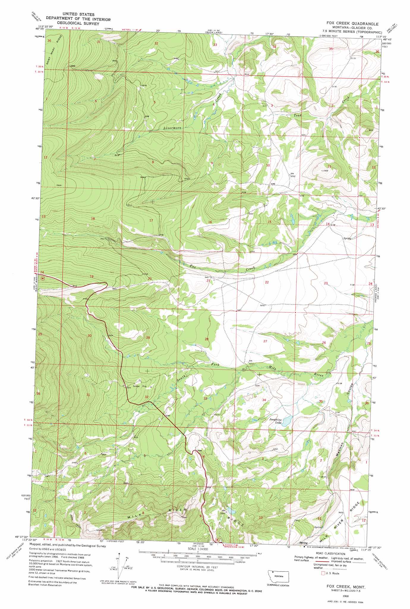
Fox Creek Topo Map Montana
To zoom in, hover over the map of Fox Creek
USGS Topo Quad 48113f3 - 1:24,000 scale
| Topo Map Name: | Fox Creek |
| USGS Topo Quad ID: | 48113f3 |
| Print Size: | ca. 21 1/4" wide x 27" high |
| Southeast Coordinates: | 48.625° N latitude / 113.25° W longitude |
| Map Center Coordinates: | 48.6875° N latitude / 113.3125° W longitude |
| U.S. State: | MT |
| Filename: | o48113f3.jpg |
| Download Map JPG Image: | Fox Creek topo map 1:24,000 scale |
| Map Type: | Topographic |
| Topo Series: | 7.5´ |
| Map Scale: | 1:24,000 |
| Source of Map Images: | United States Geological Survey (USGS) |
| Alternate Map Versions: |
Fox Creek MT 1968, updated 1972 Download PDF Buy paper map Fox Creek MT 2011 Download PDF Buy paper map Fox Creek MT 2014 Download PDF Buy paper map |
1:24,000 Topo Quads surrounding Fox Creek
Chief Mountain |
Pike Lake |
Goose Lake |
Hall Coulee |
Emigrant Gap |
Lake Sherburne |
Babb |
Duck Lake |
Wetzel |
Hoodoo Hill |
Rising Sun |
Saint Mary |
Fox Creek |
Horse Lake |
Browning Ne |
Mount Stimson |
Cut Bank Pass |
Kiowa |
Starr School |
Browning |
Mount Saint Nicholas |
Mount Rockwell |
Squaw Mountain |
East Glacier Park |
Big Rock |
> Back to 48113e1 at 1:100,000 scale
> Back to 48112a1 at 1:250,000 scale
> Back to U.S. Topo Maps home
Fox Creek topo map: Gazetteer
Fox Creek: Lakes
Josephine Lake elevation 1577m 5173′Fox Creek: Springs
34N13W08BDDD01 Spring elevation 1655m 5429′34N13W14DADC01 Spring elevation 1555m 5101′
Fox Creek digital topo map on disk
Buy this Fox Creek topo map showing relief, roads, GPS coordinates and other geographical features, as a high-resolution digital map file on DVD: