Tybee Island South Topo Map Georgia
To zoom in, hover over the map of Tybee Island South
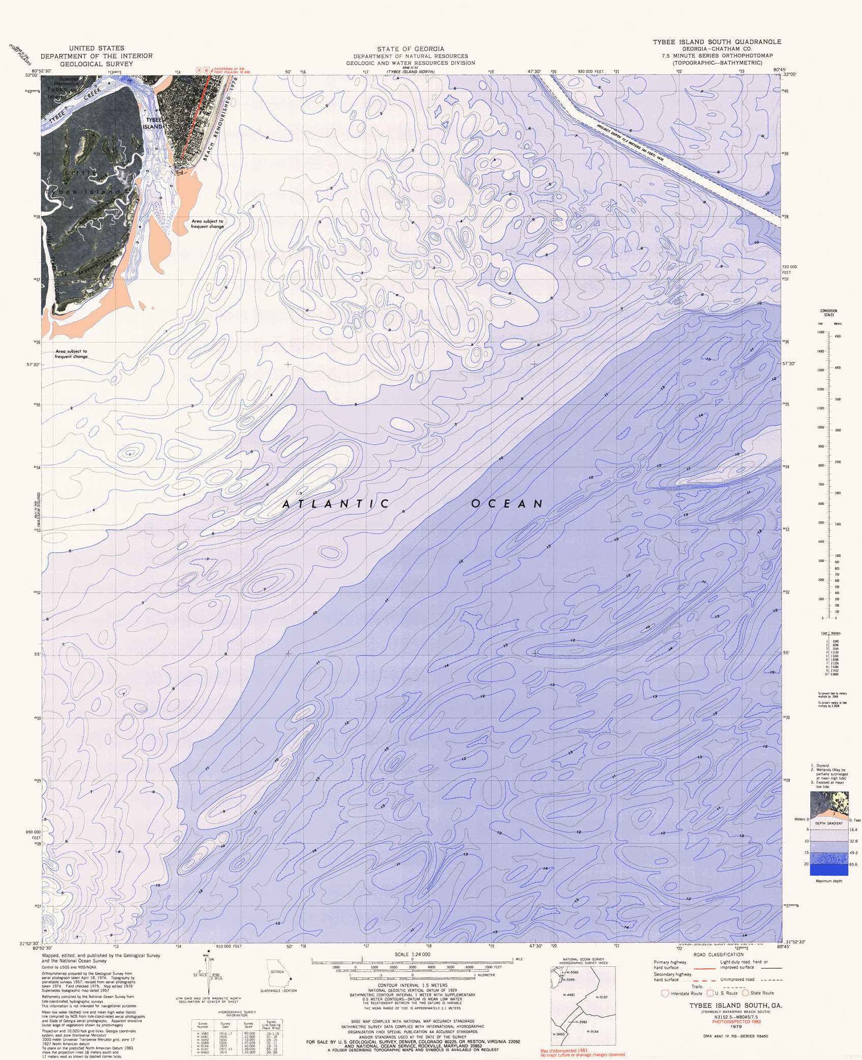
USGS Topo Quad 31080h7 - 1:24,000 scale
| Topo Map Name: | Tybee Island South |
| USGS Topo Quad ID: | 31080h7 |
| Print Size: | ca. 21 1/4" wide x 27" high |
| Southeast Coordinates: | 31.875° N latitude / 80.75° W longitude |
| Map Center Coordinates: | 31.9375° N latitude / 80.8125° W longitude |
| U.S. State: | GA |
| Filename: | p31080h7.jpg |
| Download Map JPG Image: | Tybee Island South topo map 1:24,000 scale |
| Map Type: | Orthophoto |
| Topo Series: | 7.5´ |
| Map Scale: | 1:24,000 |
| Source of Map Images: | United States Geological Survey (USGS) |
| Alternate Map Versions: |
Savannah Beach South GA 1957, updated 1959 Download PDF Buy paper map Savannah Beach South GA 1957, updated 1972 Download PDF Buy paper map Tybee Island South GA 1979, updated 1979 Download PDF Buy paper map Tybee Island South GA 1979, updated 1979 Download PDF Buy paper map Tybee Island South GA 2011 Download PDF Buy paper map Tybee Island South GA 2014 Download PDF Buy paper map |
1:24,000 Topo Quads surrounding Tybee Island South
Limehouse |
Pritchardville |
Bluffton |
Hilton Head |
|
Savannah |
Fort Pulaski |
Tybee Island North |
||
Isle Of Hope |
Wassaw Sound |
Tybee Island South |
||
Raccoon Key |
||||
> Back to 31080e1 at 1:100,000 scale
> Back to 31080a1 at 1:250,000 scale
> Back to U.S. Topo Maps home
Tybee Island South topo map: Gazetteer
Tybee Island South: Populated Places
Savannah Beach elevation 4m 13′Tybee Island South: Streams
Horse Pen Creek elevation 0m 0′Tybee Creek elevation 0m 0′
Tybee Island South digital topo map on disk
Buy this Tybee Island South topo map showing relief, roads, GPS coordinates and other geographical features, as a high-resolution digital map file on DVD: