Guadalupe Canyon Topo Map Arizona
To zoom in, hover over the map of Guadalupe Canyon
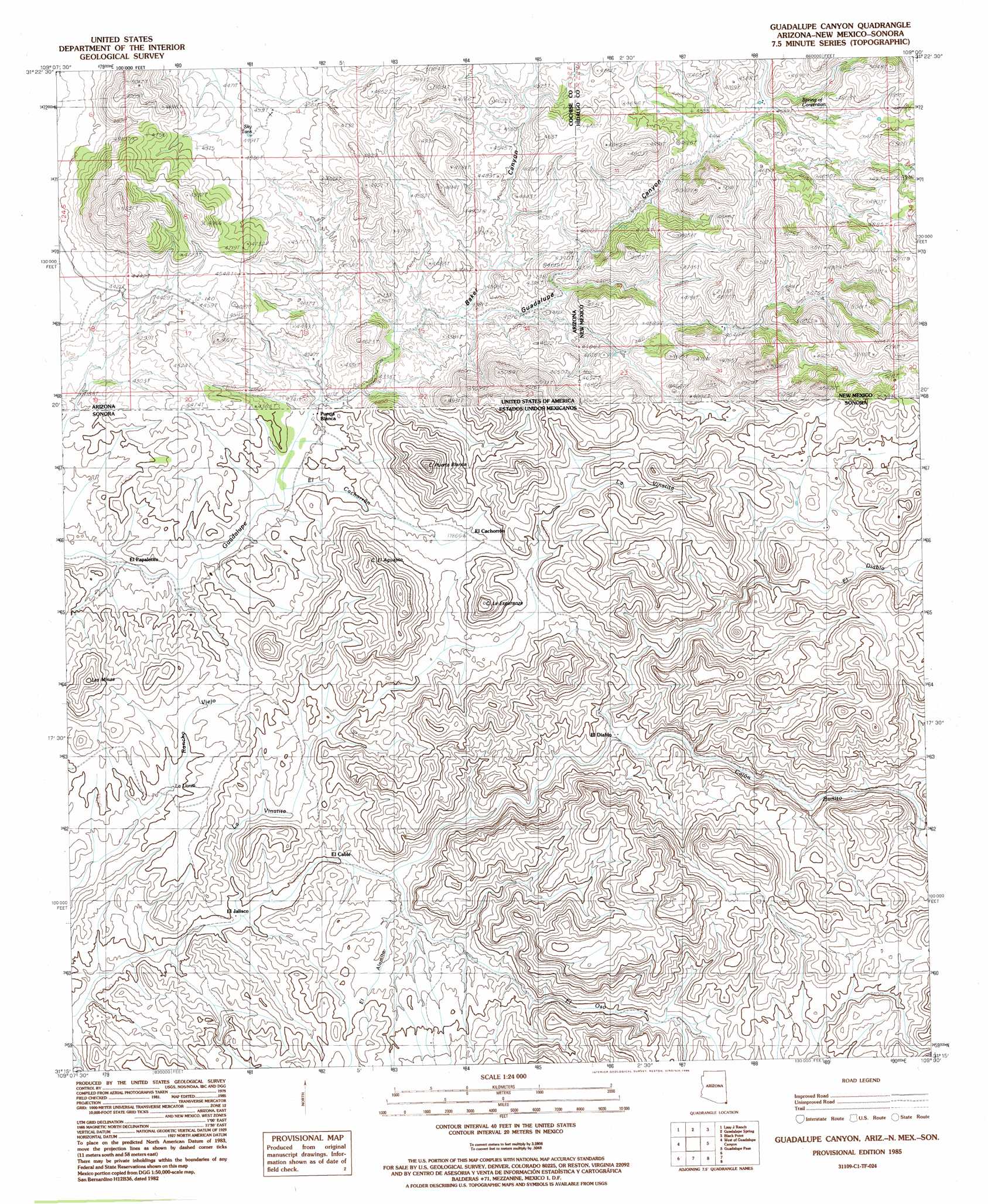
USGS Topo Quad 31109c1 - 1:24,000 scale
| Topo Map Name: | Guadalupe Canyon |
| USGS Topo Quad ID: | 31109c1 |
| Print Size: | ca. 21 1/4" wide x 27" high |
| Southeast Coordinates: | 31.25° N latitude / 109° W longitude |
| Map Center Coordinates: | 31.3125° N latitude / 109.0625° W longitude |
| U.S. States: | AZ, NM |
| Filename: | o31109c1.jpg |
| Download Map JPG Image: | Guadalupe Canyon topo map 1:24,000 scale |
| Map Type: | Topographic |
| Topo Series: | 7.5´ |
| Map Scale: | 1:24,000 |
| Source of Map Images: | United States Geological Survey (USGS) |
| Alternate Map Versions: |
Guadalupe Canyon AZ 1985, updated 1986 Download PDF Buy paper map Guadalupe Canyon AZ 2010 Download PDF Buy paper map Guadalupe Canyon AZ 2011 Download PDF Buy paper map Guadalupe Canyon AZ 2014 Download PDF Buy paper map |
1:24,000 Topo Quads surrounding Guadalupe Canyon
Pedregosa Mountains East |
Paramore Crater |
Skeleton Canyon |
Clanton Draw |
Animas Peak |
Cinder Hill |
Lazy J Ranch |
Guadalupe Spring |
Black Point |
Fitzpatricks |
San Bernardino Ranch |
West Of Guadalupe Canyon |
Guadalupe Canyon |
Guadalupe Pass |
Lang Canyon |
> Back to 31109a1 at 1:100,000 scale
> Back to 31108a1 at 1:250,000 scale
> Back to U.S. Topo Maps home
Guadalupe Canyon topo map: Gazetteer
Guadalupe Canyon: Springs
Spring of Contention elevation 1380m 4527′Guadalupe Canyon: Valleys
Baker Canyon elevation 1305m 4281′Guadalupe Canyon elevation 1281m 4202′
Guadalupe Canyon digital topo map on disk
Buy this Guadalupe Canyon topo map showing relief, roads, GPS coordinates and other geographical features, as a high-resolution digital map file on DVD: