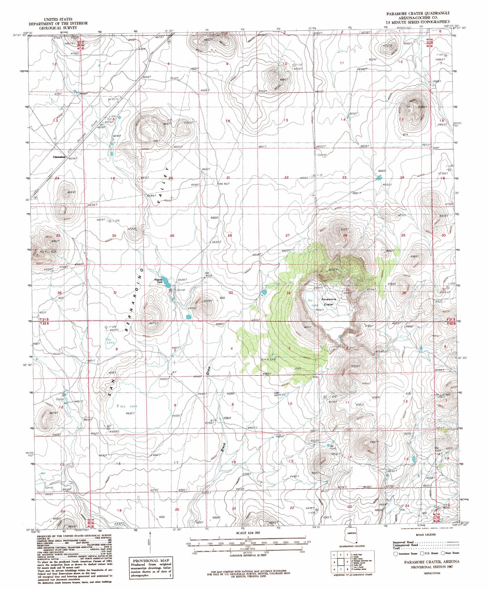
Paramore Crater Topo Map Arizona
To zoom in, hover over the map of Paramore Crater
USGS Topo Quad 31109e2 - 1:24,000 scale
| Topo Map Name: | Paramore Crater |
| USGS Topo Quad ID: | 31109e2 |
| Print Size: | ca. 21 1/4" wide x 27" high |
| Southeast Coordinates: | 31.5° N latitude / 109.125° W longitude |
| Map Center Coordinates: | 31.5625° N latitude / 109.1875° W longitude |
| U.S. State: | AZ |
| Filename: | o31109e2.jpg |
| Download Map JPG Image: | Paramore Crater topo map 1:24,000 scale |
| Map Type: | Topographic |
| Topo Series: | 7.5´ |
| Map Scale: | 1:24,000 |
| Source of Map Images: | United States Geological Survey (USGS) |
| Alternate Map Versions: |
Paramore Crater AZ 1987, updated 1987 Download PDF Buy paper map Paramore Crater AZ 1996, updated 2003 Download PDF Buy paper map Paramore Crater AZ 2011 Download PDF Buy paper map Paramore Crater AZ 2014 Download PDF Buy paper map |
1:24,000 Topo Quads surrounding Paramore Crater
Stanford Canyon |
Chiricahua Peak |
Portal Peak |
Rodeo |
Indian Peak |
Bruno Peak |
Swede Peak |
Apache |
Skull Canyon |
Mount Baldy |
Pedregosa Mountains West |
Pedregosa Mountains East |
Paramore Crater |
Skeleton Canyon |
Clanton Draw |
College Peaks |
Cinder Hill |
Lazy J Ranch |
Guadalupe Spring |
Black Point |
East Of Douglas |
San Bernardino Ranch |
West Of Guadalupe Canyon |
Guadalupe Canyon |
Guadalupe Pass |
> Back to 31109e1 at 1:100,000 scale
> Back to 31108a1 at 1:250,000 scale
> Back to U.S. Topo Maps home
Paramore Crater topo map: Gazetteer
Paramore Crater: Craters
Paramore Crater elevation 1351m 4432′Paramore Crater: Crossings
Lems Spring Overpass elevation 1460m 4790′Paramore Crater: Populated Places
Chiricahua elevation 1425m 4675′Paramore Crater: Reservoirs
Chiricahua Siding Tank elevation 1415m 4642′Malpais Tank elevation 1377m 4517′
Paramore Crater: Summits
Red Hill elevation 1533m 5029′Paramore Crater digital topo map on disk
Buy this Paramore Crater topo map showing relief, roads, GPS coordinates and other geographical features, as a high-resolution digital map file on DVD: