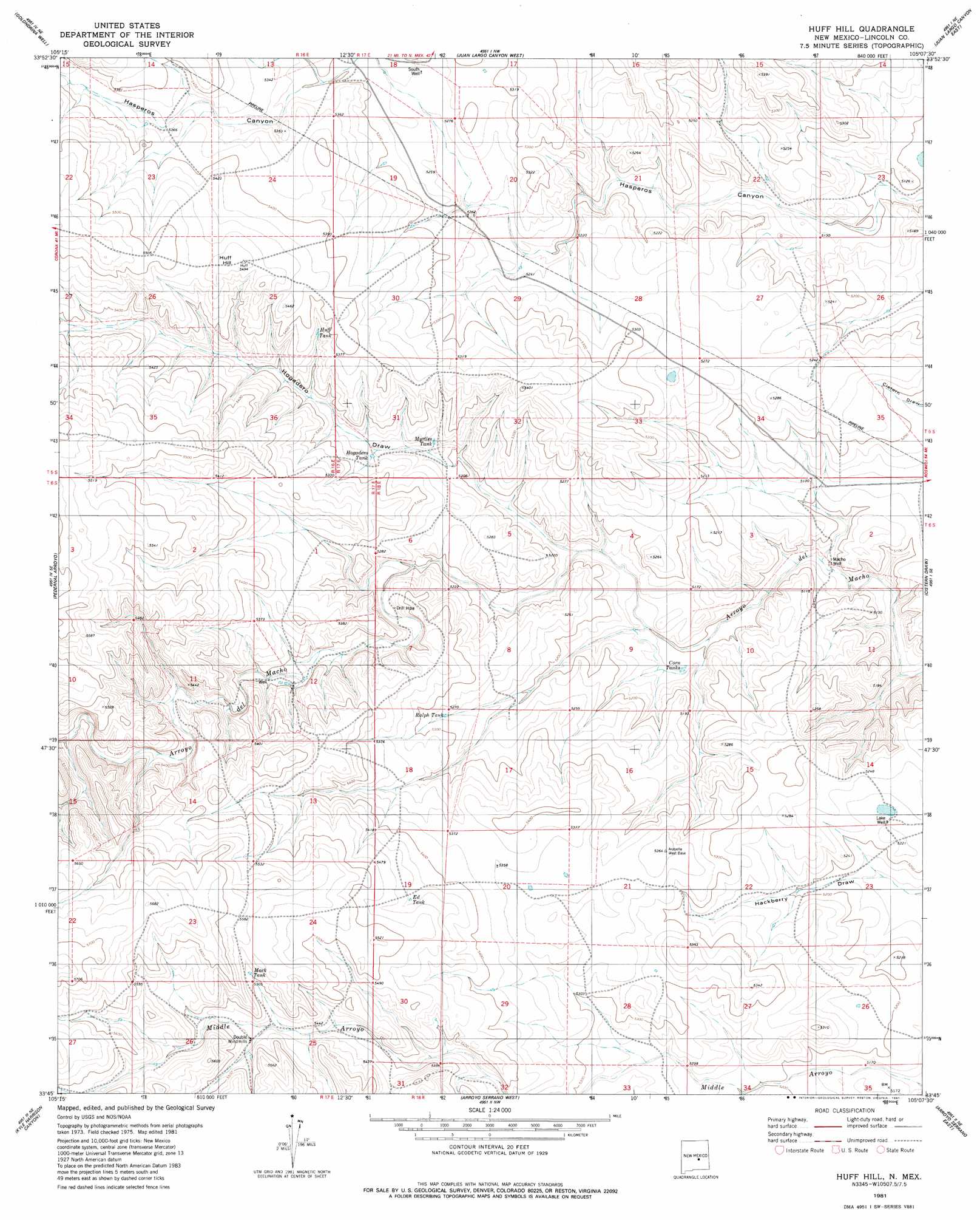
Huff Hill Topo Map New Mexico
To zoom in, hover over the map of Huff Hill
USGS Topo Quad 33105g2 - 1:24,000 scale
| Topo Map Name: | Huff Hill |
| USGS Topo Quad ID: | 33105g2 |
| Print Size: | ca. 21 1/4" wide x 27" high |
| Southeast Coordinates: | 33.75° N latitude / 105.125° W longitude |
| Map Center Coordinates: | 33.8125° N latitude / 105.1875° W longitude |
| U.S. State: | NM |
| Filename: | o33105g2.jpg |
| Download Map JPG Image: | Huff Hill topo map 1:24,000 scale |
| Map Type: | Topographic |
| Topo Series: | 7.5´ |
| Map Scale: | 1:24,000 |
| Source of Map Images: | United States Geological Survey (USGS) |
| Alternate Map Versions: |
Huff Hill NM 1981, updated 1981 Download PDF Buy paper map Huff Hill NM 2010 Download PDF Buy paper map Huff Hill NM 2013 Download PDF Buy paper map |
1:24,000 Topo Quads surrounding Huff Hill
Red Bluff Draw West |
Red Bluff Draw East |
Cowboy Mesa Sw |
Cowboy Mesa |
Ramon Sw |
Hasperos Camp |
Golondrina Well |
Juan Largo Canyon West |
Juan Largo Canyon East |
Chivita Canyon |
Box Lake |
Pedernal Arroyo |
Huff Hill |
Cistern Draw |
North Lake |
Encinoso |
Kyle Harrison Canyon |
Arroyo Serrano West |
Arroyo Serrano East |
White Flat |
Capitan Pass |
Capitan Peak |
Arabela |
Granville Canyon |
Elsie Canyon |
> Back to 33105e1 at 1:100,000 scale
> Back to 33104a1 at 1:250,000 scale
> Back to U.S. Topo Maps home
Huff Hill topo map: Gazetteer
Huff Hill: Reservoirs
Corn Tanks elevation 1561m 5121′Ed Tank elevation 1658m 5439′
Hogadero Tank elevation 1599m 5246′
Huff Tank elevation 1629m 5344′
Mack Tank elevation 1680m 5511′
Myrtle Tank elevation 1592m 5223′
Ralph Tank elevation 1606m 5269′
Huff Hill: Summits
Huff Hill elevation 1674m 5492′Huff Hill: Valleys
Hogadero Draw elevation 1566m 5137′Little Hasperos Canyon elevation 1617m 5305′
Huff Hill: Wells
Lake Well elevation 1591m 5219′Macho Well elevation 1544m 5065′
South Well elevation 1610m 5282′
Huff Hill digital topo map on disk
Buy this Huff Hill topo map showing relief, roads, GPS coordinates and other geographical features, as a high-resolution digital map file on DVD: