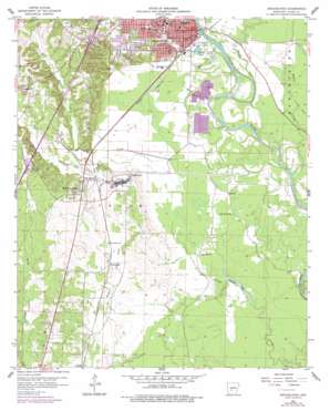
Arkadelphia Topo Map Arkansas
To zoom in, hover over the map of Arkadelphia
USGS Topo Quad 34093a1 - 1:24,000 scale
| Topo Map Name: | Arkadelphia |
| USGS Topo Quad ID: | 34093a1 |
| Print Size: | ca. 21 1/4" wide x 27" high |
| Southeast Coordinates: | 34° N latitude / 93° W longitude |
| Map Center Coordinates: | 34.0625° N latitude / 93.0625° W longitude |
| U.S. State: | AR |
| Filename: | o34093a1.jpg |
| Download Map JPG Image: | Arkadelphia topo map 1:24,000 scale |
| Map Type: | Topographic |
| Topo Series: | 7.5´ |
| Map Scale: | 1:24,000 |
| Source of Map Images: | United States Geological Survey (USGS) |
| Alternate Map Versions: |
Arkadelphia AR 1959, updated 1960 Download PDF Buy paper map Arkadelphia AR 1959, updated 1975 Download PDF Buy paper map Arkadelphia AR 1959, updated 1977 Download PDF Buy paper map Arkadelphia AR 2011 Download PDF Buy paper map Arkadelphia AR 2014 Download PDF Buy paper map |
1:24,000 Topo Quads surrounding Arkadelphia
> Back to 34093a1 at 1:100,000 scale
> Back to 34092a1 at 1:250,000 scale
> Back to U.S. Topo Maps home
Arkadelphia topo map: Gazetteer
Arkadelphia: Airports
Arkadelphia Municipal Airport elevation 54m 177′Arkadelphia: Crossings
Interchange 69 elevation 97m 318′Interchange 73 elevation 97m 318′
Arkadelphia: Lakes
Deceiper Lake elevation 49m 160′Nowlin Pond elevation 54m 177′
Arkadelphia: Parks
Clark County Fairgrounds elevation 60m 196′Sturgis Field elevation 60m 196′
Arkadelphia: Plains
Ozark Plateau elevation 49m 160′Arkadelphia: Populated Places
Arkadelphia elevation 73m 239′Central elevation 97m 318′
Daleville elevation 57m 187′
Gum Springs elevation 63m 206′
Midway elevation 87m 285′
Richwoods elevation 63m 206′
Arkadelphia: Post Offices
Arkadelphia Post Office elevation 74m 242′Arkadelphia: Springs
West Gum Springs elevation 93m 305′Arkadelphia: Streams
Little Deceiper Creek elevation 56m 183′Saline Bayou elevation 51m 167′
Tupelo Creek elevation 47m 154′
Arkadelphia digital topo map on disk
Buy this Arkadelphia topo map showing relief, roads, GPS coordinates and other geographical features, as a high-resolution digital map file on DVD:


