Hamilton Topo Map Arkansas
To zoom in, hover over the map of Hamilton
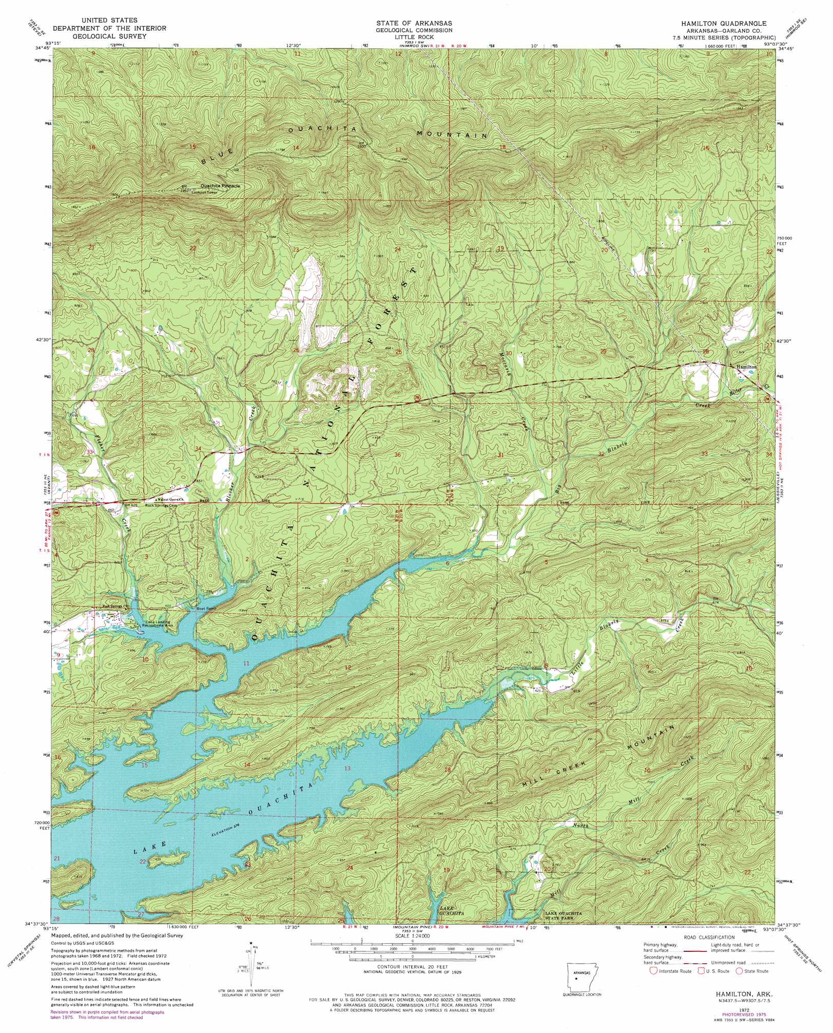
USGS Topo Quad 34093f2 - 1:24,000 scale
| Topo Map Name: | Hamilton |
| USGS Topo Quad ID: | 34093f2 |
| Print Size: | ca. 21 1/4" wide x 27" high |
| Southeast Coordinates: | 34.625° N latitude / 93.125° W longitude |
| Map Center Coordinates: | 34.6875° N latitude / 93.1875° W longitude |
| U.S. State: | AR |
| Filename: | o34093f2.jpg |
| Download Map JPG Image: | Hamilton topo map 1:24,000 scale |
| Map Type: | Topographic |
| Topo Series: | 7.5´ |
| Map Scale: | 1:24,000 |
| Source of Map Images: | United States Geological Survey (USGS) |
| Alternate Map Versions: |
Hamilton AR 1972, updated 1974 Download PDF Buy paper map Hamilton AR 1972, updated 1977 Download PDF Buy paper map Hamilton AR 2011 Download PDF Buy paper map Hamilton AR 2014 Download PDF Buy paper map |
| FStopo: | US Forest Service topo Hamilton is available: Download FStopo PDF Download FStopo TIF |
1:24,000 Topo Quads surrounding Hamilton
Rover |
Plainview |
Nimrod Dam |
Nimrod |
Aplin |
Onyx |
Steve |
Nimrod Sw |
Nimrod Se |
Paron Sw |
Fannie |
Avant |
Hamilton |
Jessieville |
Goosepond Moutain |
Mcgraw Mountain |
Crystal Springs |
Mountain Pine |
Hot Springs North |
Fountain Lake |
Bonnerdale |
Pearcy |
Hempwallace |
Hot Springs South |
Lake Catherine |
> Back to 34093e1 at 1:100,000 scale
> Back to 34092a1 at 1:250,000 scale
> Back to U.S. Topo Maps home
Hamilton topo map: Gazetteer
Hamilton: Parks
Lena Landing Public Use Area elevation 183m 600′Hamilton: Populated Places
Hamilton elevation 217m 711′Hamilton: Ridges
Blue Ouachita Mountain elevation 550m 1804′Hamilton: Streams
Big Blakely Creek elevation 177m 580′Blocker Creek elevation 173m 567′
Fisher Creek elevation 176m 577′
Little Blakely Creek elevation 175m 574′
Moccasin Creek elevation 187m 613′
North Mill Creek elevation 172m 564′
Ritter Creek elevation 212m 695′
Hamilton: Summits
Mill Creek Mountain elevation 286m 938′Ouachita Pinnacle elevation 595m 1952′
Hamilton digital topo map on disk
Buy this Hamilton topo map showing relief, roads, GPS coordinates and other geographical features, as a high-resolution digital map file on DVD: