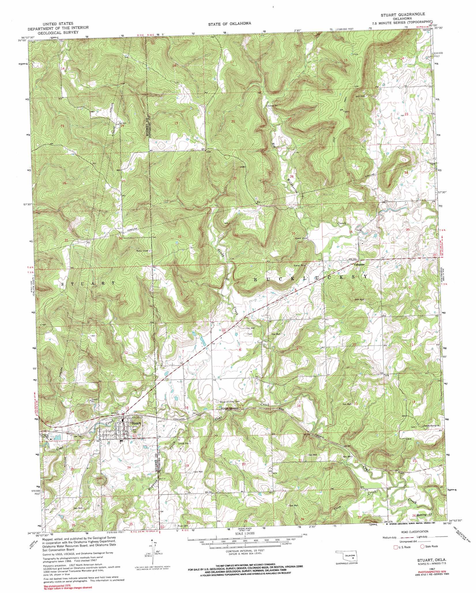
Stuart Topo Map Oklahoma
To zoom in, hover over the map of Stuart
USGS Topo Quad 34096h1 - 1:24,000 scale
| Topo Map Name: | Stuart |
| USGS Topo Quad ID: | 34096h1 |
| Print Size: | ca. 21 1/4" wide x 27" high |
| Southeast Coordinates: | 34.875° N latitude / 96° W longitude |
| Map Center Coordinates: | 34.9375° N latitude / 96.0625° W longitude |
| U.S. State: | OK |
| Filename: | o34096h1.jpg |
| Download Map JPG Image: | Stuart topo map 1:24,000 scale |
| Map Type: | Topographic |
| Topo Series: | 7.5´ |
| Map Scale: | 1:24,000 |
| Source of Map Images: | United States Geological Survey (USGS) |
| Alternate Map Versions: |
Stuart OK 1967, updated 1968 Download PDF Buy paper map Stuart OK 1967, updated 1991 Download PDF Buy paper map Stuart OK 2010 Download PDF Buy paper map Stuart OK 2012 Download PDF Buy paper map Stuart OK 2016 Download PDF Buy paper map |
1:24,000 Topo Quads surrounding Stuart
Yeager |
Wetumka |
Carson |
Hanna |
Indianola |
Lake Holdenville |
Lamar |
Wetumka Se |
Scipio |
Lake Mcalester |
Calvin West |
Calvin East |
Stuart |
Haywood |
Mcalester |
Gerty |
Non |
Ashland |
Mcalester Sw |
Savanna |
Tupelo Ne |
Parker |
Wardville |
Kiowa |
Pittsburg |
> Back to 34096e1 at 1:100,000 scale
> Back to 34096a1 at 1:250,000 scale
> Back to U.S. Topo Maps home
Stuart topo map: Gazetteer
Stuart: Dams
Oknoname 121002 Dam elevation 202m 662′Stuart: Populated Places
Cabaniss elevation 223m 731′Stuart elevation 224m 734′
Stuart: Reservoirs
Oknoname 121002 Reservoir elevation 202m 662′Stuart: Streams
Coon Creek elevation 201m 659′Hegwood Creek elevation 212m 695′
Hominy Creek elevation 203m 666′
Sandy Creek elevation 204m 669′
Stuart digital topo map on disk
Buy this Stuart topo map showing relief, roads, GPS coordinates and other geographical features, as a high-resolution digital map file on DVD: