Hilburn Topo Map Texas
To zoom in, hover over the map of Hilburn
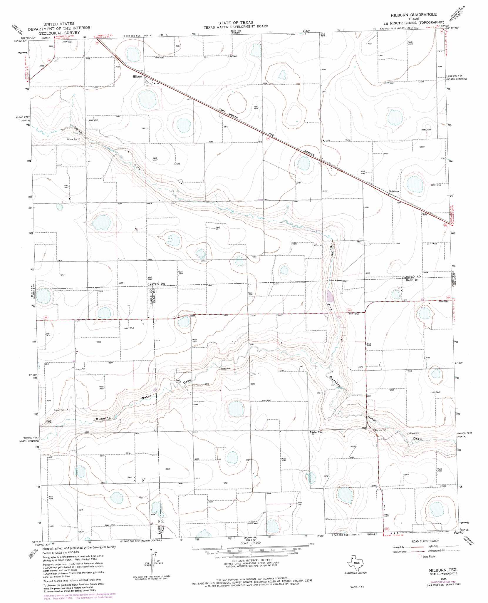
USGS Topo Quad 34102c1 - 1:24,000 scale
| Topo Map Name: | Hilburn |
| USGS Topo Quad ID: | 34102c1 |
| Print Size: | ca. 21 1/4" wide x 27" high |
| Southeast Coordinates: | 34.25° N latitude / 102° W longitude |
| Map Center Coordinates: | 34.3125° N latitude / 102.0625° W longitude |
| U.S. State: | TX |
| Filename: | o34102c1.jpg |
| Download Map JPG Image: | Hilburn topo map 1:24,000 scale |
| Map Type: | Topographic |
| Topo Series: | 7.5´ |
| Map Scale: | 1:24,000 |
| Source of Map Images: | United States Geological Survey (USGS) |
| Alternate Map Versions: |
Hilburn TX 1965, updated 1968 Download PDF Buy paper map Hilburn TX 1965, updated 1981 Download PDF Buy paper map Hilburn TX 2010 Download PDF Buy paper map Hilburn TX 2012 Download PDF Buy paper map Hilburn TX 2016 Download PDF Buy paper map |
1:24,000 Topo Quads surrounding Hilburn
Dimmitt |
Nazareth Sw |
Nazareth |
Lakeview |
Tulia |
Dodd Ne |
Hart Nw |
Hart |
Center Plains School |
Edmonson Ne |
Dodd Se |
Hart Sw |
Hilburn |
Edmonson |
Kress West |
Springlake |
Olton |
Olton Ne |
Halfway |
Wasson |
Cofferville |
Fieldton |
Corry |
Hale Center Sw |
Hale Center |
> Back to 34102a1 at 1:100,000 scale
> Back to 34102a1 at 1:250,000 scale
> Back to U.S. Topo Maps home
Hilburn topo map: Gazetteer
Hilburn: Airports
Hart Aerial Airport elevation 1112m 3648′Hilburn: Dams
Soil Conservation Service Site 2 Dam elevation 1081m 3546′Hilburn: Populated Places
Hilburn elevation 1110m 3641′Hilburn: Reservoirs
Soil Conservation Service Site 2 Reservoir elevation 1081m 3546′Hilburn: Valleys
North Fork Running Water Draw elevation 1074m 3523′Hilburn digital topo map on disk
Buy this Hilburn topo map showing relief, roads, GPS coordinates and other geographical features, as a high-resolution digital map file on DVD: