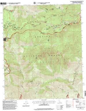
Waterman Mountain Topo Map California
To zoom in, hover over the map of Waterman Mountain
USGS Topo Quad 34117c8 - 1:24,000 scale
| Topo Map Name: | Waterman Mountain |
| USGS Topo Quad ID: | 34117c8 |
| Print Size: | ca. 21 1/4" wide x 27" high |
| Southeast Coordinates: | 34.25° N latitude / 117.875° W longitude |
| Map Center Coordinates: | 34.3125° N latitude / 117.9375° W longitude |
| U.S. State: | CA |
| Filename: | o34117c8.jpg |
| Download Map JPG Image: | Waterman Mountain topo map 1:24,000 scale |
| Map Type: | Topographic |
| Topo Series: | 7.5´ |
| Map Scale: | 1:24,000 |
| Source of Map Images: | United States Geological Survey (USGS) |
| Alternate Map Versions: |
Waterman Mtn CA 1959, updated 1960 Download PDF Buy paper map Waterman Mtn CA 1959, updated 1965 Download PDF Buy paper map Waterman Mtn CA 1959, updated 1979 Download PDF Buy paper map Waterman Mtn CA 1959, updated 1987 Download PDF Buy paper map Waterman Mountain CA 1995, updated 1999 Download PDF Buy paper map Waterman Mountain CA 2012 Download PDF Buy paper map Waterman Mountain CA 2015 Download PDF Buy paper map |
1:24,000 Topo Quads surrounding Waterman Mountain
> Back to 34117a1 at 1:100,000 scale
> Back to 34116a1 at 1:250,000 scale
> Back to U.S. Topo Maps home
Waterman Mountain topo map: Gazetteer
Waterman Mountain: Flats
Buckhorn Flat elevation 1993m 6538′Waterman Mountain: Gaps
Cloudburst Summit elevation 2144m 7034′Waterman Mountain: Parks
Ridge Crest Picnic Ground elevation 2085m 6840′Vista Picnic Ground elevation 2094m 6870′
Waterman Mountain: Populated Places
Cedar Springs elevation 2081m 6827′Three Points elevation 1801m 5908′
Waterman Mountain: Ridges
Kratka Ridge elevation 2181m 7155′Waterman Mountain: Springs
Buckhorn Spring elevation 2085m 6840′Cedar Spring elevation 2091m 6860′
Rattlesnake Spring elevation 1882m 6174′
Sulphur Spring elevation 1593m 5226′
Winston Spring elevation 1976m 6482′
Waterman Mountain: Streams
West Fork Bear Creek elevation 653m 2142′Waterman Mountain: Summits
Twin Peaks elevation 2365m 7759′Waterman Mountain elevation 2433m 7982′
Winston Peak elevation 2277m 7470′
Waterman Mountain: Trails
Rattlesnake Trail elevation 1866m 6122′Waterman Mountain: Valleys
Cloudburst Canyon elevation 1645m 5396′Cooper Canyon elevation 1711m 5613′
Waterman Mountain digital topo map on disk
Buy this Waterman Mountain topo map showing relief, roads, GPS coordinates and other geographical features, as a high-resolution digital map file on DVD:


