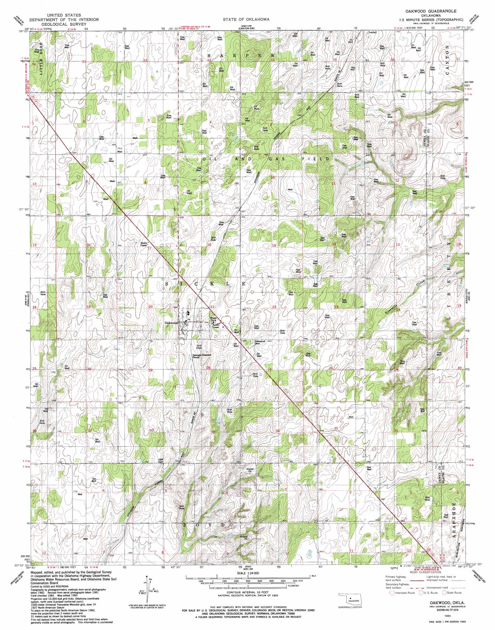
Oakwood Topo Map Oklahoma
To zoom in, hover over the map of Oakwood
USGS Topo Quad 35098h6 - 1:24,000 scale
| Topo Map Name: | Oakwood |
| USGS Topo Quad ID: | 35098h6 |
| Print Size: | ca. 21 1/4" wide x 27" high |
| Southeast Coordinates: | 35.875° N latitude / 98.625° W longitude |
| Map Center Coordinates: | 35.9375° N latitude / 98.6875° W longitude |
| U.S. State: | OK |
| Filename: | o35098h6.jpg |
| Download Map JPG Image: | Oakwood topo map 1:24,000 scale |
| Map Type: | Topographic |
| Topo Series: | 7.5´ |
| Map Scale: | 1:24,000 |
| Source of Map Images: | United States Geological Survey (USGS) |
| Alternate Map Versions: |
Oakwood OK 1985, updated 1985 Download PDF Buy paper map Oakwood OK 2010 Download PDF Buy paper map Oakwood OK 2012 Download PDF Buy paper map Oakwood OK 2016 Download PDF Buy paper map |
1:24,000 Topo Quads surrounding Oakwood
Seiling |
Orion |
Canton Nw |
Longdale |
Homestead |
Taloga |
Hucmac |
Canton Sw |
Canton |
Southard |
Putnam Nw |
Parallel |
Oakwood |
Eagle City |
Watonga Lake |
Putnam |
Rough Creek |
Fay |
Oakwood Se |
Watonga |
Custer City |
Clinton Ne |
Weatherford Nw |
Squaw Creek |
Greenfield |
> Back to 35098e1 at 1:100,000 scale
> Back to 35098a1 at 1:250,000 scale
> Back to U.S. Topo Maps home
Oakwood digital topo map on disk
Buy this Oakwood topo map showing relief, roads, GPS coordinates and other geographical features, as a high-resolution digital map file on DVD: