Shattuck Topo Map Oklahoma
To zoom in, hover over the map of Shattuck
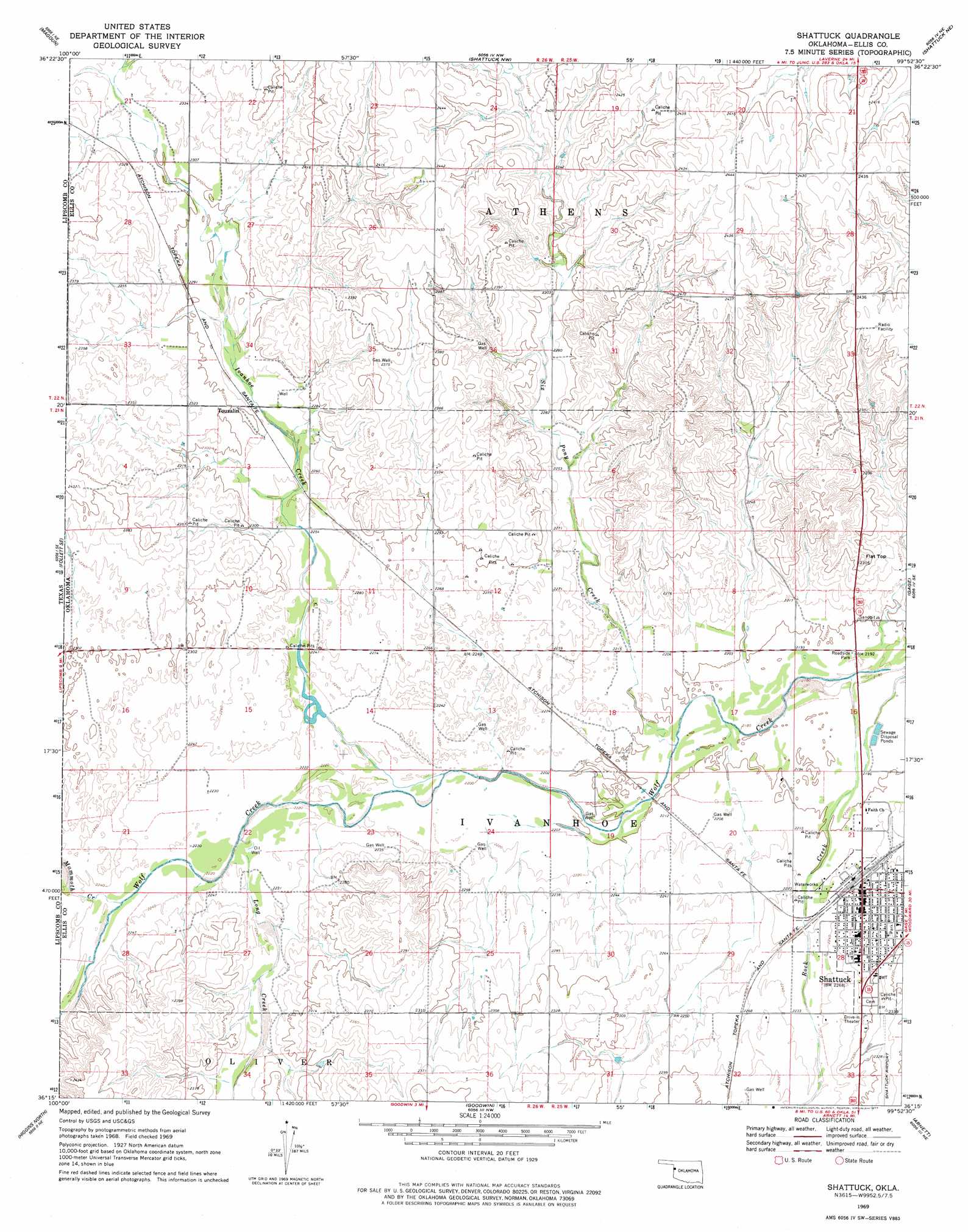
USGS Topo Quad 36099c8 - 1:24,000 scale
| Topo Map Name: | Shattuck |
| USGS Topo Quad ID: | 36099c8 |
| Print Size: | ca. 21 1/4" wide x 27" high |
| Southeast Coordinates: | 36.25° N latitude / 99.875° W longitude |
| Map Center Coordinates: | 36.3125° N latitude / 99.9375° W longitude |
| U.S. State: | OK |
| Filename: | o36099c8.jpg |
| Download Map JPG Image: | Shattuck topo map 1:24,000 scale |
| Map Type: | Topographic |
| Topo Series: | 7.5´ |
| Map Scale: | 1:24,000 |
| Source of Map Images: | United States Geological Survey (USGS) |
| Alternate Map Versions: |
Shattuck OK 1969, updated 1971 Download PDF Buy paper map Shattuck OK 1969, updated 1977 Download PDF Buy paper map Shattuck OK 2010 Download PDF Buy paper map Shattuck OK 2012 Download PDF Buy paper map Shattuck OK 2016 Download PDF Buy paper map |
1:24,000 Topo Quads surrounding Shattuck
Logan |
Slapout |
Laverne Sw |
May West |
May East |
Follett |
Magoun |
Shattuck Nw |
Shattuck Ne |
Fargo Nw |
Skunk Creek |
Follett Se |
Shattuck |
Gage |
Fargo Sw |
Willow Creek |
Higgins North |
Goodwin |
Arnett |
Harmon Nw |
Coburn |
Higgins South |
Arnett Sw |
Arnett Se |
Harmon Sw |
> Back to 36099a1 at 1:100,000 scale
> Back to 36098a1 at 1:250,000 scale
> Back to U.S. Topo Maps home
Shattuck topo map: Gazetteer
Shattuck: Airports
Shattuck Hospital Heliport elevation 709m 2326′Shattuck: Populated Places
Shattuck elevation 685m 2247′Touzalin elevation 700m 2296′
Shattuck: Streams
Ivanhoe Creek elevation 672m 2204′Ivanhoe Creek elevation 672m 2204′
Long Creek elevation 677m 2221′
Long Creek elevation 677m 2221′
Mammoth Creek elevation 682m 2237′
Mammoth Creek elevation 682m 2237′
Rock Creek elevation 665m 2181′
Six Pony Creek elevation 669m 2194′
Shattuck: Summits
Flat Top elevation 722m 2368′Shattuck digital topo map on disk
Buy this Shattuck topo map showing relief, roads, GPS coordinates and other geographical features, as a high-resolution digital map file on DVD: