Logan Topo Map Oklahoma
To zoom in, hover over the map of Logan
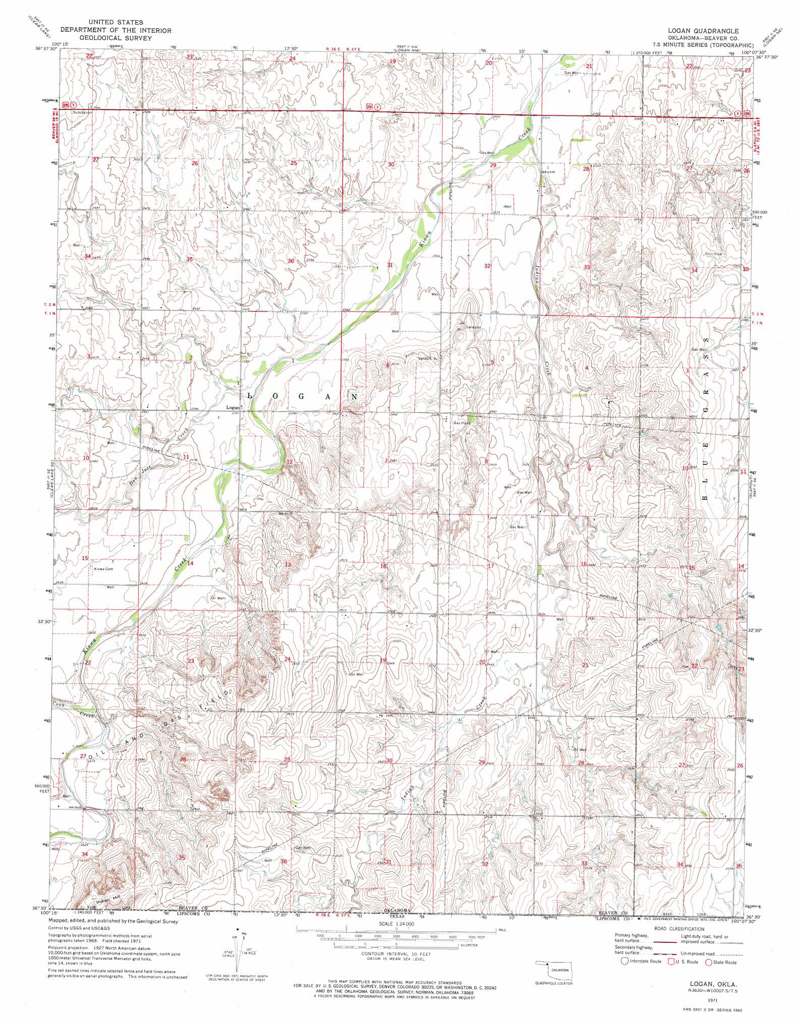
USGS Topo Quad 36100e2 - 1:24,000 scale
| Topo Map Name: | Logan |
| USGS Topo Quad ID: | 36100e2 |
| Print Size: | ca. 21 1/4" wide x 27" high |
| Southeast Coordinates: | 36.5° N latitude / 100.125° W longitude |
| Map Center Coordinates: | 36.5625° N latitude / 100.1875° W longitude |
| U.S. State: | OK |
| Filename: | o36100e2.jpg |
| Download Map JPG Image: | Logan topo map 1:24,000 scale |
| Map Type: | Topographic |
| Topo Series: | 7.5´ |
| Map Scale: | 1:24,000 |
| Source of Map Images: | United States Geological Survey (USGS) |
| Alternate Map Versions: |
Logan OK 1971, updated 1973 Download PDF Buy paper map Logan OK 2010 Download PDF Buy paper map Logan OK 2012 Download PDF Buy paper map Logan OK 2016 Download PDF Buy paper map |
1:24,000 Topo Quads surrounding Logan
Mocane Sw |
Mocane Se |
Knowles |
Gate |
Rosston |
Clear Lake Nw |
Clear Lake |
Logan Nw |
Logan Ne |
Laverne |
Clear Lake Sw |
Clear Lake Se |
Logan |
Slapout |
Laverne Sw |
Gaylord |
Darrouzett |
Follett |
Magoun |
Shattuck Nw |
Twin Grove |
Dugout Creek |
Skunk Creek |
Follett Se |
Shattuck |
> Back to 36100e1 at 1:100,000 scale
> Back to 36100a1 at 1:250,000 scale
> Back to U.S. Topo Maps home
Logan topo map: Gazetteer
Logan: Dams
Jett Number 3 Dam elevation 739m 2424′Logan: Populated Places
Logan elevation 726m 2381′Logan: Reservoirs
Jett Number 3 Reservoir elevation 739m 2424′Logan: Streams
Coon Creek elevation 732m 2401′Don Jose Creek elevation 719m 2358′
Indian Creek elevation 707m 2319′
Indian Creek elevation 707m 2319′
Logan: Summits
Indian Hill elevation 790m 2591′Logan digital topo map on disk
Buy this Logan topo map showing relief, roads, GPS coordinates and other geographical features, as a high-resolution digital map file on DVD: