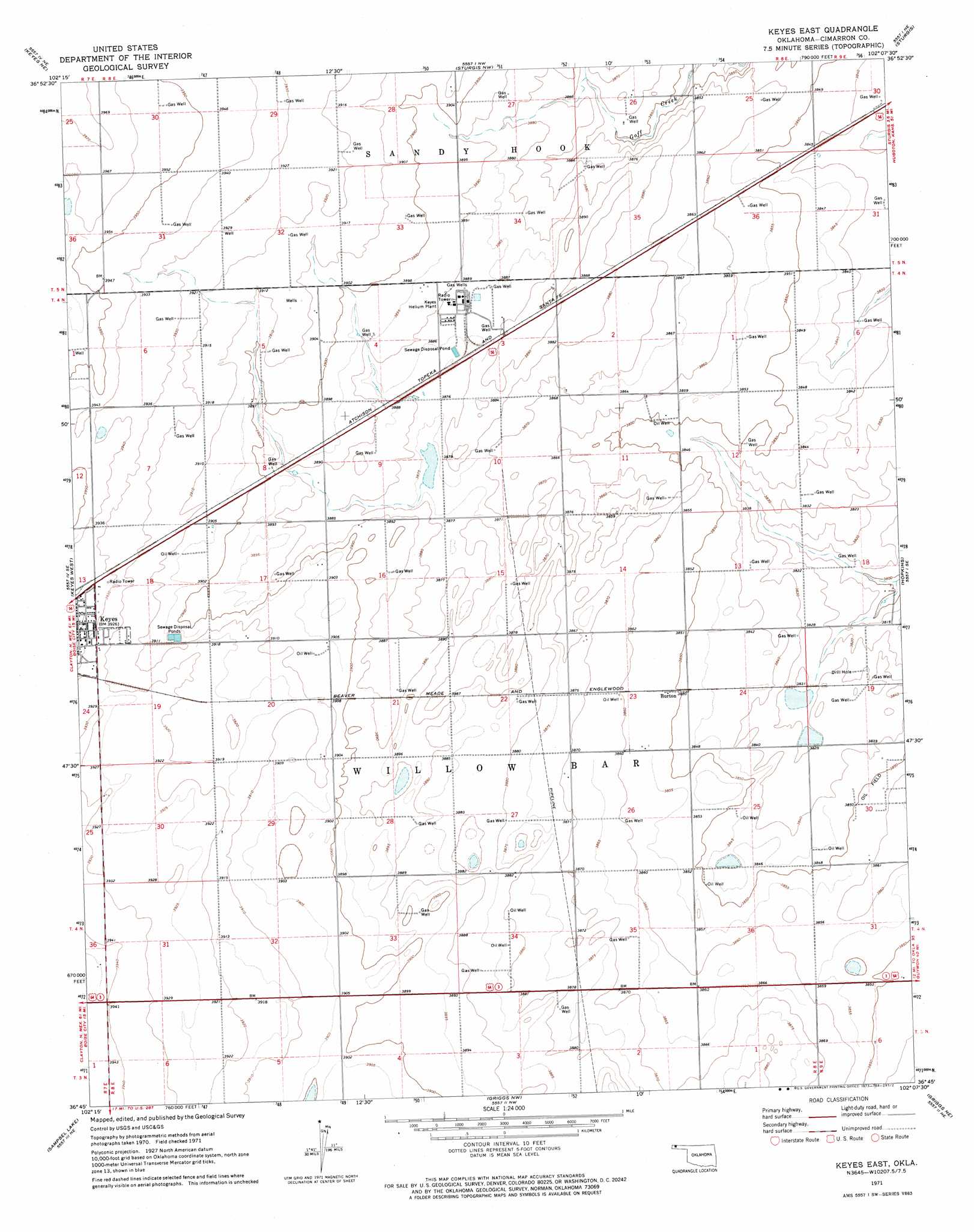
Keyes East Topo Map Oklahoma
To zoom in, hover over the map of Keyes East
USGS Topo Quad 36102g2 - 1:24,000 scale
| Topo Map Name: | Keyes East |
| USGS Topo Quad ID: | 36102g2 |
| Print Size: | ca. 21 1/4" wide x 27" high |
| Southeast Coordinates: | 36.75° N latitude / 102.125° W longitude |
| Map Center Coordinates: | 36.8125° N latitude / 102.1875° W longitude |
| U.S. State: | OK |
| Filename: | o36102g2.jpg |
| Download Map JPG Image: | Keyes East topo map 1:24,000 scale |
| Map Type: | Topographic |
| Topo Series: | 7.5´ |
| Map Scale: | 1:24,000 |
| Source of Map Images: | United States Geological Survey (USGS) |
| Alternate Map Versions: |
Keyes East OK 1971, updated 1973 Download PDF Buy paper map Keyes East OK 2010 Download PDF Buy paper map Keyes East OK 2012 Download PDF Buy paper map Keyes East OK 2016 Download PDF Buy paper map |
1:24,000 Topo Quads surrounding Keyes East
Moore Draw Sw |
Moore Draw Se |
Midway Sw |
Midway Se |
Elkhart North |
Keyes Nw |
Keyes Ne |
Sturgis Nw |
Sturgis |
Elkhart South |
Keyes Sw |
Keyes West |
Keyes East |
Hopkins |
Eva |
Conrad Nw |
Sampsel Lake |
Griggs Nw |
Griggs Ne |
Texhoma Nw |
Conrad Sw |
Conrad |
Griggs Sw |
Griggs |
Texhoma Sw |
> Back to 36102e1 at 1:100,000 scale
> Back to 36102a1 at 1:250,000 scale
> Back to U.S. Topo Maps home
Keyes East digital topo map on disk
Buy this Keyes East topo map showing relief, roads, GPS coordinates and other geographical features, as a high-resolution digital map file on DVD: