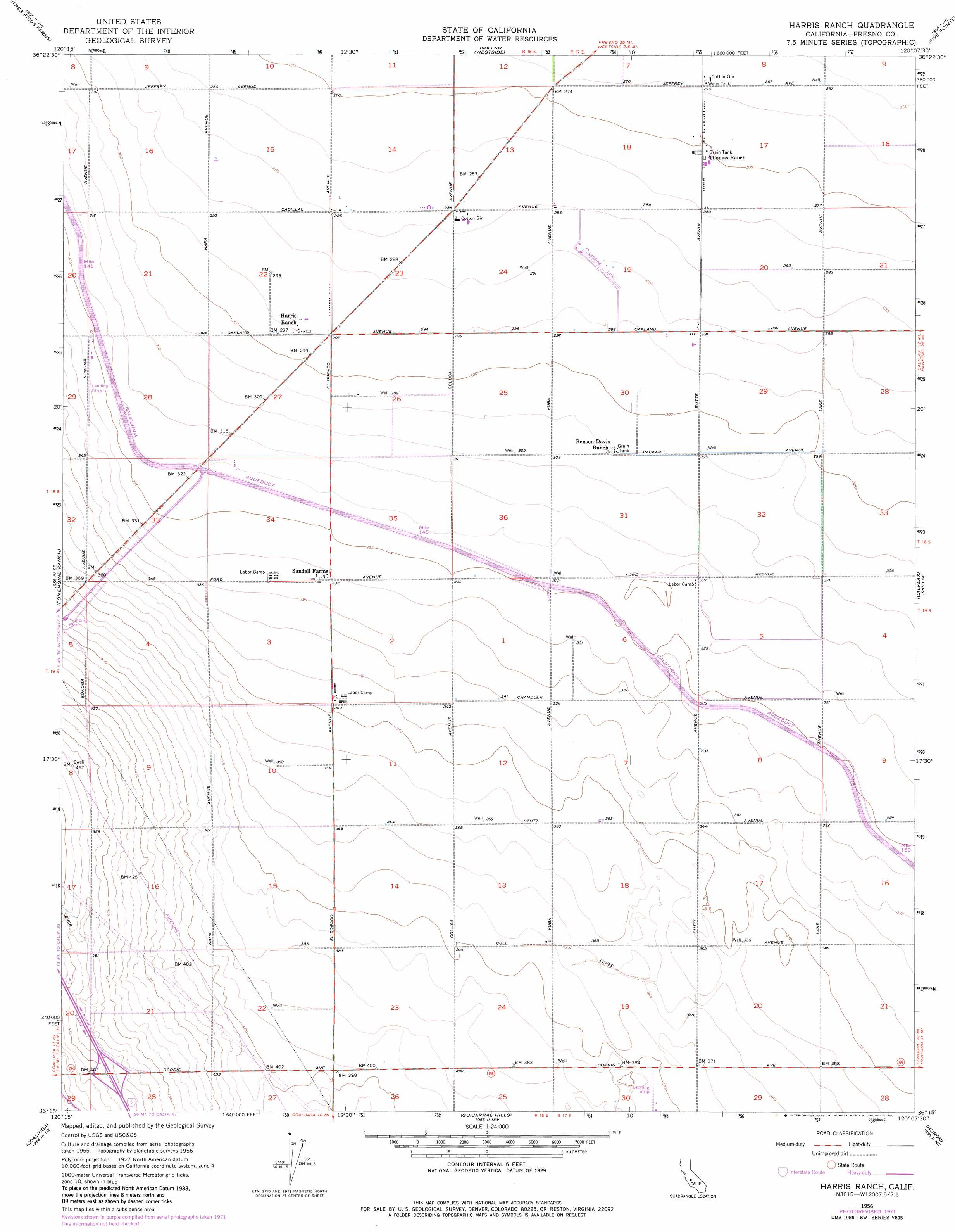
Harris Ranch Topo Map California
To zoom in, hover over the map of Harris Ranch
USGS Topo Quad 36120c2 - 1:24,000 scale
| Topo Map Name: | Harris Ranch |
| USGS Topo Quad ID: | 36120c2 |
| Print Size: | ca. 21 1/4" wide x 27" high |
| Southeast Coordinates: | 36.25° N latitude / 120.125° W longitude |
| Map Center Coordinates: | 36.3125° N latitude / 120.1875° W longitude |
| U.S. State: | CA |
| Filename: | o36120c2.jpg |
| Download Map JPG Image: | Harris Ranch topo map 1:24,000 scale |
| Map Type: | Topographic |
| Topo Series: | 7.5´ |
| Map Scale: | 1:24,000 |
| Source of Map Images: | United States Geological Survey (USGS) |
| Alternate Map Versions: |
Harris Ranch CA 1956, updated 1957 Download PDF Buy paper map Harris Ranch CA 1956, updated 1972 Download PDF Buy paper map Harris Ranch CA 1956, updated 1980 Download PDF Buy paper map Harris Ranch CA 2012 Download PDF Buy paper map Harris Ranch CA 2015 Download PDF Buy paper map |
1:24,000 Topo Quads surrounding Harris Ranch
Levis |
Cantua Creek |
San Joaquin |
Helm |
Raisin |
Lillis Ranch |
Tres Picos Farms |
Westside |
Five Points |
Burrel |
Joaquin Rocks |
Domengine Ranch |
Harris Ranch |
Calflax |
Vanguard |
Alcalde Hills |
Coalinga |
Guijarral Hills |
Huron |
Westhaven |
Curry Mountain |
Kreyenhagen Hills |
Avenal |
La Cima |
Kettleman City |
> Back to 36120a1 at 1:100,000 scale
> Back to 36120a1 at 1:250,000 scale
> Back to U.S. Topo Maps home
Harris Ranch topo map: Gazetteer
Harris Ranch: Airports
Harris-Agro West Airport elevation 102m 334′Harris Ranch digital topo map on disk
Buy this Harris Ranch topo map showing relief, roads, GPS coordinates and other geographical features, as a high-resolution digital map file on DVD: