San Joaquin Topo Map California
To zoom in, hover over the map of San Joaquin
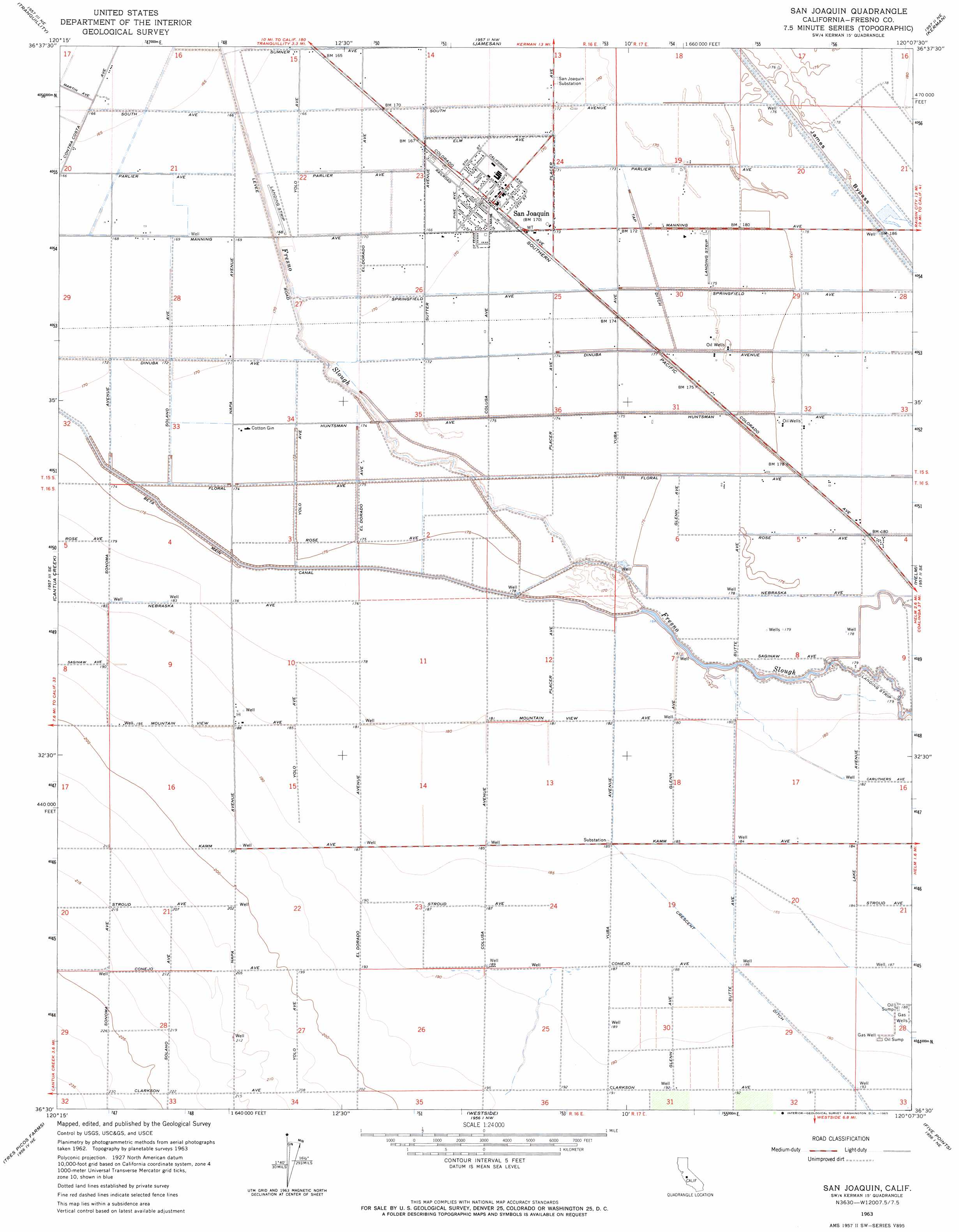
USGS Topo Quad 36120e2 - 1:24,000 scale
| Topo Map Name: | San Joaquin |
| USGS Topo Quad ID: | 36120e2 |
| Print Size: | ca. 21 1/4" wide x 27" high |
| Southeast Coordinates: | 36.5° N latitude / 120.125° W longitude |
| Map Center Coordinates: | 36.5625° N latitude / 120.1875° W longitude |
| U.S. State: | CA |
| Filename: | o36120e2.jpg |
| Download Map JPG Image: | San Joaquin topo map 1:24,000 scale |
| Map Type: | Topographic |
| Topo Series: | 7.5´ |
| Map Scale: | 1:24,000 |
| Source of Map Images: | United States Geological Survey (USGS) |
| Alternate Map Versions: |
San Joaquin CA 1947 Download PDF Buy paper map San Joaquin CA 1963, updated 1965 Download PDF Buy paper map San Joaquin CA 2012 Download PDF Buy paper map San Joaquin CA 2015 Download PDF Buy paper map |
1:24,000 Topo Quads surrounding San Joaquin
Firebaugh |
Mendota Dam |
Gravelly Ford |
Biola |
Herndon |
Coit Ranch |
Tranquillity |
Jamesan |
Kerman |
Kearney Park |
Levis |
Cantua Creek |
San Joaquin |
Helm |
Raisin |
Lillis Ranch |
Tres Picos Farms |
Westside |
Five Points |
Burrel |
Joaquin Rocks |
Domengine Ranch |
Harris Ranch |
Calflax |
Vanguard |
> Back to 36120e1 at 1:100,000 scale
> Back to 36120a1 at 1:250,000 scale
> Back to U.S. Topo Maps home
San Joaquin topo map: Gazetteer
San Joaquin: Canals
Beta Canal elevation 54m 177′San Joaquin: Dams
Mud 1085 Dam elevation 54m 177′San Joaquin: Parks
San Joaquin City Park elevation 53m 173′San Joaquin: Populated Places
Caldwell (historical) elevation 54m 177′San Joaquin elevation 53m 173′
San Joaquin: Post Offices
San Joaquin Post Office elevation 53m 173′San Joaquin digital topo map on disk
Buy this San Joaquin topo map showing relief, roads, GPS coordinates and other geographical features, as a high-resolution digital map file on DVD: