Spruce Topo Map Missouri
To zoom in, hover over the map of Spruce
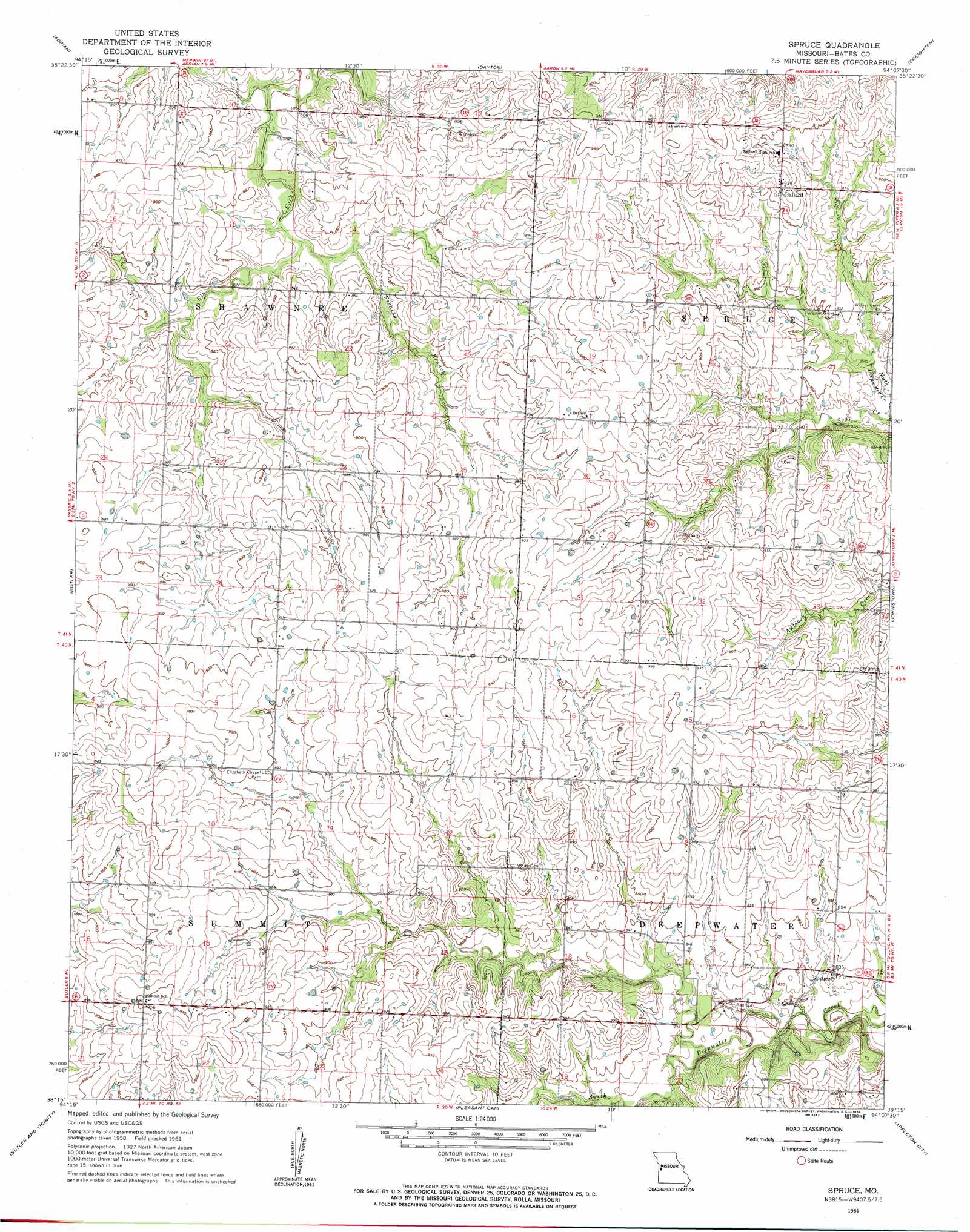
USGS Topo Quad 38094c2 - 1:24,000 scale
| Topo Map Name: | Spruce |
| USGS Topo Quad ID: | 38094c2 |
| Print Size: | ca. 21 1/4" wide x 27" high |
| Southeast Coordinates: | 38.25° N latitude / 94.125° W longitude |
| Map Center Coordinates: | 38.3125° N latitude / 94.1875° W longitude |
| U.S. State: | MO |
| Filename: | o38094c2.jpg |
| Download Map JPG Image: | Spruce topo map 1:24,000 scale |
| Map Type: | Topographic |
| Topo Series: | 7.5´ |
| Map Scale: | 1:24,000 |
| Source of Map Images: | United States Geological Survey (USGS) |
| Alternate Map Versions: |
Spruce MO 1961, updated 1962 Download PDF Buy paper map Spruce MO 2011 Download PDF Buy paper map Spruce MO 2014 Download PDF Buy paper map |
1:24,000 Topo Quads surrounding Spruce
Everett |
Austin |
Garden City |
Quick City |
Blairstown |
Main City |
Adrian |
Dayton |
Creighton |
Hartwell |
Virginia |
Butler |
Spruce |
Johnstown |
Montrose |
New Home |
Butler & Vic |
Pleasant Gap |
Appleton City |
Monegaw Springs Nw |
Sprague |
Rich Hill |
Papinsville |
Rockville |
Taberville |
> Back to 38094a1 at 1:100,000 scale
> Back to 38094a1 at 1:250,000 scale
> Back to U.S. Topo Maps home
Spruce topo map: Gazetteer
Spruce: Populated Places
Ballard elevation 281m 921′Spruce elevation 254m 833′
Spruce: Streams
Fishing Branch elevation 245m 803′Straight Branch elevation 250m 820′
Spruce digital topo map on disk
Buy this Spruce topo map showing relief, roads, GPS coordinates and other geographical features, as a high-resolution digital map file on DVD: