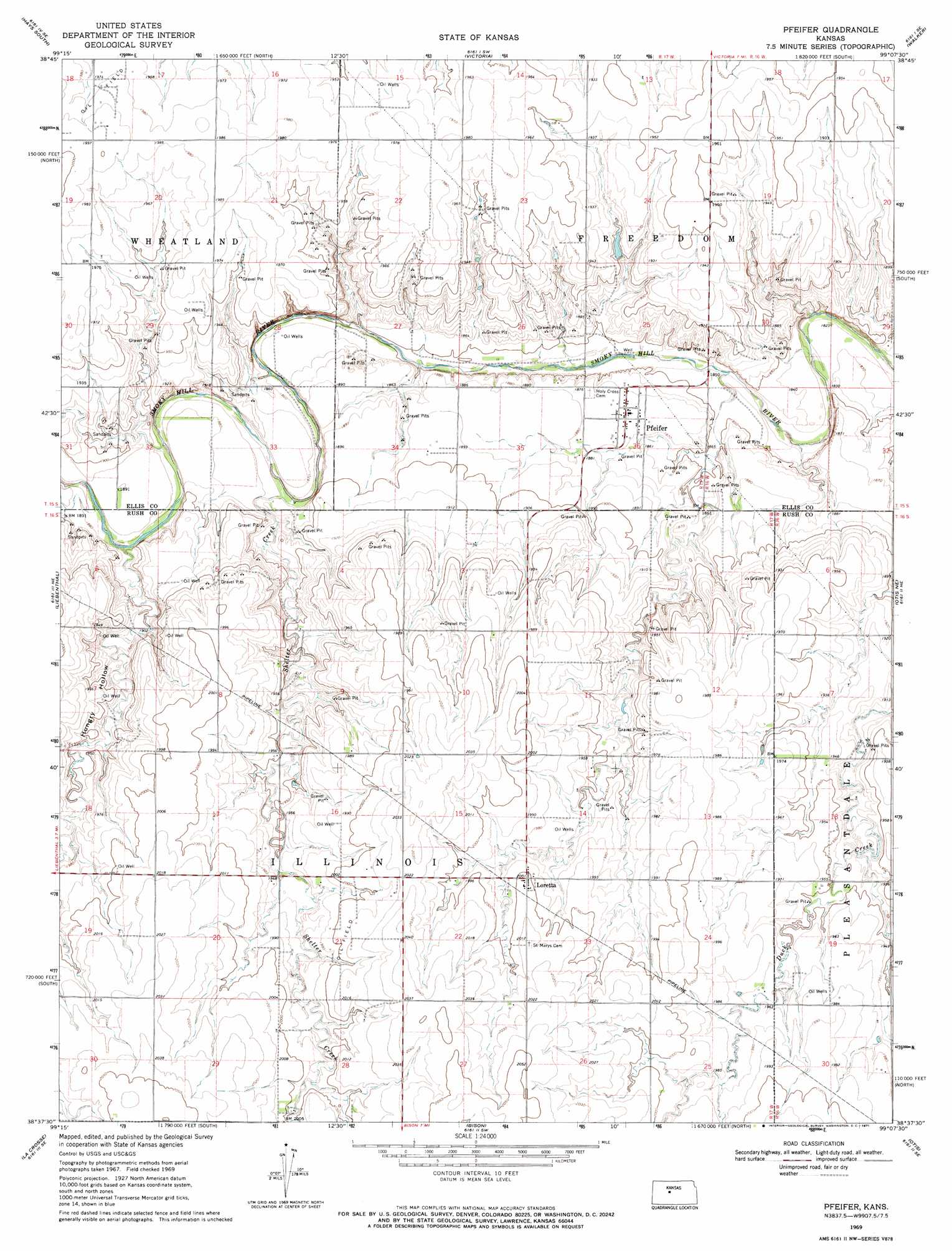
Pfeifer Topo Map Kansas
To zoom in, hover over the map of Pfeifer
USGS Topo Quad 38099f2 - 1:24,000 scale
| Topo Map Name: | Pfeifer |
| USGS Topo Quad ID: | 38099f2 |
| Print Size: | ca. 21 1/4" wide x 27" high |
| Southeast Coordinates: | 38.625° N latitude / 99.125° W longitude |
| Map Center Coordinates: | 38.6875° N latitude / 99.1875° W longitude |
| U.S. State: | KS |
| Filename: | o38099f2.jpg |
| Download Map JPG Image: | Pfeifer topo map 1:24,000 scale |
| Map Type: | Topographic |
| Topo Series: | 7.5´ |
| Map Scale: | 1:24,000 |
| Source of Map Images: | United States Geological Survey (USGS) |
| Alternate Map Versions: |
Pfeifer KS 1969, updated 1971 Download PDF Buy paper map Pfeifer KS 2009 Download PDF Buy paper map Pfeifer KS 2012 Download PDF Buy paper map Pfeifer KS 2015 Download PDF Buy paper map |
1:24,000 Topo Quads surrounding Pfeifer
Yocemento |
Hays North |
Catharine |
Gorham |
Russell Nw |
Antonino |
Hays South |
Victoria |
Walker |
Russell Sw |
La Crosse Nw |
Liebenthal |
Pfeifer |
Otis Ne |
Galatia |
Hargrave |
La Crosse |
Bison |
Otis |
Olmitz |
Nekoma |
Rush Center |
Timken |
Albert |
Heizer |
> Back to 38099e1 at 1:100,000 scale
> Back to 38098a1 at 1:250,000 scale
> Back to U.S. Topo Maps home
Pfeifer topo map: Gazetteer
Pfeifer: Populated Places
Loretta elevation 610m 2001′Pfeifer elevation 571m 1873′
Pfeifer: Streams
Shelter Creek elevation 563m 1847′Pfeifer: Valleys
Hungry Hollow elevation 569m 1866′Pfeifer digital topo map on disk
Buy this Pfeifer topo map showing relief, roads, GPS coordinates and other geographical features, as a high-resolution digital map file on DVD: