Havenville Topo Map Kansas
To zoom in, hover over the map of Havenville
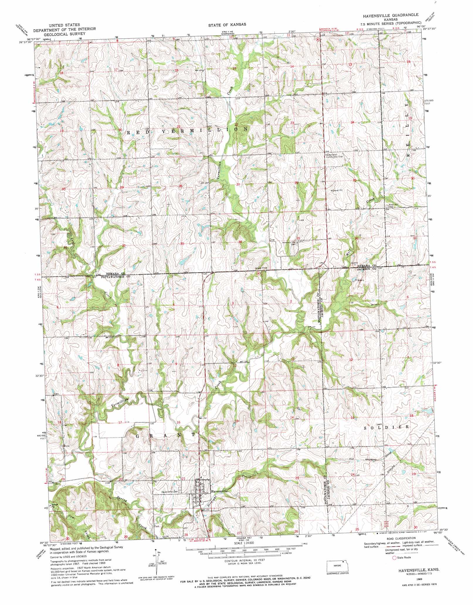
USGS Topo Quad 39096e1 - 1:24,000 scale
| Topo Map Name: | Havenville |
| USGS Topo Quad ID: | 39096e1 |
| Print Size: | ca. 21 1/4" wide x 27" high |
| Southeast Coordinates: | 39.5° N latitude / 96° W longitude |
| Map Center Coordinates: | 39.5625° N latitude / 96.0625° W longitude |
| U.S. State: | KS |
| Filename: | o39096e1.jpg |
| Download Map JPG Image: | Havenville topo map 1:24,000 scale |
| Map Type: | Topographic |
| Topo Series: | 7.5´ |
| Map Scale: | 1:24,000 |
| Source of Map Images: | United States Geological Survey (USGS) |
| Alternate Map Versions: |
Havensville KS 1969, updated 1971 Download PDF Buy paper map Havensville KS 2009 Download PDF Buy paper map Havensville KS 2012 Download PDF Buy paper map Havensville KS 2015 Download PDF Buy paper map |
1:24,000 Topo Quads surrounding Havenville
Axtell |
Baileyville |
Seneca |
Oneida |
Woodlawn |
Vermillon |
Centralia |
Corning |
Goff |
Wetmore |
Wheaton |
Duluth |
Havenville |
Soldier |
Circleville |
Westmoreland Ne |
Onaga |
Onaga Ne |
Soldier Creek Nw |
Soldier Creek Ne |
Louisville |
Laclede |
Emmett |
Soldier Creek Sw |
Soldier Creek Se |
> Back to 39096e1 at 1:100,000 scale
> Back to 39096a1 at 1:250,000 scale
> Back to U.S. Topo Maps home
Havenville topo map: Gazetteer
Havenville: Populated Places
America City elevation 390m 1279′Havensville elevation 365m 1197′
Havenville: Streams
Coal Creek elevation 331m 1085′Spring Creek elevation 330m 1082′
Straight Creek elevation 344m 1128′
Wolf Creek elevation 347m 1138′
Havenville digital topo map on disk
Buy this Havenville topo map showing relief, roads, GPS coordinates and other geographical features, as a high-resolution digital map file on DVD: