Alton Topo Map Kansas
To zoom in, hover over the map of Alton
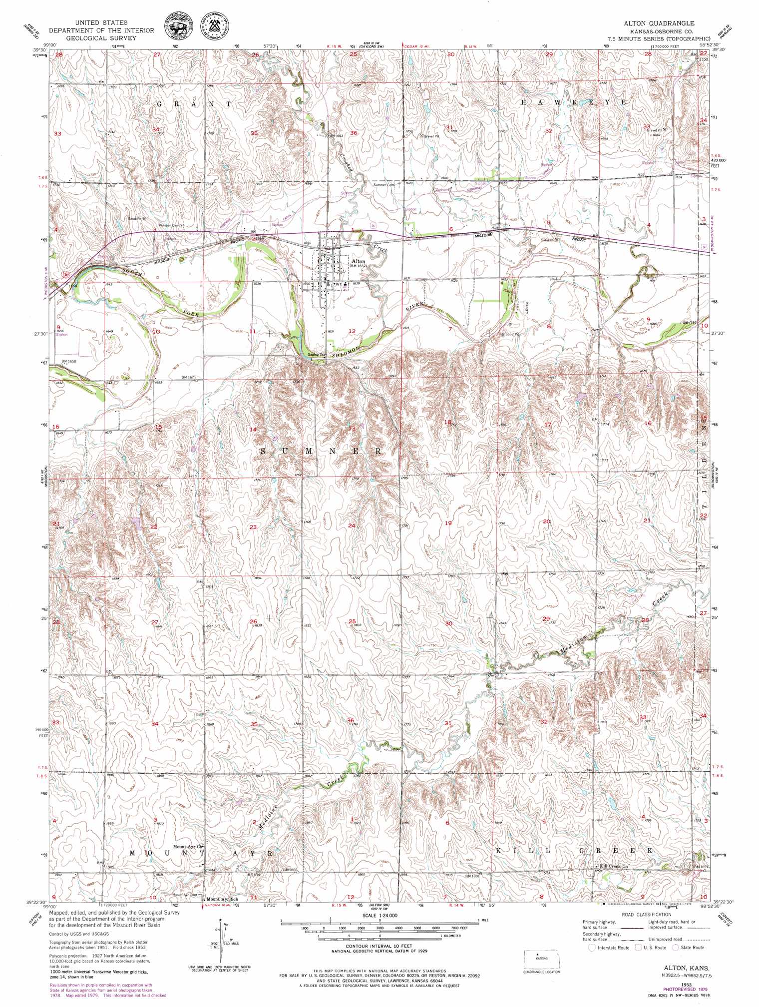
USGS Topo Quad 39098d8 - 1:24,000 scale
| Topo Map Name: | Alton |
| USGS Topo Quad ID: | 39098d8 |
| Print Size: | ca. 21 1/4" wide x 27" high |
| Southeast Coordinates: | 39.375° N latitude / 98.875° W longitude |
| Map Center Coordinates: | 39.4375° N latitude / 98.9375° W longitude |
| U.S. State: | KS |
| Filename: | o39098d8.jpg |
| Download Map JPG Image: | Alton topo map 1:24,000 scale |
| Map Type: | Topographic |
| Topo Series: | 7.5´ |
| Map Scale: | 1:24,000 |
| Source of Map Images: | United States Geological Survey (USGS) |
| Alternate Map Versions: |
Alton KS 1953, updated 1954 Download PDF Buy paper map Alton KS 1953, updated 1979 Download PDF Buy paper map Alton KS 2009 Download PDF Buy paper map Alton KS 2012 Download PDF Buy paper map Alton KS 2015 Download PDF Buy paper map |
1:24,000 Topo Quads surrounding Alton
Kirwin Reservoir |
Kirwin |
Cedar |
Gaylord |
Portis Nw |
Kirwin Sw |
Kirwin Se |
Gaylord Sw |
Harlan |
Portis |
Woodston Nw |
Woodston |
Alton |
Bloomington |
Osborne |
Twin Mound |
Laton |
Alton Sw |
Covert |
Osborne Sw |
Codell |
Natoma |
Paradise Nw |
Paradise Ne |
Vincent |
> Back to 39098a1 at 1:100,000 scale
> Back to 39098a1 at 1:250,000 scale
> Back to U.S. Topo Maps home
Alton topo map: Gazetteer
Alton: Canals
Osborne Canal elevation 506m 1660′Alton: Populated Places
Alton elevation 503m 1650′Alton: Streams
Crooked Creek elevation 488m 1601′Alton digital topo map on disk
Buy this Alton topo map showing relief, roads, GPS coordinates and other geographical features, as a high-resolution digital map file on DVD: