Kirwin Sw Topo Map Kansas
To zoom in, hover over the map of Kirwin Sw
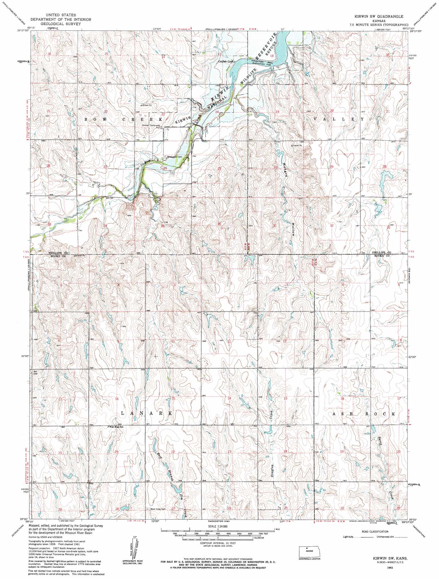
USGS Topo Quad 39099e2 - 1:24,000 scale
| Topo Map Name: | Kirwin Sw |
| USGS Topo Quad ID: | 39099e2 |
| Print Size: | ca. 21 1/4" wide x 27" high |
| Southeast Coordinates: | 39.5° N latitude / 99.125° W longitude |
| Map Center Coordinates: | 39.5625° N latitude / 99.1875° W longitude |
| U.S. State: | KS |
| Filename: | o39099e2.jpg |
| Download Map JPG Image: | Kirwin Sw topo map 1:24,000 scale |
| Map Type: | Topographic |
| Topo Series: | 7.5´ |
| Map Scale: | 1:24,000 |
| Source of Map Images: | United States Geological Survey (USGS) |
| Alternate Map Versions: |
Kirwin SW KS 1961, updated 1963 Download PDF Buy paper map Kirwin SW KS 2010 Download PDF Buy paper map Kirwin SW KS 2012 Download PDF Buy paper map Kirwin SW KS 2015 Download PDF Buy paper map |
1:24,000 Topo Quads surrounding Kirwin Sw
Stuttgart |
Phillipsburg North |
Gretna |
Kensington |
Athol |
Speed |
Phillipsburg South |
Kirwin Reservoir |
Kirwin |
Cedar |
Glade Sw |
Glade Se |
Kirwin Sw |
Kirwin Se |
Gaylord Sw |
Webster Dam |
Stockton |
Woodston Nw |
Woodston |
Alton |
Stockton Sw |
Stockton Se |
Twin Mound |
Laton |
Alton Sw |
> Back to 39099e1 at 1:100,000 scale
> Back to 39098a1 at 1:250,000 scale
> Back to U.S. Topo Maps home
Kirwin Sw topo map: Gazetteer
Kirwin Sw: Airports
Baughman Farm Strip elevation 595m 1952′Kirwin Sw: Bays
Catfish Cove elevation 530m 1738′Kirwin Sw: Valleys
Hungry Hollow elevation 536m 1758′Kirwin Sw digital topo map on disk
Buy this Kirwin Sw topo map showing relief, roads, GPS coordinates and other geographical features, as a high-resolution digital map file on DVD: