Mount Sunflower Nw Topo Map Colorado
To zoom in, hover over the map of Mount Sunflower Nw
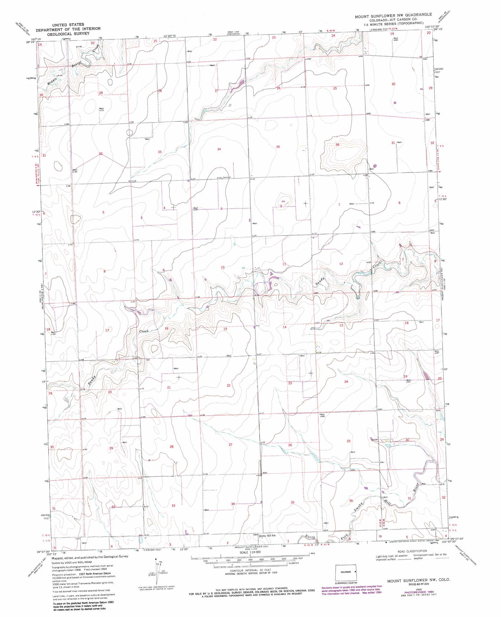
USGS Topo Quad 39102b2 - 1:24,000 scale
| Topo Map Name: | Mount Sunflower Nw |
| USGS Topo Quad ID: | 39102b2 |
| Print Size: | ca. 21 1/4" wide x 27" high |
| Southeast Coordinates: | 39.125° N latitude / 102.125° W longitude |
| Map Center Coordinates: | 39.1875° N latitude / 102.1875° W longitude |
| U.S. State: | CO |
| Filename: | o39102b2.jpg |
| Download Map JPG Image: | Mount Sunflower Nw topo map 1:24,000 scale |
| Map Type: | Topographic |
| Topo Series: | 7.5´ |
| Map Scale: | 1:24,000 |
| Source of Map Images: | United States Geological Survey (USGS) |
| Alternate Map Versions: |
Mount Sunflower NW CO 1969, updated 1972 Download PDF Buy paper map Mount Sunflower NW CO 1969, updated 1985 Download PDF Buy paper map Mount Sunflower NW CO 2010 Download PDF Buy paper map Mount Sunflower NW CO 2013 Download PDF Buy paper map Mount Sunflower NW CO 2016 Download PDF Buy paper map |
1:24,000 Topo Quads surrounding Mount Sunflower Nw
Settlement |
Burlington Ne |
Kanorado Nw |
Kanorado Ne |
Ruleton Nw |
Bethune |
Burlington |
Peconic |
Kanorado |
Ruleton |
Burlington 3 Nw |
Burlington 3 Ne |
Mount Sunflower Nw |
Mount Sunflower Ne |
Horsethief Draw Nw |
Burlington 3 Sw |
Burlington 3 Se |
Mount Sunflower Sw |
Mount Sunflower |
Horsethief Draw |
Cheyenne Wells Nw |
Cheyenne Wells Ne |
Arapahoe Nw |
Arapahoe Ne |
Weskan Nw |
> Back to 39102a1 at 1:100,000 scale
> Back to 39102a1 at 1:250,000 scale
> Back to U.S. Topo Maps home
Mount Sunflower Nw topo map: Gazetteer
Mount Sunflower Nw: Streams
North Fork Smoky Hill River elevation 1227m 4025′Sandy Creek elevation 1232m 4041′
Mount Sunflower Nw digital topo map on disk
Buy this Mount Sunflower Nw topo map showing relief, roads, GPS coordinates and other geographical features, as a high-resolution digital map file on DVD: