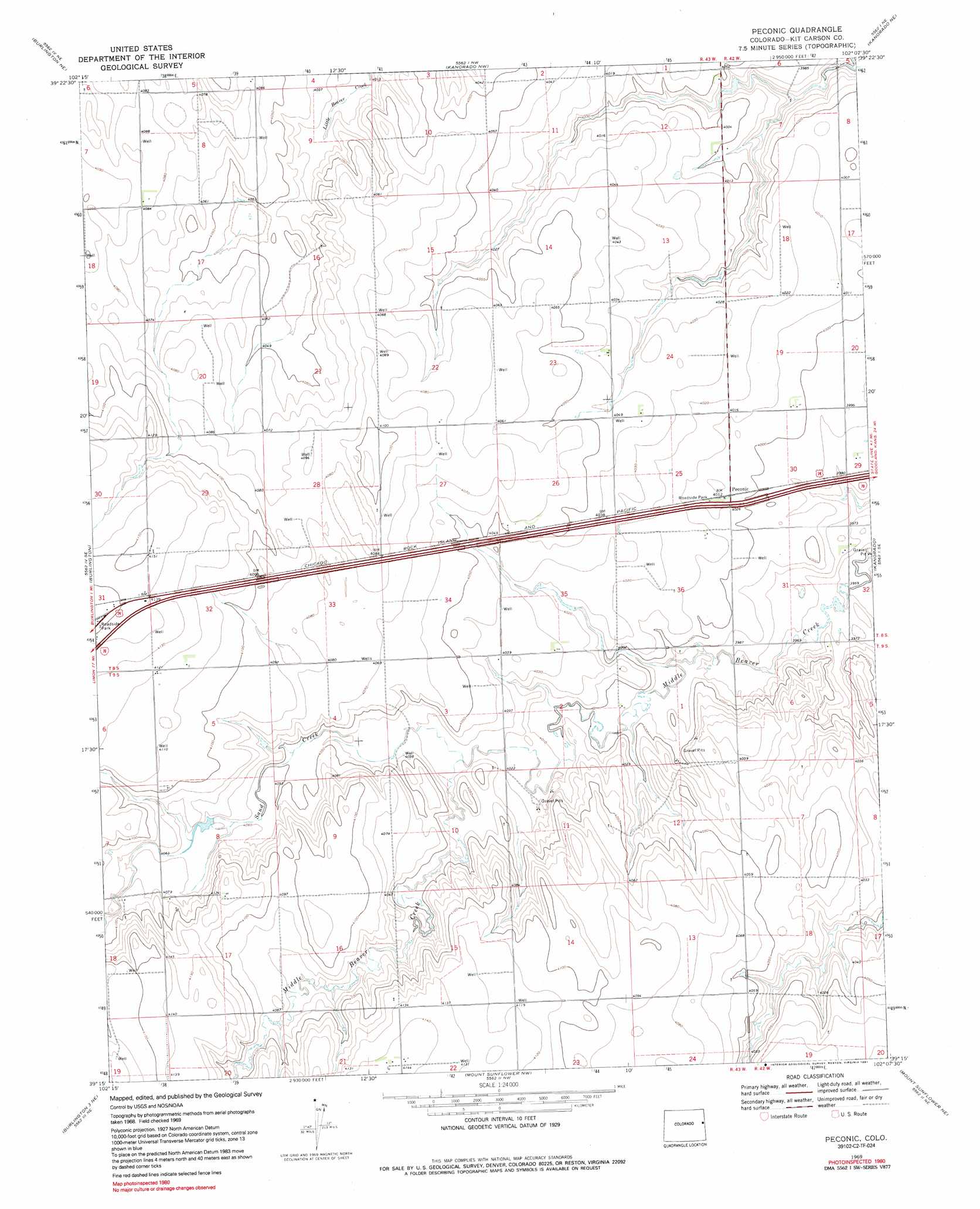
Peconic Topo Map Colorado
To zoom in, hover over the map of Peconic
USGS Topo Quad 39102c2 - 1:24,000 scale
| Topo Map Name: | Peconic |
| USGS Topo Quad ID: | 39102c2 |
| Print Size: | ca. 21 1/4" wide x 27" high |
| Southeast Coordinates: | 39.25° N latitude / 102.125° W longitude |
| Map Center Coordinates: | 39.3125° N latitude / 102.1875° W longitude |
| U.S. State: | CO |
| Filename: | o39102c2.jpg |
| Download Map JPG Image: | Peconic topo map 1:24,000 scale |
| Map Type: | Topographic |
| Topo Series: | 7.5´ |
| Map Scale: | 1:24,000 |
| Source of Map Images: | United States Geological Survey (USGS) |
| Alternate Map Versions: |
Peconic CO 1969, updated 1972 Download PDF Buy paper map Peconic CO 1969, updated 1972 Download PDF Buy paper map Peconic CO 1969, updated 1991 Download PDF Buy paper map Peconic CO 2010 Download PDF Buy paper map Peconic CO 2013 Download PDF Buy paper map Peconic CO 2016 Download PDF Buy paper map |
1:24,000 Topo Quads surrounding Peconic
Idalia Sw |
Idalia Se |
Bonny Reservoir South |
Bonny Reservoir Se |
Saint Francis 3 Sw |
Settlement |
Burlington Ne |
Kanorado Nw |
Kanorado Ne |
Ruleton Nw |
Bethune |
Burlington |
Peconic |
Kanorado |
Ruleton |
Burlington 3 Nw |
Burlington 3 Ne |
Mount Sunflower Nw |
Mount Sunflower Ne |
Horsethief Draw Nw |
Burlington 3 Sw |
Burlington 3 Se |
Mount Sunflower Sw |
Mount Sunflower |
Horsethief Draw |
> Back to 39102a1 at 1:100,000 scale
> Back to 39102a1 at 1:250,000 scale
> Back to U.S. Topo Maps home
Peconic topo map: Gazetteer
Peconic: Dams
C H Parks Dam elevation 1245m 4084′Peconic: Populated Places
Peconic elevation 1222m 4009′Peconic: Reservoirs
C H Parks Reservoir elevation 1245m 4084′Peconic: Streams
Middle Beaver Creek elevation 1235m 4051′Sand Creek elevation 1226m 4022′
Peconic digital topo map on disk
Buy this Peconic topo map showing relief, roads, GPS coordinates and other geographical features, as a high-resolution digital map file on DVD: