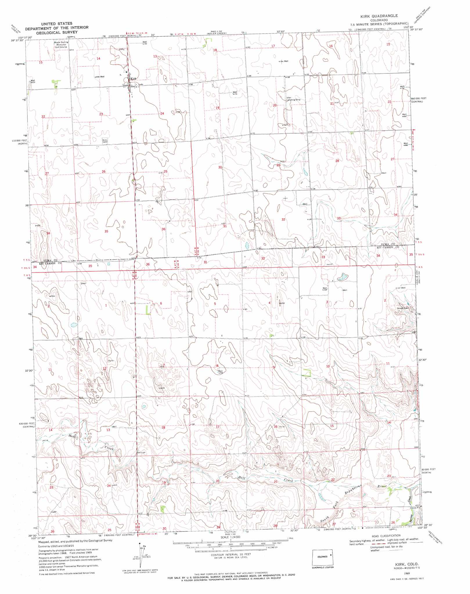
Kirk Topo Map Colorado
To zoom in, hover over the map of Kirk
USGS Topo Quad 39102e5 - 1:24,000 scale
| Topo Map Name: | Kirk |
| USGS Topo Quad ID: | 39102e5 |
| Print Size: | ca. 21 1/4" wide x 27" high |
| Southeast Coordinates: | 39.5° N latitude / 102.5° W longitude |
| Map Center Coordinates: | 39.5625° N latitude / 102.5625° W longitude |
| U.S. State: | CO |
| Filename: | o39102e5.jpg |
| Download Map JPG Image: | Kirk topo map 1:24,000 scale |
| Map Type: | Topographic |
| Topo Series: | 7.5´ |
| Map Scale: | 1:24,000 |
| Source of Map Images: | United States Geological Survey (USGS) |
| Alternate Map Versions: |
Kirk CO 1969, updated 1972 Download PDF Buy paper map Kirk CO 2010 Download PDF Buy paper map Kirk CO 2013 Download PDF Buy paper map Kirk CO 2016 Download PDF Buy paper map |
1:24,000 Topo Quads surrounding Kirk
De Nova Se |
Abarr |
Abarr Se |
Vernon Sw |
Wildcat Canyon |
Cope |
Joes |
Adler Creek |
Spring Canyon |
Idalia |
Cope Se |
Joes Sw |
Kirk |
Idalia Sw |
Idalia Se |
Seibert Ne |
Stratton Nw |
Tuttle |
Settlement |
Burlington Ne |
Seibert |
Vona |
Stratton |
Bethune |
Burlington |
> Back to 39102e1 at 1:100,000 scale
> Back to 39102a1 at 1:250,000 scale
> Back to U.S. Topo Maps home
Kirk topo map: Gazetteer
Kirk: Airports
Idlers Field elevation 1265m 4150′Kirk: Populated Places
Kirk elevation 1281m 4202′Kirk: Streams
Hell Creek elevation 1227m 4025′Spring Creek elevation 1220m 4002′
Kirk digital topo map on disk
Buy this Kirk topo map showing relief, roads, GPS coordinates and other geographical features, as a high-resolution digital map file on DVD: