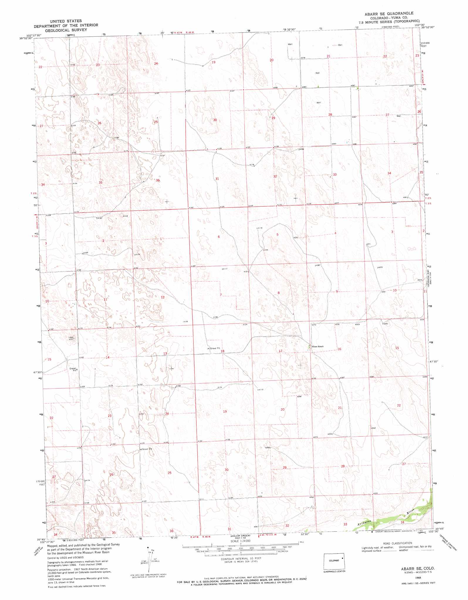
Abarr Se Topo Map Colorado
To zoom in, hover over the map of Abarr Se
USGS Topo Quad 39102g5 - 1:24,000 scale
| Topo Map Name: | Abarr Se |
| USGS Topo Quad ID: | 39102g5 |
| Print Size: | ca. 21 1/4" wide x 27" high |
| Southeast Coordinates: | 39.75° N latitude / 102.5° W longitude |
| Map Center Coordinates: | 39.8125° N latitude / 102.5625° W longitude |
| U.S. State: | CO |
| Filename: | o39102g5.jpg |
| Download Map JPG Image: | Abarr Se topo map 1:24,000 scale |
| Map Type: | Topographic |
| Topo Series: | 7.5´ |
| Map Scale: | 1:24,000 |
| Source of Map Images: | United States Geological Survey (USGS) |
| Alternate Map Versions: |
Abarr SE CO 1968, updated 1971 Download PDF Buy paper map Abarr SE CO 2010 Download PDF Buy paper map Abarr SE CO 2013 Download PDF Buy paper map Abarr SE CO 2016 Download PDF Buy paper map |
1:24,000 Topo Quads surrounding Abarr Se
Otis Se |
Yuma South |
Schramm |
Eckley |
Robb |
De Nova Ne |
Beverly Grove |
Heartstrong |
Vernon Nw |
Vernon |
De Nova Se |
Abarr |
Abarr Se |
Vernon Sw |
Wildcat Canyon |
Cope |
Joes |
Adler Creek |
Spring Canyon |
Idalia |
Cope Se |
Joes Sw |
Kirk |
Idalia Sw |
Idalia Se |
> Back to 39102e1 at 1:100,000 scale
> Back to 39102a1 at 1:250,000 scale
> Back to U.S. Topo Maps home
No gazetteer data is available for the Abarr Se topo map sheet.
Abarr Se digital topo map on disk
Buy this Abarr Se topo map showing relief, roads, GPS coordinates and other geographical features, as a high-resolution digital map file on DVD: