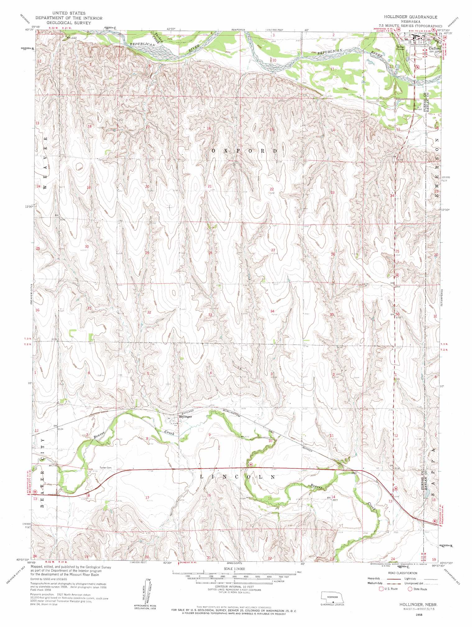
Hollinger Topo Map Nebraska
To zoom in, hover over the map of Hollinger
USGS Topo Quad 40099b6 - 1:24,000 scale
| Topo Map Name: | Hollinger |
| USGS Topo Quad ID: | 40099b6 |
| Print Size: | ca. 21 1/4" wide x 27" high |
| Southeast Coordinates: | 40.125° N latitude / 99.625° W longitude |
| Map Center Coordinates: | 40.1875° N latitude / 99.6875° W longitude |
| U.S. State: | NE |
| Filename: | O40099b6.jpg |
| Download Map JPG Image: | Hollinger topo map 1:24,000 scale |
| Map Type: | Topographic |
| Topo Series: | 7.5´ |
| Map Scale: | 1:24,000 |
| Source of Map Images: | United States Geological Survey (USGS) |
| Alternate Map Versions: |
Hollinger NE 1958, updated 1959 Download PDF Buy paper map Hollinger NE 2011 Download PDF Buy paper map Hollinger NE 2014 Download PDF Buy paper map |
1:24,000 Topo Quads surrounding Hollinger
Arapahoe Nw |
Arapahoe Ne |
Oxford Nw |
Loomis |
Holdrege West |
Arapahoe |
Edison |
Oxford |
Mascot |
Atlanta |
Hendley |
Beaver City |
Hollinger |
Stamford |
Orleans |
Beaver City Sw |
Beaver City Se |
Precept |
Stamford Se |
Alma Sw |
Norton Nw |
Norton Ne |
Almena |
Long Island |
Woodruff |
> Back to 40099a1 at 1:100,000 scale
> Back to 40098a1 at 1:250,000 scale
> Back to U.S. Topo Maps home
Hollinger topo map: Gazetteer
Hollinger: Dams
Cadwalder Dam elevation 635m 2083′Sturtevant Dam elevation 659m 2162′
Hollinger: Populated Places
Hollinger elevation 637m 2089′Oxford elevation 633m 2076′
Hollinger: Post Offices
Hollinger Post Office (historical) elevation 637m 2089′Oxford Post Office elevation 632m 2073′
Hollinger: Reservoirs
Cadwalder Reservoir elevation 635m 2083′Sturtevant Reservoir elevation 659m 2162′
Hollinger: Streams
Turkey Creek elevation 634m 2080′Hollinger digital topo map on disk
Buy this Hollinger topo map showing relief, roads, GPS coordinates and other geographical features, as a high-resolution digital map file on DVD: