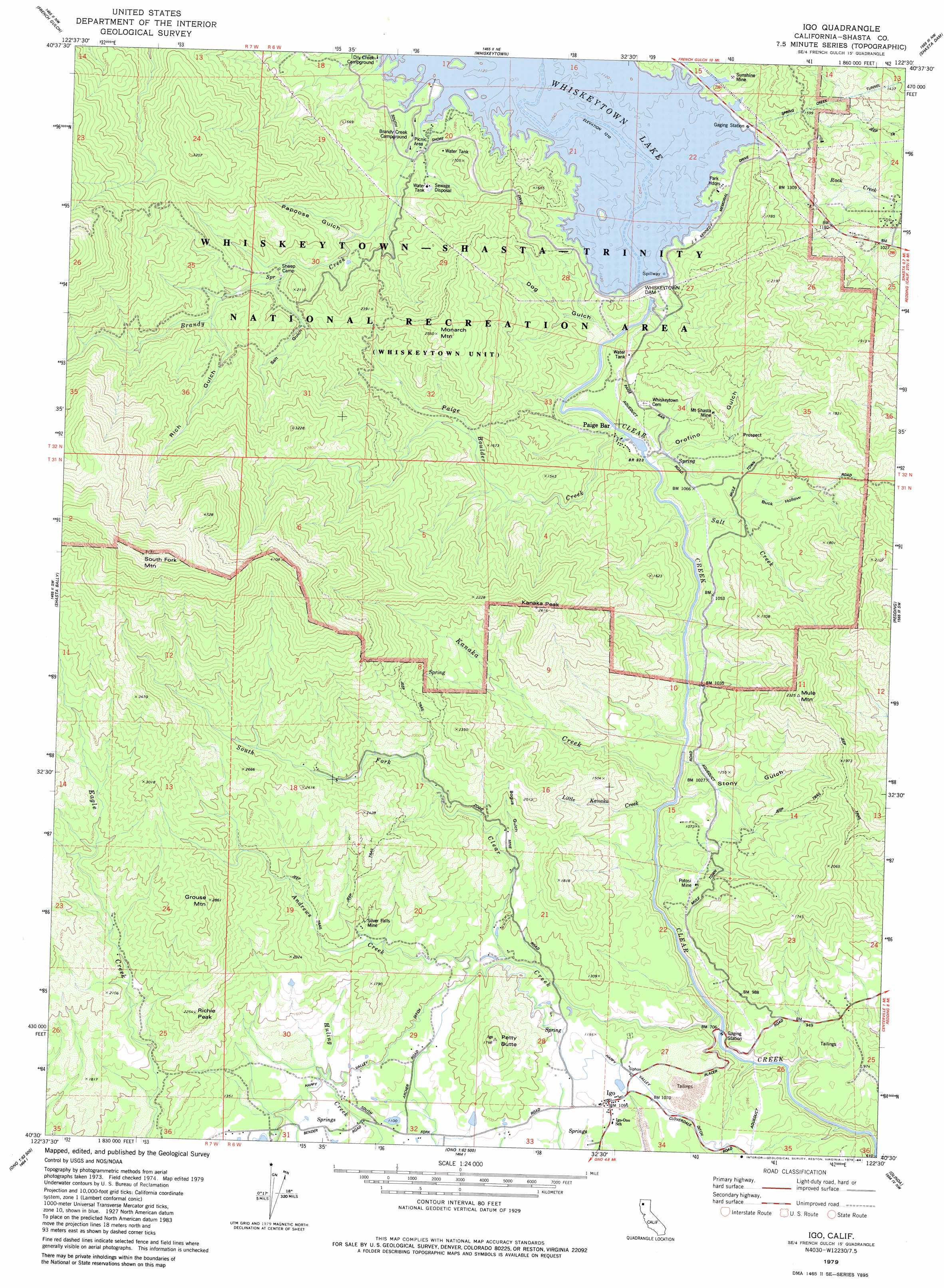
Igo Topo Map California
To zoom in, hover over the map of Igo
USGS Topo Quad 40122e5 - 1:24,000 scale
| Topo Map Name: | Igo |
| USGS Topo Quad ID: | 40122e5 |
| Print Size: | ca. 21 1/4" wide x 27" high |
| Southeast Coordinates: | 40.5° N latitude / 122.5° W longitude |
| Map Center Coordinates: | 40.5625° N latitude / 122.5625° W longitude |
| U.S. State: | CA |
| Filename: | o40122e5.jpg |
| Download Map JPG Image: | Igo topo map 1:24,000 scale |
| Map Type: | Topographic |
| Topo Series: | 7.5´ |
| Map Scale: | 1:24,000 |
| Source of Map Images: | United States Geological Survey (USGS) |
| Alternate Map Versions: |
Igo CA 1979, updated 1979 Download PDF Buy paper map Igo CA 1979, updated 1984 Download PDF Buy paper map Igo CA 1998, updated 2002 Download PDF Buy paper map Igo CA 2012 Download PDF Buy paper map Igo CA 2015 Download PDF Buy paper map |
1:24,000 Topo Quads surrounding Igo
Trinity Dam |
Papoose Creek |
Schell Mountain |
Bohemotash Mountain |
O'Brien |
Lewiston |
French Gulch |
Whiskeytown |
Shasta Dam |
Project City |
Bully Choop Mountain |
Shasta Bally |
Igo |
Redding |
Enterprise |
Arbuckle Mountain |
Ono |
Olinda |
Cottonwood |
|
Beegum |
Rosewood |
Mitchell Gulch |
Hooker |
> Back to 40122e1 at 1:100,000 scale
> Back to 40122a1 at 1:250,000 scale
> Back to U.S. Topo Maps home
Igo topo map: Gazetteer
Igo: Bars
Paige Bar elevation 308m 1010′Igo: Dams
Clair A. Hill Whiskeytown Dam elevation 370m 1213′Igo: Mines
Mount Shasta Mine elevation 365m 1197′Potosi Mine elevation 313m 1026′
Silver Falls Mine elevation 482m 1581′
Sunshine Mine elevation 390m 1279′
Igo: Populated Places
Igo elevation 332m 1089′Paige Bar elevation 287m 941′
Igo: Reservoirs
Whiskeytown Lake elevation 370m 1213′Igo: Streams
Andrews Creek elevation 342m 1122′Brandy Creek elevation 370m 1213′
Kanaka Creek elevation 256m 839′
Little Kanaka Creek elevation 259m 849′
Paige Boulder Creek elevation 285m 935′
Paige Soube elevation 284m 931′
Papoose Creek elevation 486m 1594′
Salt Creek elevation 269m 882′
South Fork Clear Creek elevation 220m 721′
Igo: Summits
Grouse Mountain elevation 867m 2844′Kanaka Peak elevation 773m 2536′
Monarch Mountain elevation 742m 2434′
Mule Mountain elevation 708m 2322′
Petty Butte elevation 532m 1745′
Richie Peak elevation 681m 2234′
South Fork Mountain elevation 1521m 4990′
Igo: Valleys
Bogus Gulch elevation 391m 1282′Buck Hollow elevation 318m 1043′
Dog Gulch elevation 322m 1056′
Dows Gulch elevation 370m 1213′
Orofino Gulch elevation 292m 958′
Papoose Gulch elevation 464m 1522′
Rich Gulch elevation 727m 2385′
Salt Gulch elevation 584m 1916′
Stony Gulch elevation 245m 803′
Igo digital topo map on disk
Buy this Igo topo map showing relief, roads, GPS coordinates and other geographical features, as a high-resolution digital map file on DVD: